There will be some warm air and sunshine about this week, if you are still on holiday. More rain too and a brisk, chilly wind off the North Sea.
This week will become dominated by an easterly flow once more, bringing lots of cloud from the North Sea and a coolness to the east coast of Britain. However, the source of this air is away to the south, the eastern Mediterranean, not Siberia like in weeks past. So, it won’t be feeling too bad for much of the UK and in western areas, there should be some fine sunshine with temperatures at or just above average.
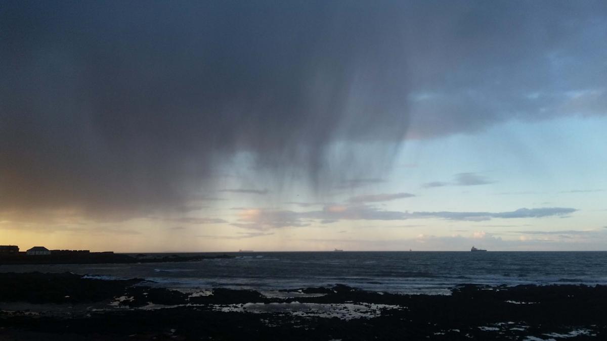
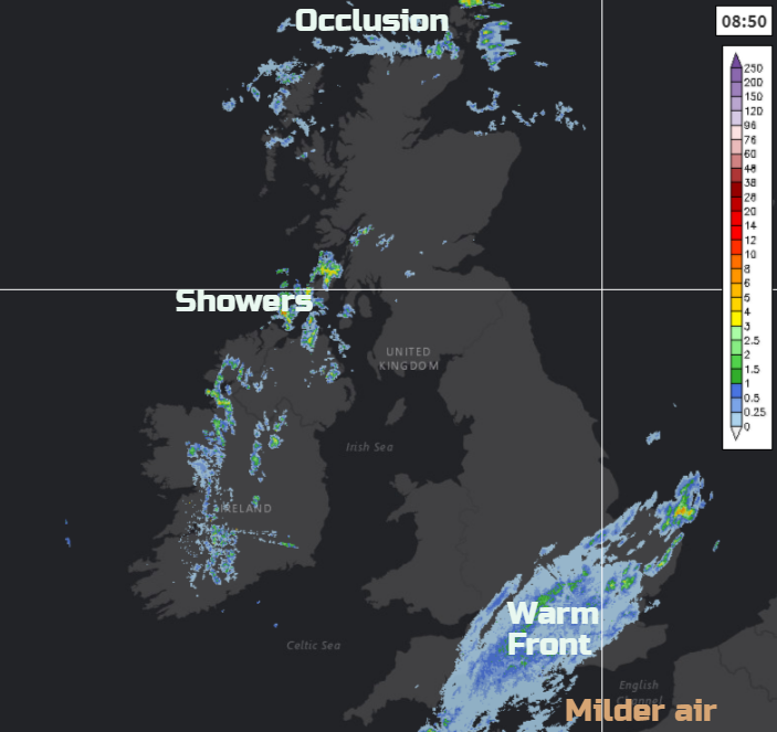
This morning we have a warm front over SE Britain bringing rain to London, East Anglia and much of southern England. It is murky but mild enough for the SE in the warm sector air. Low cloud will trouble North Sea coasts this week but ahead of the frontal area, away to the north and west, there is some fine weather for Monday morning. Sunshine for Wales and parts of Scotland, but early low cloud and murk over Northern Ireland and other parts of Britain. This should stir and break today, brightening up. Then with the areas of sunshine and brightness, showers break out, a cluster for western Scotland, a few for Northern Ireland and NW England, which could be heavy even thundery. Further north there is an old occluded front which is bringing more cloud and a bit of rain to the far north of Scotland. Shetland stays in the colder air today with a top temperature of 5C in an easterly wind.
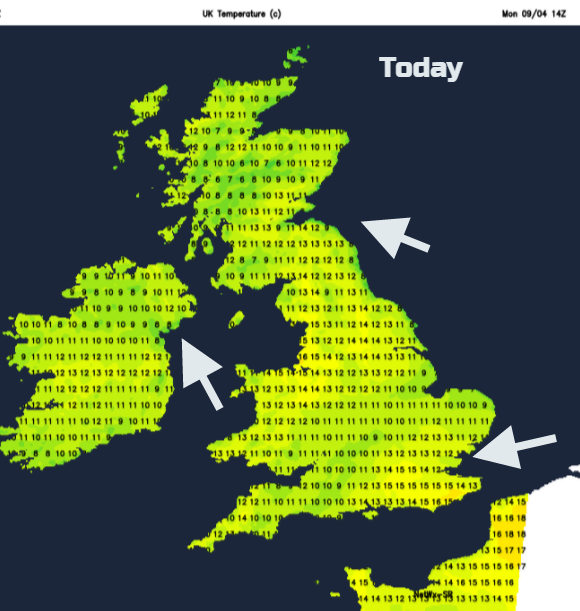
Within the warm sector, there is a light NE veering E wind. For the rest of the UK, there is hardly any breeze which has brought the misty grey conditions to start the working week. Gradually a light SE wind takes over, then an easterly tonight. Temperatures today will widely be in double figures with 15 or 16 possible in sunnier western spots. Along the east coast, 8 or 9C is more likely as the North Sea SST is still only about 6C.
Thought the day the rain eases from London and Home Counties although it looks like the cloud will remain, capping the temperatures today. The rain band will lie from The Wash across to the Bristol Channel by mid-afternoon, down into Devon and Somerset with a few sharp showers being set off along the SW peninsula. The grey, damp conditions spread up into the Midlands, SE Wales with Lincolnshire staying grey. To the north, the bright and sunny spells continue with a scattering of hefty showers. There are still some flood warnings for Anglia and alerts in the Midlands, a combination of recent heavy rain, high tides and still more rain to come.
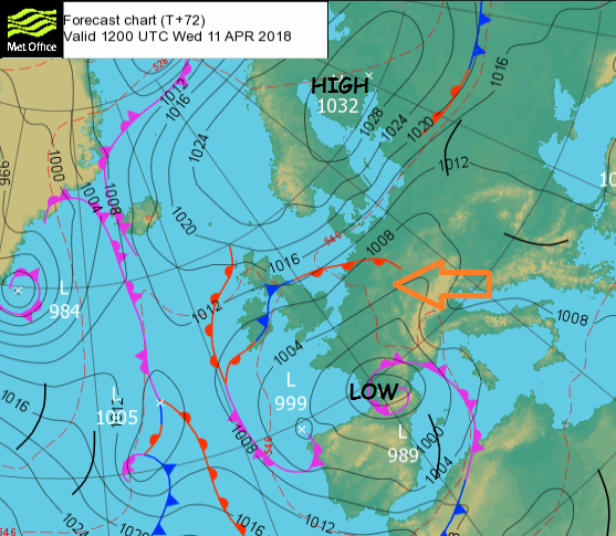
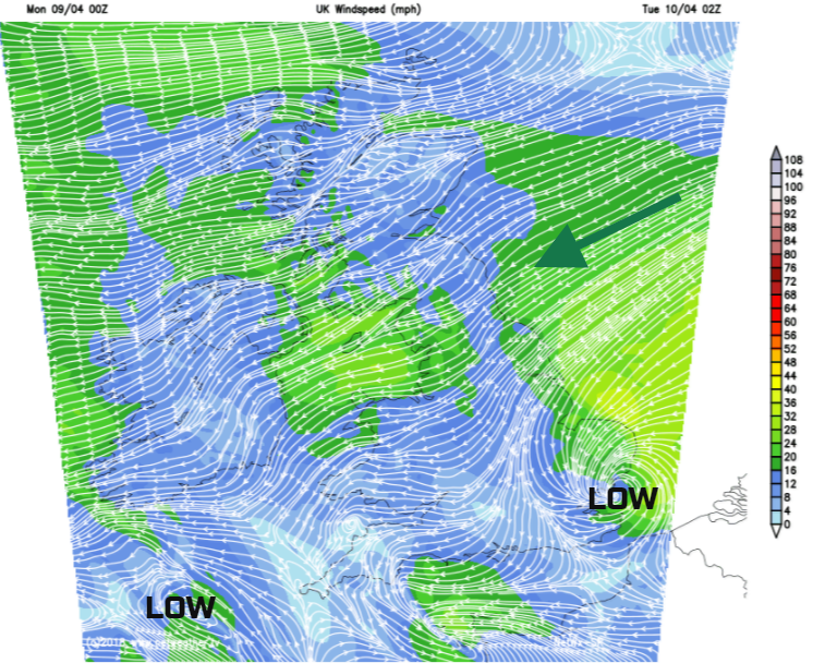
By this evening and overnight, the cold front and triple point of one low will be heading north towards the Channel as another low brushes past western Ireland heading south. These two swing around each other on Tuesday.
Northern Britain turns cooler in the easterly breeze tonight. Further south, it will be mild but with a keen east then NE Wind off the North Sea. It will turn wet overnight for SE Britain with rain extending over much of southern Britain.
The warm and cold front will be moving NW wards bringing a wet start for some on Tuesday morning. There is the risk of localised flooding, as this rain will be heavy and persistent for some. Environment Agency:
"Through Monday night and Tuesday local river and surface water flooding is possible across parts of England and Wales due to near saturated ground and further persistent rain. High river levels may continue into Wednesday. Land, roads and properties may flood and there may be local travel disruption."
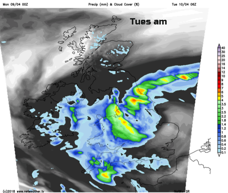
Throughout Tuesday the warm front rain band heads over to Northern Ireland and up into Scotland but fragments. The cold front will bring some hefty, sharp showers over southern Britain. IN the brighter slots, temperatures will lift quite nicely for England and Wales into the mid-teens, possibly 18 or 19C for London.
By Wednesday, there will be a noticeable east wind for northern Britain, NW Scotland seeing some fine sunshine. An area of rain is showing up on the forecast models heading across a central swathe of Britain from the North Sea and reaching Northern Ireland later on Wednesday.
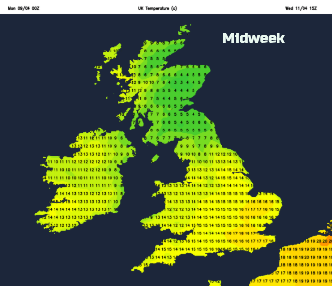
It will feel warmer for England and Wales, 15 to 20C with Northern Ireland and Western Scotland peaking at 13 or 14C. Northern England and rest of Scotland will feel colder in the wind.
This easterly flow remains through the week, spinning in pockets of rain from time to time. Mixed with brighter, sunnier spells where it will feel warm, as long as you’re not exposed to the breeze along the cool east coast.