
Thaw across the north next few days, unsettled with showers or longer spells of rain in week ahead.
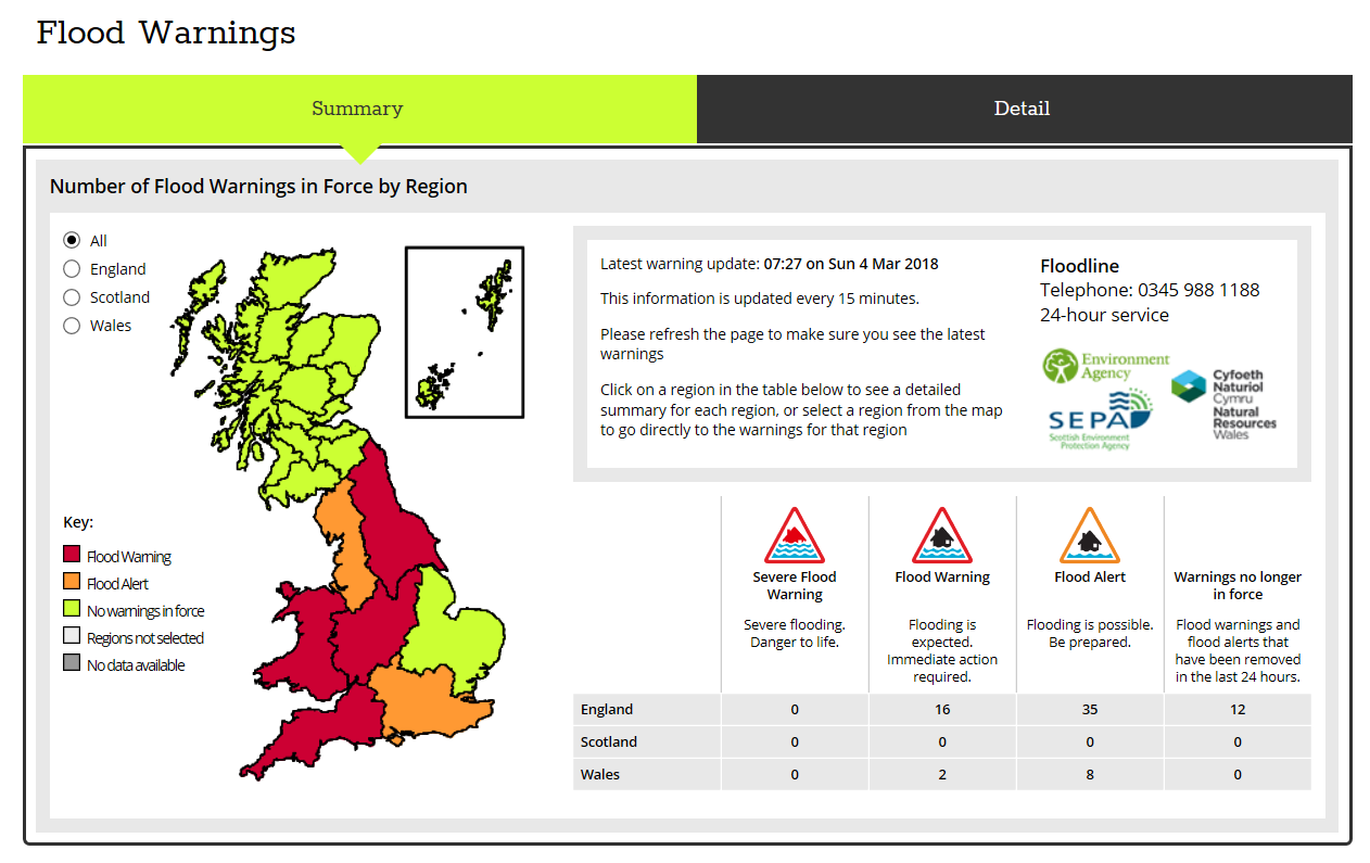
As we head into the new week, we will be looking towards the Atlantic rather than NE Europe for our weather prospects, with low pressure becoming slow-moving across western Britain through much of the week bringing unsettled but less cold conditions. This will mean the cold conditions still hanging on across Scotland and northern England will retreat north over the next few days, with snow becoming confined to the hills. The thaw of snow may lead to some flooding from high river levels in the north and west from the snow melt working through. Flood warnings are in effect in places.
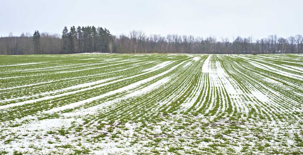
Much of Britain seeing showers or bands of rain spreading north through the week, mountain snow initially across the north, but a thaw of recent snow in low-lying areas of the north. Becoming mild in the south and less cold in the north too, though there will be some chilly nights, especially in the north, where there will be the greatest risk of frost and ice.
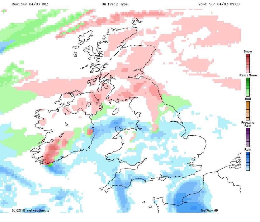
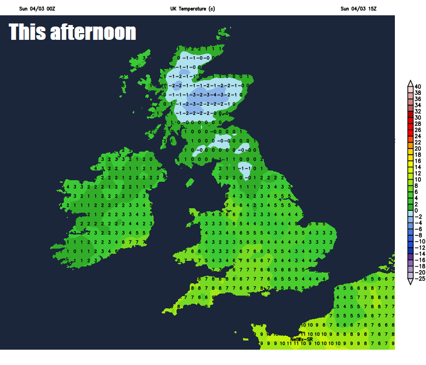
For now, it’s still cold with a risk of ice from the Midlands northwards this morning, with temperatures widely at or below freezing to start the day with snow showers continuing across NE Scotland, bands of snow moving north across north across the far north of England and southern Scotland, while further south there are showers falling as mixture of sleet or snow moving through the Midlands and north Wales. Some rain showers, locally heavy, across south Wales and far southwest of England to start the morning, but mostly dry with blue skies across SE England and East Anglia.
It will continue to be a wintry picture for Scotland and the far north of England for the rest of the day, with bands of sleet and snow spreading north, with snow showers continuing across the far NE of Scotland, though snow gradually becoming confined to the hills across northern England and southern Scotland, with a slow thaw at lower levels and turning foggy. Further south across the rest of England and Wales, areas of showers, locally heavy with thunder across the south, will spread north, though with some sunny spells between the showers. Perhaps some more persistent rain for the far SE England this afternoon.
Northern areas will see temperatures reach 2-5C at best, but across the south it will feel milder than of late with temperatures reaching 6-8C, feeling pleasant in any sunshine. A southeasterly breeze in the south, easterly in the north.
The north will see generally cloudy skies with further spells of rain, sleet and hill snow tonight, mist and foggy too, risk of ice across northern Scotland – where temperatures will be close to or below freezing. Southern areas will see clear spells develop, perhaps allowing temperatures to fall enough for some patchy frost, but there will be a few scattered showers around too, mostly across southern counties of England and Wales.
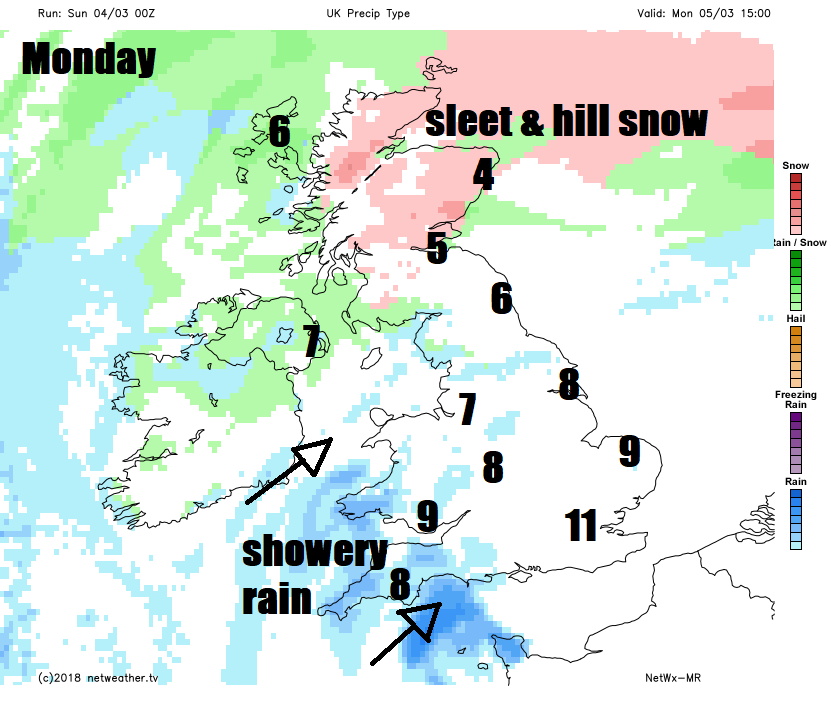
Mostly cloudy with rain, sleet and hill snow for Scotland, perhaps snow getting to lower levels in the north and east of Scotland. For England, Wales, and N. Ireland - after a dry and bright start, turning cloudier, with showery rain spreading up from the southwest. Temperatures reaching 4-7C across Scotland, northern England and N. Ireland. Across Wales, central, southern and eastern England reaching 7-11C.
Staying unsettled Tuesday to Friday, thanks to slow-moving low pressure across the west. Tuesday perhaps driest and sunniest for southern areas, cloudy still for the north, with rain and hill snow. Wednesday seeing sunshine and showers for many areas, perhaps thundery in the south. Detail for Thursday and Friday a bit elusive given weather model differences, suffice to say generally unsettled with showers or longer spells of rain affecting many parts. With slack low pressure close to the west, winds will, at least, be generally light, though perhaps breezy across the west. Where skies clear overnight, with light winds, there is a risk of patchy frost and ice.


