


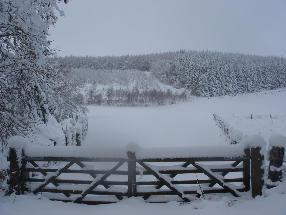
A cold, sunny & dry weekend, very cold air from Siberia arriving from Sunday night, bringing snow next week.
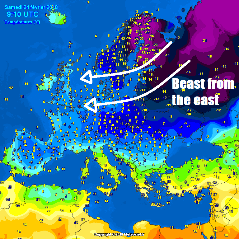
A chilly start to the weekend out there this morning, with a widespread frost, which will lead into a mostly dry, sunny but cold weekend with a raw easterly breeze, thanks to high pressure close by to the east, with overnight frost returning this evening. But if you think it’s cold now, it will feel balmy compared to even colder air arriving from Sunday night all the way from Siberia – where temperatures have been falling below -30C. A bitterly cold easterly flow will prevail through much of the new week, the very cold air crossing the North Sea will create snow showers. Eastern areas will see the most frequent snow showers, but snow showers will get inland towards the west at times with troughs in the easterly flow, particularly across central and northern areas.
For now, temperatures widely at or below freezing to start Saturday, thanks to clear skies and cold, dry continental flow from the east. Temperature at 7am as low as -6C at Southampton, with -3 to -4C widely in the south. Temperatures will take some time to recover through the morning, but for most it will be dry with plenty of sunshine and blue skies, perhaps cloudier across the far SW of England, Northern Ireland and NW Scotland. A cold easterly or southeasterly wind will make it feel colder than the screen temperatures which will reach 4-5C generally, perhaps 6C in the southwest.
Mostly clear skies as we head through the evening and overnight will lead to a widespread frost quickly forming away from eastern coasts, some patchy cloud likely towards eastern coasts of Scotland and NE England. A strong easterly wind across the south.
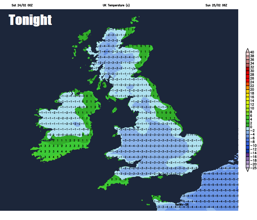
A frosty start to Sunday and for most it will be another dry and sunny but cold day, the exception will be across eastern coastal areas of Scotland and NE Scotland, where it will be cloudier, thick enough to bring some snow flurries into the afternoon. A stronger easterly wind will mean it will be colder tomorrow, temperatures struggling to reach 1-3C across eastern areas, 4-5C towards the west.
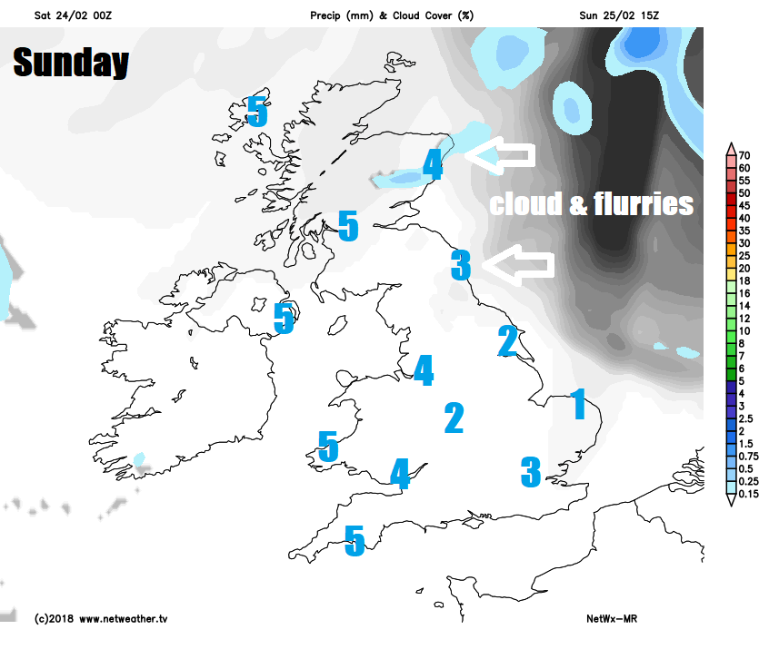
Deep cold air all the way from Siberia arrives Sunday night, temperatures aloft will fall below -10C at about 1500m high which, crossing the relatively warmer North Sea which is around 6-7C, will allow ‘lake effect’ snow showers to develop and affect eastern coastal areas on Monday. Away from eastern coastal counties of Scotland and England – it will be mostly dry with sunny spells. Feeling bitterly cold in the raw easterly wind, temperatures reaching 1-3C at best, but the wind chill will make it feel like it’s well below freezing.
Snow showers will likely turn heavier and more frequent from Monday evening, overnight and through Tuesday across eastern areas, perhaps getting inland across SE England and perhaps the Midlands from Lincolnshire northwards. Also, a trough of low pressure embedded in the easterly flow and associated frontal system is modelled to track WSW off the North Sea across northern England and Scotland, perhaps bringing a more organised area of snow showers – which could bring some moderate snowfall accumulations.
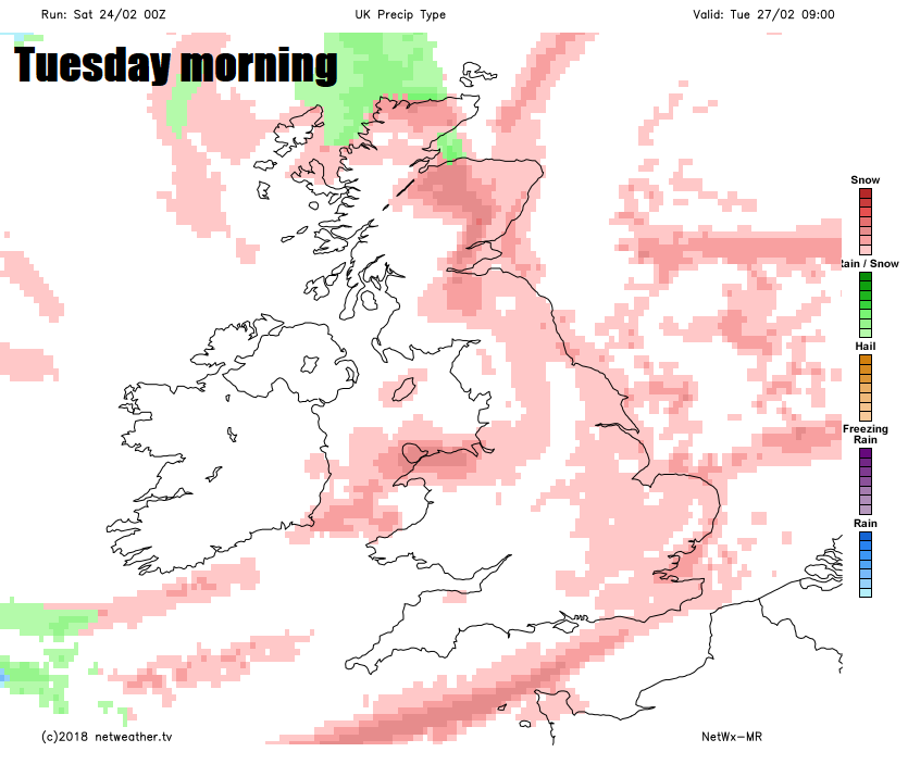
Therefore there is potential for some travel disruption on Tuesday, the snow will be powdery in nature, given how cold and dry the air will be at the surface, so is liable to drift in the strong easterly wind, causing deep drifts in places, adding to potential for disruption to road, rail and air.
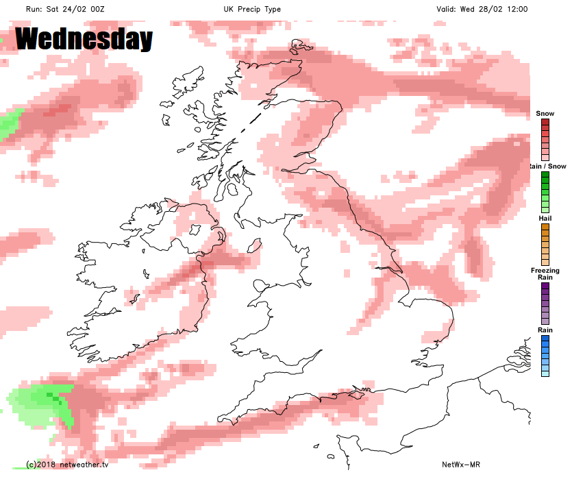
Further snow showers on Wednesday, frequent and heavy locally, especially towards the east, though snow showers getting well inland at times, so potential for further travel disruption from snow accumulations and also ice – with temperature staying close to or below freezing across many areas during the day.
Increasing uncertainty as we head through Thursday and Friday, as weather models diverge over the track of low pressure system moving in across Iberia on Thursday before tracking north towards the UK by Friday. Thursday will likely be the coldest day of the week for many, as the easterly or northeasterly wind strengthens even more, temperatures perhaps not getting above freezing in many parts, despite many seeing sunny spells, further snow showers towards the east.
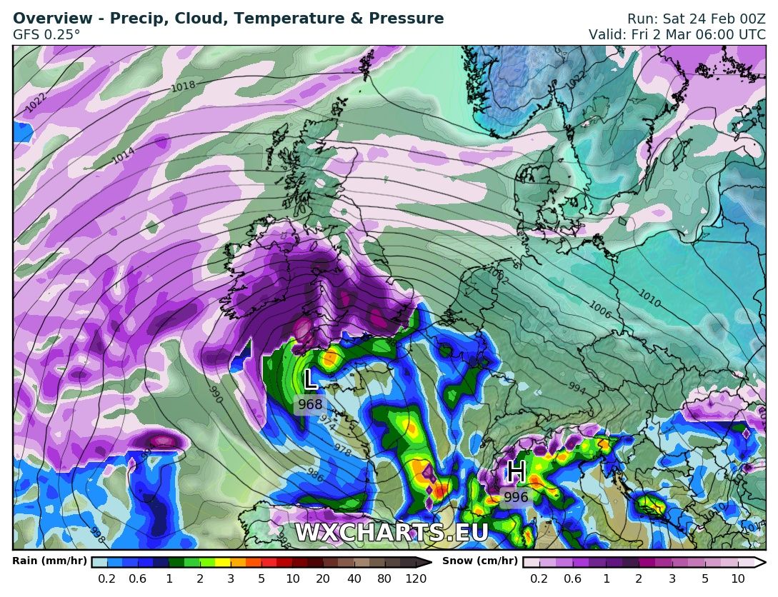
Credit: wcharts.eu
Then we may see a more organised area of snow move up from the south Thursday evening and night, as that low tracks north from Spain to the west of France and bumps into the very cold air. GFS and ECMWF models then diverge over how far north to take the low, ECMWF no further than the English Channel before the low fills, but giving heavy snow to southern counties of England, perhaps blizzard conditions for the SW Moors. While GFS spins the low close to the SW Friday and into the weekend, bringing prolonged snow on Friday and Saturday across England, Wales and southern Scotland, but turning less cold across southern England by the weekend, with snow turning to rain.


