
Winter's not over, but the next few days will bring some easing of February's chilly grip.
The weather will become more settled, so if you are finishing half term (or just enjoying less traffic), there will still be wintry showers or rain from the NW but drying up further south. If the school holidays are next week, that does look drier overall as pressure begins to rise.
As yesterday’s frontal band clears away from the SE, there will be bright or sunny skies, a brisk cold wind and fair weather for Thursday. It’s mild in the SE around 8 or 9C, Further north and west showers continue to whistle in on the fresh to strong SW winds with gusts again over 60mph. Temperatures range from only 1 or 2C to 6 or 7C in the Midlands. There are ice warnings for Northern Ireland and parts of northern Britain with another wintry day.
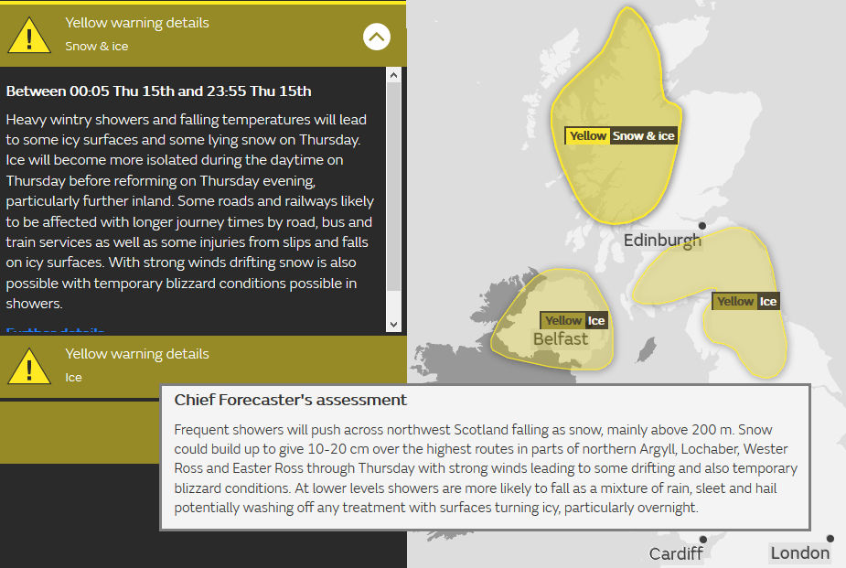
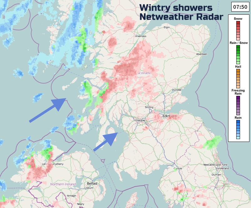
There have been squally conditions over the Western Isles with heavy showers continuing to move in from the west. Hail, thunder, sleet and snow with the risk of drifting in the strong winds. The heaviest snowfall is forecast for western Scotland midmorning and over lunchtime, with snow likely along the M8. Snow showers will also move across Northern Ireland, with some parts getting a covering, others not seeing anything. The risk of ice will return later.
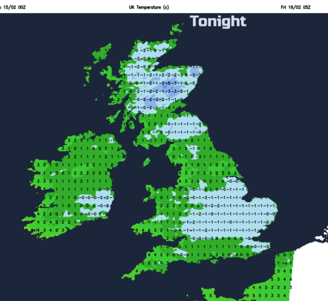
Tonight, it turns cold everywhere with temperatures down to or below freezing. There will be ice and still more snow showers coming in from the far NW. The northern half of the UK keeps a cold breeze and the south has lighter winds.
Friday looks fine, with pressure rising in the south, lighter winds and a lot of dry, bright weather about. There will still be wintry showers for NW Scotland. A southerly wind begins to pick up for Northern Ireland by lunchtime. Temperatures will be around 7 or 8C more widely tomorrow. Through the afternoon a frontal band begins to throw cloud, outbreaks of rain and bring freshening winds to more of Ireland and western Scotland. This will move across the Irish Sea on Friday evening and also bring more snow to the Highlands.
Weekend
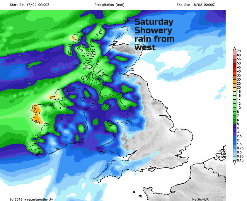
Weather fronts continue to head our way from the NW. With high pressure over Europe, they will fade. Saturday is fine for most with a scattering of rain showers for western Britain and Northern Ireland. Cloud increases later on as heavier rain moves in from the Atlantic on warm front. Sunday the UK will be in some milder air with a lot of cloud and damp weather about for Wales, Irish Sea coasts, the SW of England and a spell of heavier rain passing across the UK. In SW winds, temperatures will be up, 9 to 11C
Monday looks mild again with light winds and a good deal of cloud.


