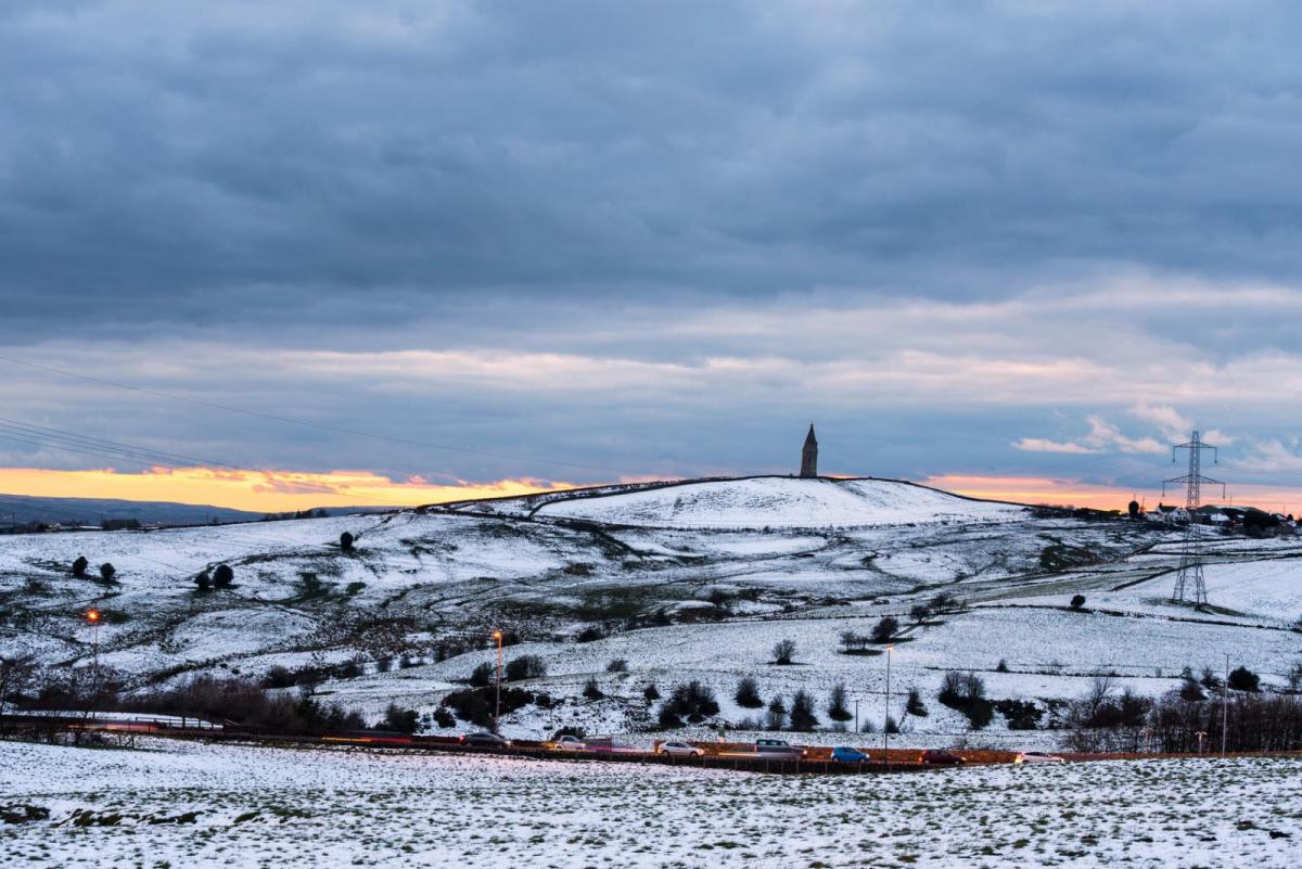
Rain, sleet and snow today and tomorrow, but turning drier and more settled from Thursday. It could turn bitterly cold from the east next week.
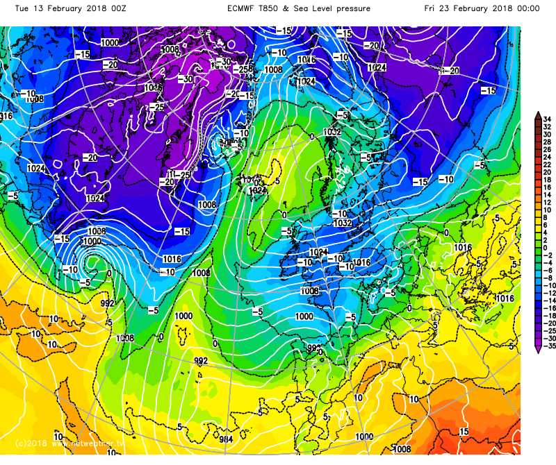
It remains mostly on the cold side for the rest of the week, but more unsettled over the next few days, with a band of squally rain, sleet, snow and even hail move east across all parts today, then wet and windy weather returns from the west on Wednesday, with hill snow in the north, but turning briefly milder in the south. Then it’s back to a cold polar westerly flow on Thursday and Friday, bringing sunny spells and wintry showers, with a risk of widespread overnight frost. The weekend is looking mostly dry for England and Wales as high pressure builds, cloud and rain at times for Scotland, N. Ireland and perhaps northern England, temperatures close to average but feeling chilly after frosty starts. High pressure continues to build north next week, perhaps eventually allowing a bitterly cold easterly flow to develop, as a sudden stratospheric warming that started yesterday triggers high latitude blocking.
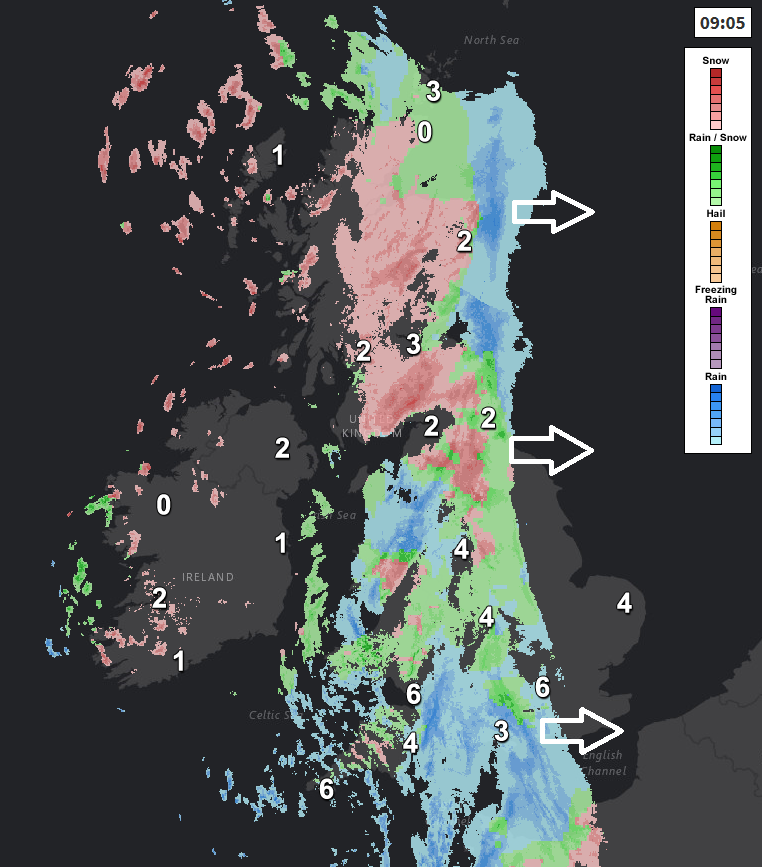
In more detail for today, it’s a windy start to Tuesday, with a band of rain, sleet and snow moving in across northern and western areas for the morning commute. Heavy rain and hill snow across Wales and western areas of England, while across the north of England and much of Scotland it’s snow falling away from coasts, which is bringing some issues on the roads across Scotland this morning, with some accidents on some major routes as traffic negotiates tricky conditions with heavy snow settling, though snow accumulations are patchy, with some areas seeing no settling snow.
The rain, sleet and snow will continue towards eastern England this morning after a dry but dull start here, then a cold and wet afternoon here, while sleet and snow perhaps lingering across the east of Scotland too, continuing to bring some travel disruption here, but drier and brighter conditions following across many western areas this afternoon, though with scattered wintry showers across the west.
Temperatures struggling today, reaching 4-6C generally, feeling colder than this in the strong wind, which will be southerly initially before veering westerly and easing as the rain, sleet and snow clears.
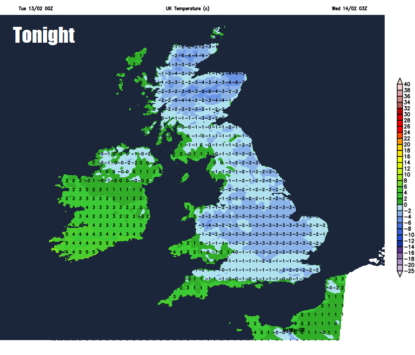
Today’s band of rain, sleet and snow will slowly pull away from eastern areas this evening, leaving clear skies overnight and as the airmass will be polar, temperatures will fall close to or below freezing, leading to widespread frost developing and risk of ice on untreated wet surfaces following today’s wet or snowy weather. Cloudier skies with rain and hill snow arriving across Ireland and N. Ireland by the end of the night though.
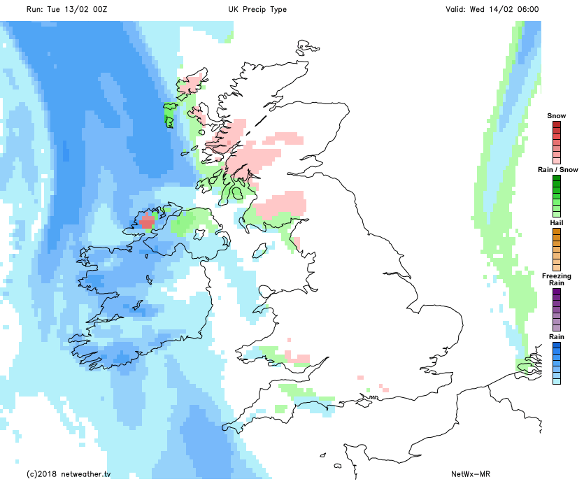
The next Atlantic frontal system arriving from the west will bring outbreaks of heavy rain and strong winds in across the north and west during the morning, preceded by snow across the north, which could again cause some travel disruption for Scotland and northern England. Snow turning back to rain at lower levels as milder air tries to move in from the southwest through the afternoon, rain and hill snow lingering through much of the day, though winds easing. Rain perhaps not reaching SE England and East Anglia until the afternoon. Milder in the south, where temperatures could reach 8-10C, in the north reaching 5-7C.
The weather calming down as we end the week, which will allow those on half-term to get and about more. A strong westerly flow will bring chilly conditions across all areas, though temperatures close to average during the day, Thursday will see a mixture of sunny spells and wintry showers, most of the showers across the north and west, with some eastern areas staying dry and sunny. Winds easing and mostly dry and sunny across southern parts on Friday, sunny spells, wintry showers and breezy across northern parts.
Saturday is looking mostly fine and dry with lighter winds, though there will be some showery rain at first across the north. After a frosty start, Sunday’s not looking too bad for England and Wales as high pressure builds in, with a mostly dry and bright day with light winds. But for Scotland and Northern Ireland it is looking cloudier and breezier with some patchy rain.
High pressure looks to build north across the UK early next week, bringing mostly fine, dry and sunny weather by day, with risk of widespread overnight frost and perhaps some fog. Some uncertainty how far north the high will build next week, but if it drifts far enough north, which there is a good possibility given a sudden stratospheric warming (SSW) to start the week likely encourage high pressure to build further north, then there is chance that an easterly or northeasterly flow will develop, bringing cold air from NE Europe and a risk of snow in places.