


January saw a north-south split across the UK, with Scotland and N. Ireland, ending up slightly colder than average, according to Met Office provisional data. The jet stream was slightly further south than the climatological average, and the predominantly strong westerly flow drew in cold air across the Atlantic at times from an intense cold vortex sitting over Canada and bringing some significant snowfall and low temperatures to Scotland and N. Ireland, particularly mid-month. However, with the jet stream close to south, southern Britain was less cold and so temperatures were slightly above average, England was 1.0C and Wales 0.7 °C above average, and it was also quite wet, with England and Wales seeing 107% and 104% respectively.
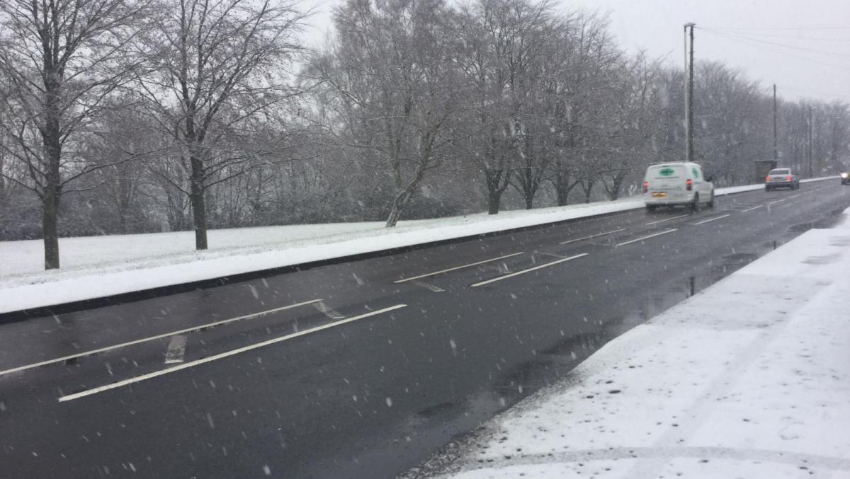
After a mild start to this week, the last day of January and first few days of February have brought a chilly feel thanks to northwesterly or northerly winds, with further snow over higher parts of Scotland and temporarily to lower levels and some wintriness reaching further south too, though temperatures on the whole are close to average for the time of year. The chilly conditions linger into the weekend. An occluding frontal system moving in from the Atlantic will stall as it bumps into high pressure building over Scandinavia, patchy rain along this front affecting Wales, northern and western England and Scotland will turn to snow over northern hills, though doesn’t look to amount to much. This patchy rain and hill snow in the north and west will fade away south into Sunday, which will be a drier and bright day. However, an increasingly cold northeasterly wind will develop across England and Wales, as high pressure over Scandinavia and Azores high extending NE join across the UK. This heralds a change to a more blocked and much colder pattern than of late through next week, bringing a risk of low temperatures and snow nationwide and not just the north – and it is likely to turn out to be coldest spell of the winter so far.
The change to a more ‘blocked’ and colder pattern, i.e. a blocking area of high pressure holding back the usual west to east movement of Atlantic lows that bring the usual wind and rain in winter, has been on mine and other forecasters radar for a few weeks at least, though the exact position of the blocking, duration and depth of cold has only recently started to be resolved by Numerical Weather Prediction (NWP) models. Weather forecasters have been watching the progression of the Madden-Julian Oscillation (MJO) over the past few weeks for the precusor to a pattern change, but also changes in the stratosphere and a few other drivers may have their role to now and for the rest of February.
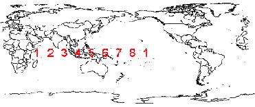
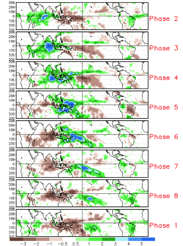
The MJO is an eastward moving disturbance of tropical convection (thunderstorms) that traverses the planet in the tropics and returns to its initial starting point in 30 to 60 days. This atmospheric disturbance can have dramatic impacts on weather patterns in the mid to higher latitudes of the northern hemisphere. The MJO wave moves through 8 phases as it crosses the equatorial Indian and west Pacific Oceans and these different phases are linked to different weather patterns across the Atlantic and Europe. Phases 2-5, where the MJO crosses over the Indian Ocean through to the West Pacific are associated with a positive North Atlantic Oscillation and milder weather for NW Europe. Phase 6 can be associated with blocking over Atlantic which can bring in colder weather from the north or northwest, as MJO enters phase 7 the lagged response can be associated with Atlantic blocking extending further northeast towards Scandinavia, then the ‘coldest phases of 8 and 1 are associated with high latitude blocking, i.e. blocking either over Greenland or Scandinavia. It may seem strange that a wave of convection over the western Pacific, so far away, would affect the weather over Europe. However, Rossby waves created by upper level divergence from enhanced tropical convection of the MJO wave moving into the western-central Pacific can significantly alter upper patterns at high latitudes of the Pacific, N America and even the arctic, which can lead to blocking downstream over the Atlantic and Europe and eventually high latitudes of Europe when the MJO moves into phase 8.
Position of the MJO phases, second diagram - blues show enhanced area of convection which moves eastward across tropics
Upper level charts over the last few days have shown anticyclonic wave breaking propagating poleward across NE Europe, probably induced the MJO wave propagation into the western Pacific (phase 6-7-8), this is warming the upper levels of the troposphere and creating blocking in the area.
There are other atmospheric drivers that can affect upper patterns, either working in tandem the MJO, which is a major driver of northern hemisphere patterns in winter, or against them - which can cause a lot more uncertainty. Atmospheric Angular Momentum (AAM) and ENSO (currently La Nina) can work with or against MJO, AAM is a measure of how fast the atmosphere is spinning relative to the Earth’s rotation, and is a complex variable that can have particular effects od flow configurations within the atmosphere. Low AAM is often linked to a La Nina driven pattern, like currently, and such a combined pattern often drives a zonal or mobile westerly pattern that is not conducive to blocking. However, given the MJO wave through phase 6 has been at record amplitude and likely will be through 7, the effects on upper patterns are likely to be overridding over these other drivers. We are also heading towards a solar minimum over the next few years and also the Quasi-Biennial Oscillation (QBO) is in easterly phase (often associated with a weaker polar vortex) which both will aid current MJO signal towards a blocked and colder pattern.
Furthermore, on the stratospheric level, both the American GFS and ECMWF have been indicating a wave number 2 warming over NE Europe in the next 5-6 days coupled with ongoing wave 1 warming over the Pacific side of the arctic which eventually leads to a split in the stratospheric polar vortex (SPV) over the next 10 days or so. We have seen the SPV displaced by poleward warming over the North Pacific / Alaska to northern Russia from its usual home centred near the north pole this winter so far, this doesn’t tend to bring drastic changes to weather patterns, however, a sudden stratospheric warming (SSW) and split of the polar vortex into two daughter vortices can, though not always, have profound effects on upper patterns, bringing high latitude blocking and extremes of cold to N America and Europe. If the SSW happens mid-late month, we could see further cold and wintry weather continue or return into late month and even into early March.
Possible SSW / polar vortex split mid-month may lead to extension or return of cold and wintry weather
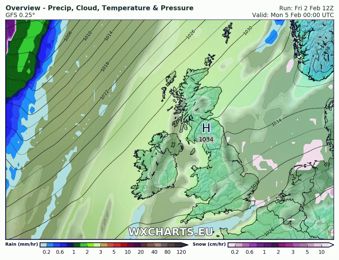
So next week is looking below average temperature-wise across the UK and much of mainland Europe (away from the SE), as high pressure blocking builds over northern Europe to start the week and draws bitterly cold air over Russia westwards and southwestwards. The upper-level ridging in the troposphere does look to weaken and retreat east over northern Europe as the week progresses, however, dense cold air pooling at lower levels and some weak upper level ridging will prevent Atlantic frontal systems trying to push in from the west getting very far east. Probably not getting much further east than eastern Britain and western France before stalling against the cold block next week. An Atlantic frontal system is modelled to move in across the UK on Tuesday, likely readily turning to snow as it bumps into cold ahead of it that has moved in from the east but also equally cold air following the front from the northwest. Quite an usual set-up having equally cold air, at least aloft, both sides of and Atlantic frontal system progressing east. Uncertainty between models how far east the front gets though, GFS further east than ECMWF, reaching eastern England, with clearer polar airmass with sleet/snow showers following in the west. Before Tuesday, which will have a more widespread risk of snow (albeit uncertainties over eastern extent) – there is a chance of sleet and snow showers moving in across eastern parts of England, later on Sunday and through Monday. Beyond Tuesday, there are no definite signs of a breakdown of the cold from the Atlantic. We could see another Atlantic frontal system move in from the west, perhaps on Thursday, which would likely bring mostly snow, followed by snow showers across the west, but again, uncertainty over how far east the front will get. Recent models runs are trending to perhaps introduce less cold air from the west by the end of the week though, more particularly across the north and west, though no certainty on this.
So February may end up below average temperature-wise, with potential for snow to affect many areas next week, though not likely any significant amounts, but perhaps causing some local travel disruption, though detail over where and how much cannot be forecast this far off yet, so we’ll keep you updated.


