We're into the final month of winter, and it's off to a chilly, wintry start.
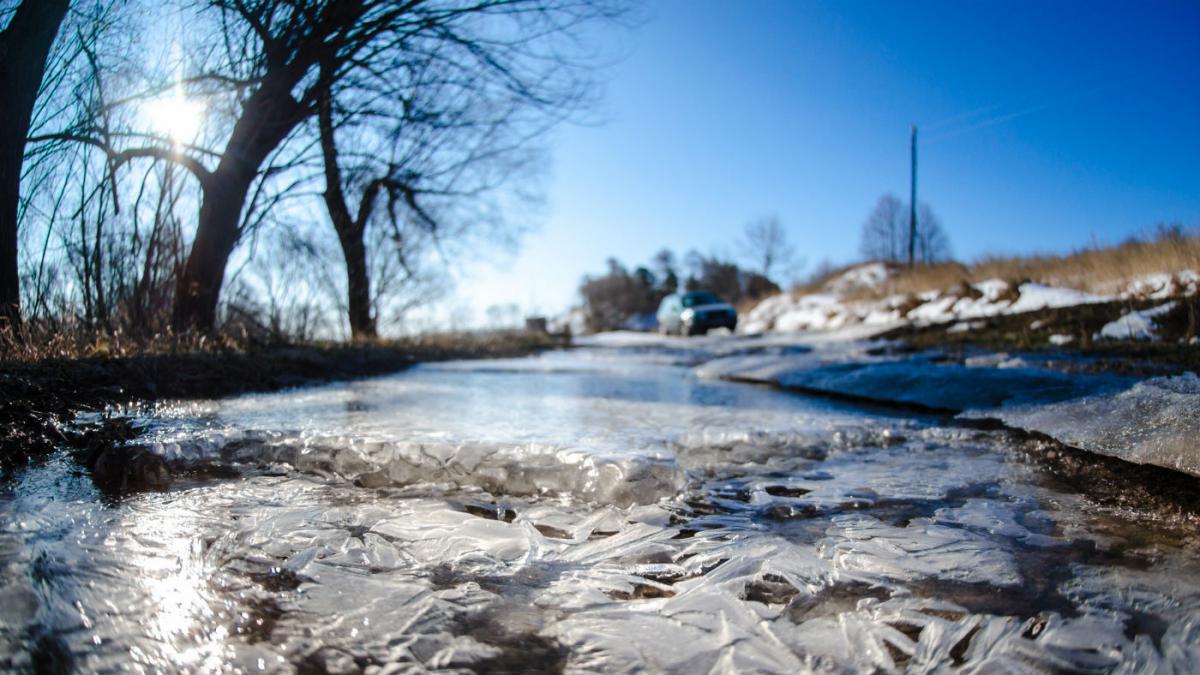
Although for many, the temperature is above freezing this morning, it's a cold feeling start to the day in the strong northwest wind. Adding to the quite wintry picture, we also have some showers in western and northern regions, which are falling as sleet and snow - especially up over the higher ground.
Through the day, the wind keeps coming, with gales or even severe gales affecting exposed regions in Scotland and northern England. The wintry showers which have started the day in the north and west will also begin to creep into eastern counties - mainly falling as rain close to the coast, but turning to sleet and snow inland and over the hills.
Elsewhere, there'll be plenty of sunshine to be had today, so not feeling too bad if you can get some shelter. Temperatures will range from 3-7c typically across much of the country, but the wind chill will make it feel that much colder.
 Overnight tonight, the winds will take their time to ease back, but they will eventually calm a little. There'll be frost in central regions, but the showers will keep coming closer to the coast - especially in the east.
Tomorrow, there'll be varying amounts of cloud around, but there should be some sunny spells breaking through. Scattered showers, wintry showers will continue to affect coastal areas, but they'll be fewer and further between than today. With lighter winds, it'll not feel quite as raw, but still a cold day.
The reason for the slight lull is that the low which bringing the windy, showery weather will be easing away toward the continent, having drifted down the North Sea during today. Then there'll be a brief ridge of high pressure ahead of an Atlantic system arriving this weekend.
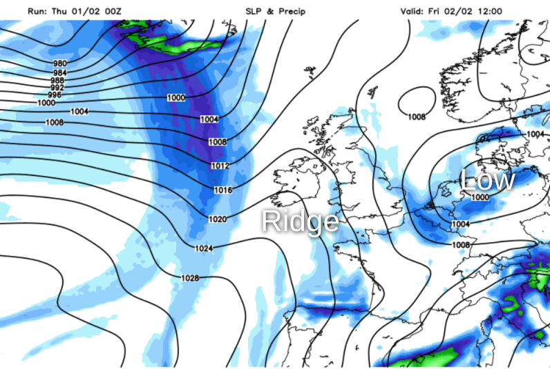
That Atlantic weather front is going to be crossing into Ireland during the evening, reaching western Scotland by the end of the day. Then it'll march steadily east overnight and into Saturday. Ahead of it all, Friday night will be cold and frosty in many places, but complications will soon arrive.
We've been here many times, and once or twice already this winter, so you probably know the drill. We'll have cold air in situ over the country, so as the rain comes in from the Atlantic and meets it, it's going to be falling as snow in places.
As ever with this sort of setup, it's on a bit of a knife edge, with the margins between rain and snow very slender - so subject to change from the animation shown above. But, there is the risk of some heavy, accumulating snow from the early hours of Saturday - especially inland and over the hills.
Once that mess has cleared, we're left with a cold weekend, with some sunshine, and just a scattering of wintry showers. The next thing to look out for early next week will be rain moving down from the northwest, which again could turn to snow in places. Deeper cold could arrive behind that too, and the cold air could well get locked in over the UK for the remainder of the week.