High winds, heavy rain, flooding risk. Quite a wild Wednesday morning thanks to #StormGeorgina. Cooler conditions taking over behind the lively rain band.
It windy this morning and for some very wet. There will be further high gusts although the worst of Storm Georgina has moved away from Ireland now. There is the risk of localised flooding due to sodden ground, snowmelt adding into the mix and then today's frontal rain. Ahead of the cold front, a band of line convection is showing, resulting in a brief spell of torrential downpours and very gusty winds.
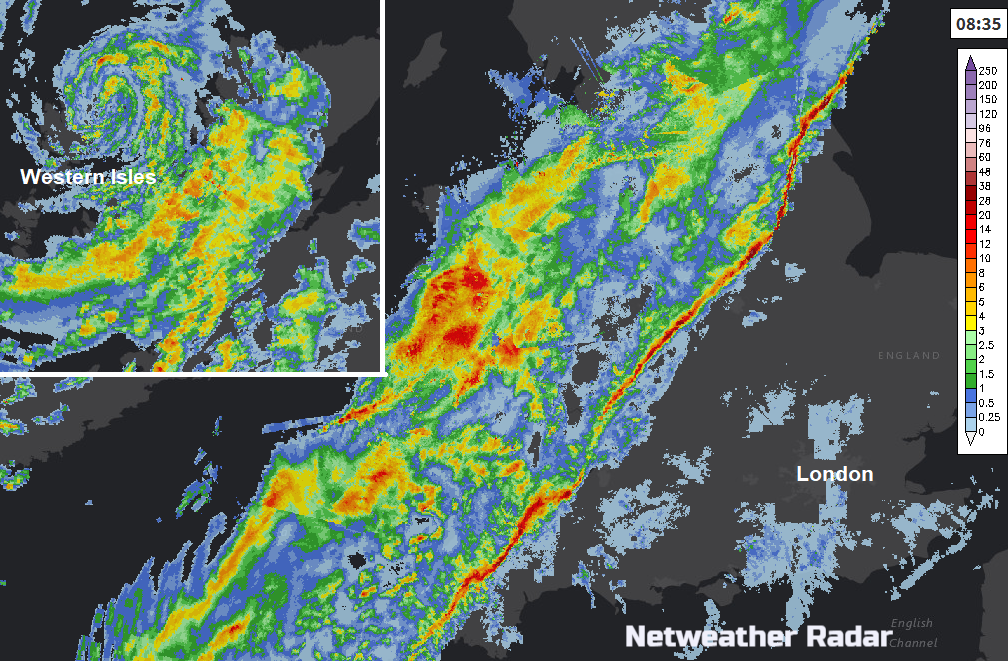
The thin bright line is the line convection and behind this is cooler air. It’s will move over the rest of England so keep an eye on the Netweather Radar app, so you don’t step out of the door as that arrives. This morning southern Britain started the day at 11 to 13C, very mild for a January morning and northern areas were around 6 or 7C. Behind the line, the cold front, it will feel noticeably cooler as the mild ‘warm sector’ air moves on.
Winds
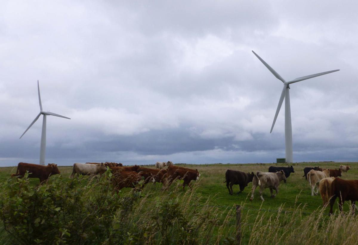
The Met Office has a yellow warning for the strong winds over NW and northern Scotland this morning and at lunchtime for the far NE. already there has been a gust of 85mph for the Western Isles and that risk continues for the NW Highlands around rush hour. Ferries have been cancelled to the Northern Isles, restrictions on bridges and another landslide in Scotland thanks to the heavy downpours and wild conditions.
Flooding
The Environment Agency has highlighted a low risk of river flooding for northern England on Wednesday and flooding in the River Severn basin is forecast to continue on Thursday from all the recent rain. There are several Flood warnings in place and the Yellow warning from the Met office about heavy rain over the Pennines with 40-50mm likely. SEPA also have several flood warnings as the melting snow adds to the amount of water.
Levels on the River Ouse are continuing to rise in response to recent rainfall and melting snow in the upper catchments. The river levels at York and Naburn are expected to continue to rise as a result of rain forecast to pass across the catchment and are expected to peak late on Wednesday.
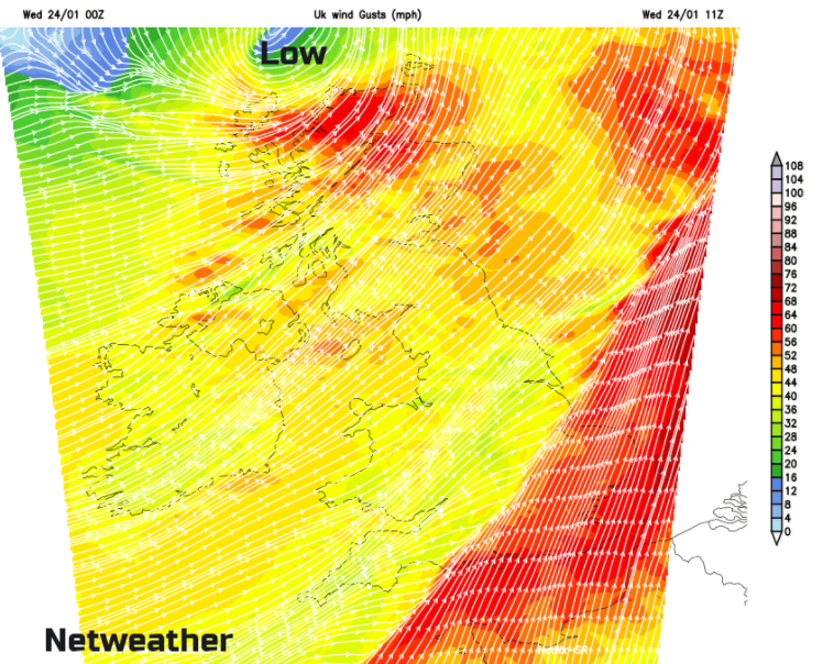
By midday, the band of wet weather will have reached the Wash across to the Isle of Wight and then will move over SE England lunchtime into Kent mid-afternoon with strong gusty winds. Behind this band will be bright spells and blustery showers, mainly for western counties. Further north the low pressure centre moves over Shetland at lunchtime, with gales clipping the north of the mainland and wild conditions around the Moray Forth early afternoon. It will stay windy today, but the worst of the gusts and gales should be leaving eastern Britain by mid-afternoon.
Colder air will creep in from the NW with the showers turning to snow over the Scottish mountains and wintry over high ground. It will feel cooler everywhere by later afternoon, a real difference after the brief mildness this week.
Blustery showers continue to blow in overnight on brisk SW winds before another area of low pressure brings a band of rain into Northern Ireland and western Scotland to start Thursday.
The winds become much lighter over Scotland and further bands of showers push over Britain, but it won’t be as windy as today and there should be more brightness in between.
Friday will be colder with the wind in the north. There will be showers caught up in the flow for eastern England with wintry bits in the far north. The frost will return with light winds away from the east and south coasts but there should be some fine winter sunshine.
Wet and windy weather sweeps through on Saturday as it becomes milder again and Sunday looks brighter away from the far NW.