A look at areas of the UK likely to see snow showers this week in the cold Arctic North winds.
Only a few more days left of Meteorological autumn, and cold Arctic air will be setting in for this week and next. The northerly flow will bring snow showers but not for everyone.
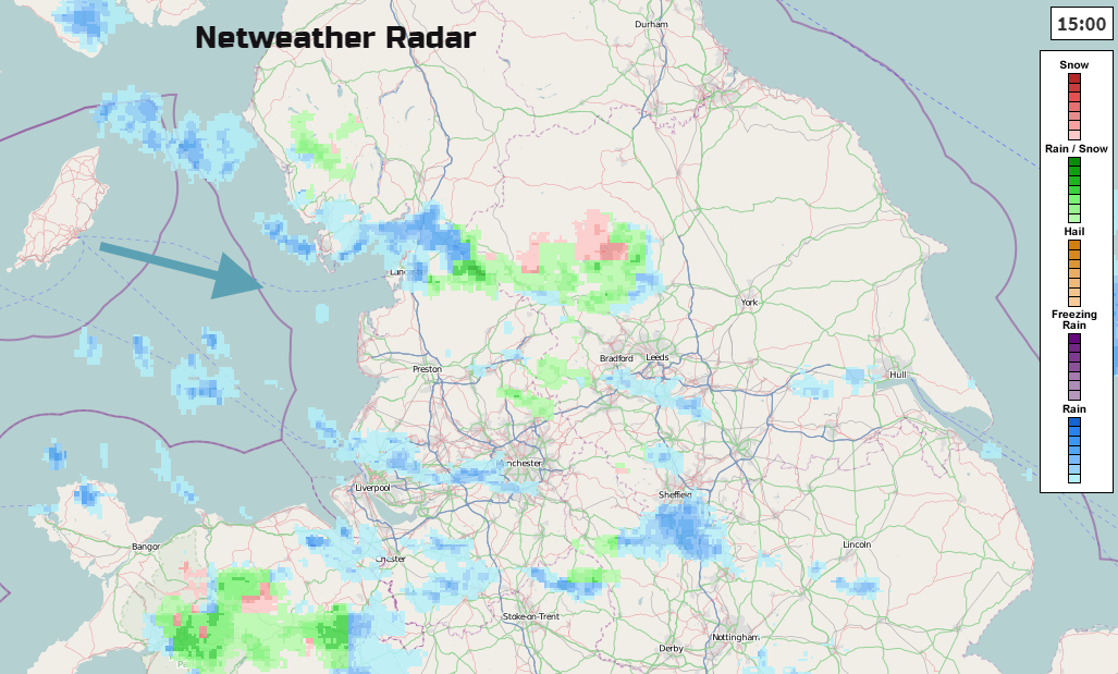
As the wind began to veer from westerly to northerly on Monday any of the blustery showers over high ground began to turn wintry. The blue shows rain, green a mixture of rain and snow, and pink show where snow is falling. Just chose Weather type on within Netweather or Precip Type on in the Netweather Radar Extra app.
It's all going to be about the wind direction this week, as to who gets the showers and so maybe the snow. Northern Scotland has already seen snow over the hills and mountains this weekend and more on Monday as an occluding front pushed down from the north. The ski resorts are glad to see some snow appearing but more is needed.
Northern Scotland will be most prone to the snow showers over the next few days. They will also drift down the west coast and east coast with the Central Belt being more sheltered. Everywhere will feel cold, even bitter in the wind.
Northern Ireland will see showers running down from the north. the Antrim Hills should get a covering and there will be flurries and perhaps a dusting for Antrim, Derry and Tyrone. In the stronger winds, sleet and wet snow may reach other parts but it will come and go.
North and west Wales look most prone, especially Snowdonia. Other showers will brush along the west coast and could reach SW England with a bit of snow for the Moors. Cumbria, the Dales, Pennines down to the Peak District could see some wintry flurries to start the week coming in from the west and NW but as the wind swings aorund to a northerly there will be more shelter. Until showers begin to head in from the North Sea and other areas will be at risk.
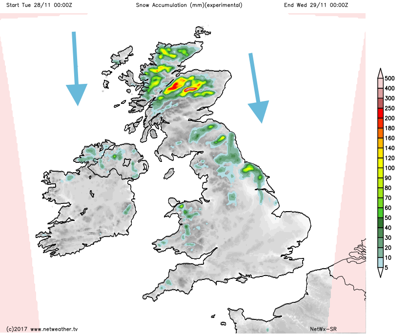
The snow accumulation forecast for Tuesday shows parts of NE and eastern England likely to get snow showers, the North York Moors and Cheviots standing out with brighter colours and higher amounts. A few light showers and flurries could run down to Norfolk by the afternoon, and through the evening further into East Anglia. This feed, down through eastern England, could continue for Wednesday morning. It will be interesting to watch their progress through midweek.
There will be ice and frost to watch out for as well as the biting winds. Thursday will be the coldest day with a fresh north wind across the UK.
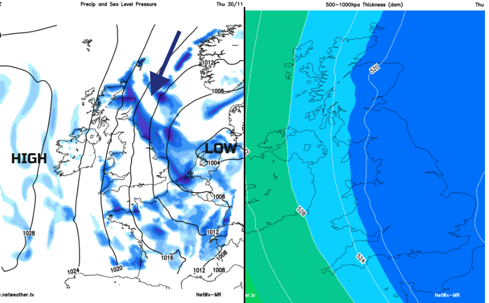
The snow level is around 150m by Thursday, with flurries to low levels in the much colder air. During Thursday the high pressure begins to take hold and settles down some of the showers through the day. Gradually the winds back slightly to the NW and cloud and rain could head in through Friday, If a frontal zone does move in from the far NW, it could result in more snow over the high ground of northern Britain as it moves southwards later on Friday. Low confidence about this.
So for most, it will just be bitterly cold with frost. Other areas in the far north and for western and eastern coastal counties run the risk of showers being blown in with winds around a northerly. And also ice where the showers have fallen, as rain, sleet or melted/compacted snow.