Rain, wind and snow all likely to affect the UK at times during the rest of this week.
The Met Office have issued warnings for rain and wind for parts of England and Wales for Wednesday through to early Thursday, then snow for northern Scotland on Thursday morning. There is then the potential for further snow in places Friday evening. This blog aims to elaborate on these risks over the coming few days.
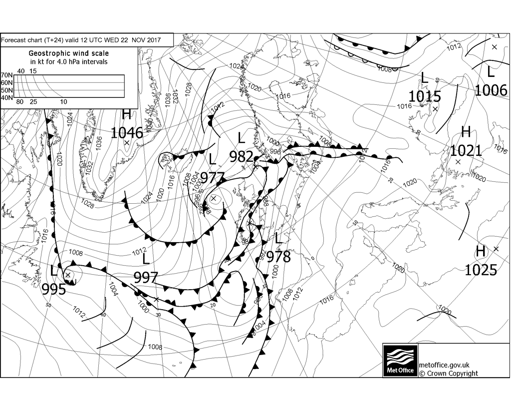
A complex system of slow-moving waving fronts will slide up from the southwest across Ireland, central and northern Britain during Wednesday. A strong southwesterly flow transporting mild and moist air of sub-tropical origin from west of Iberia will be forced to ascend by this waving frontal zone across central Britain, which combined with orographic lift over windward hills, will produce persistent rain leading to some large rainfall totals over northwest Wales, northern England and southern Scotland on Wednesday before rain gradually eases during Wednesday night. 25-50mm is likely widely in these areas, with 50-100mm possible over higher ground. This will lead to spray and surface water flooding on roads and may flood some properties in places.
Slow-moving waving fronts and plentiful supply of moist air from the SW = heavy rain.
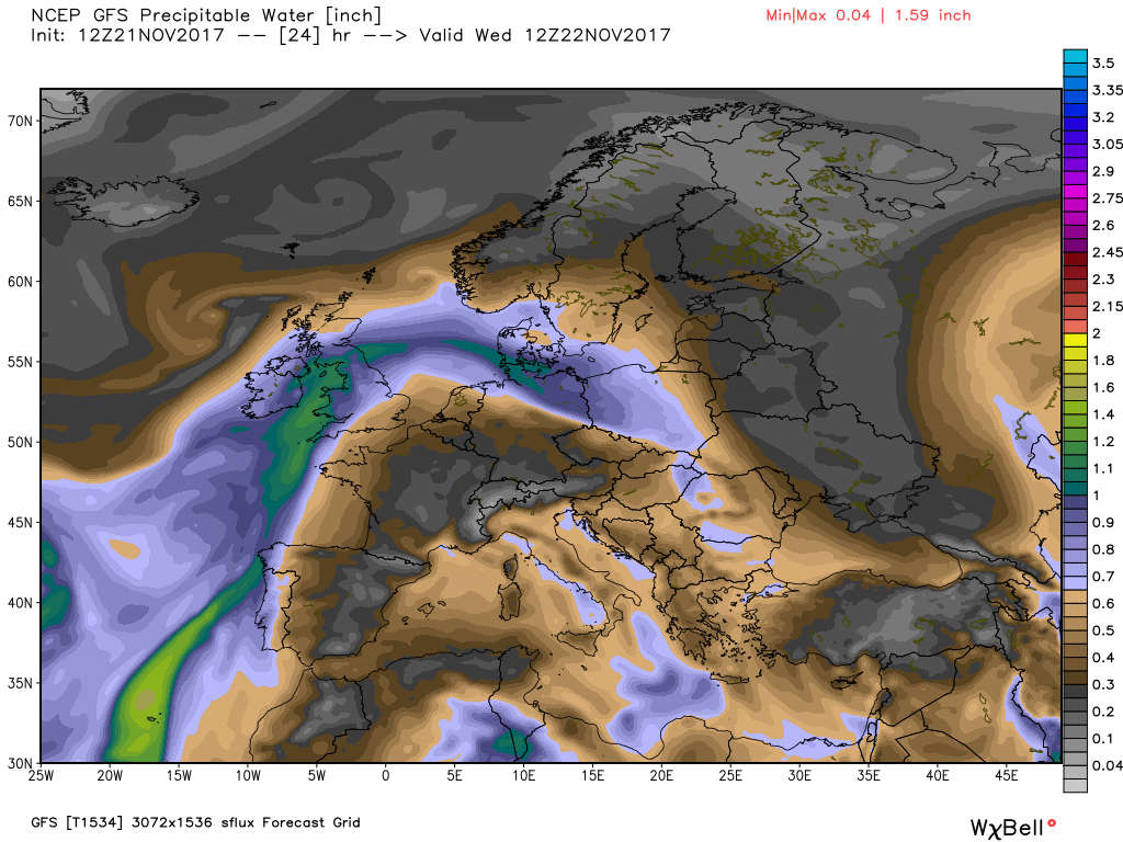
Credit: weatherbell.com
In addition to this swathe of heavy rain over central Britain, tight spacing in the isobars to the south of the waving frontal system across central Britain will produce some strong winds across England and Wales during Wednesday, with gusts of 60-70mph possible over higher ground and along southern and western coasts of SW England, Wales and northern England – while elsewhere gusts of 40-50mph can be expected widely, perhaps 50-60mph along coasts of SE England and East Anglia in the evening. Strongest swathe of winds arriving across western areas around midday on Wednesday before transferring toward eastern England by the evening, before winds finally ease across SE England after midnight.
There will likely be an overlap of the heavy rainfall risk in addition to the strong wind risk across north Wales and northern England.
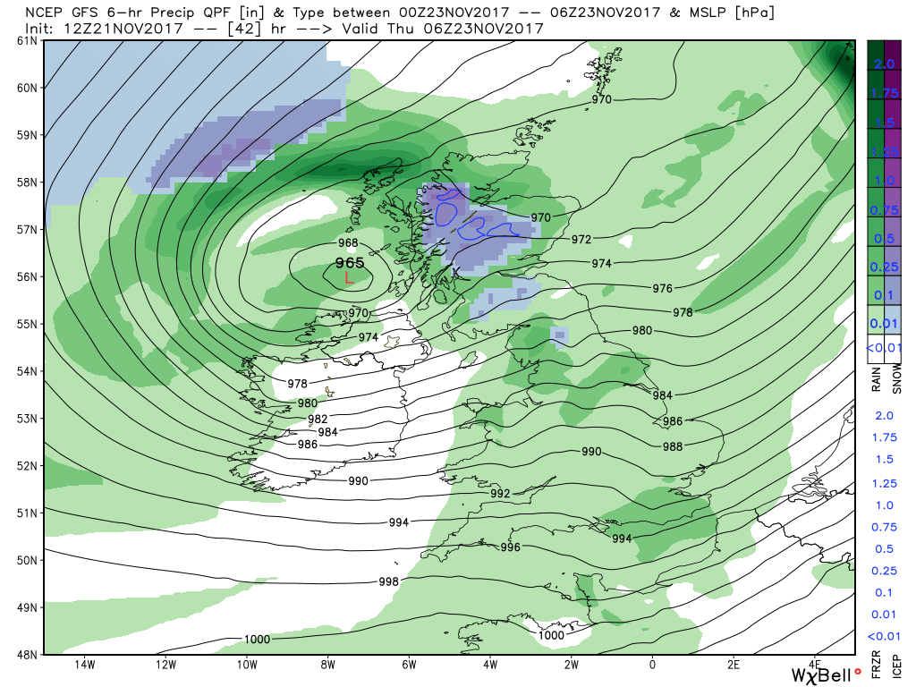
Attention then turns to northern Scotland for a risk of snow for a time on Thursday morning. This snow develops as drier and colder arctic air at the surface wrapping around an area of low pressure moving northeast across the far north of Scotland undercuts an area of heavy and persistent precipitation associated with the low. This colder drier air combined with evaporative cooling – turning initial rain to snow. The Met Office are suggesting 2-5cm widely across inland areas of northern Scotland, with 10-20cm possible in places, mainly over higher ground. Clearer conditions spreading in during the afternoon from the northwest, but with it a risk of hail, sleet and snow showers bringing further snow accumulations in places, more likely over higher ground.
Credit: weatherbell.com
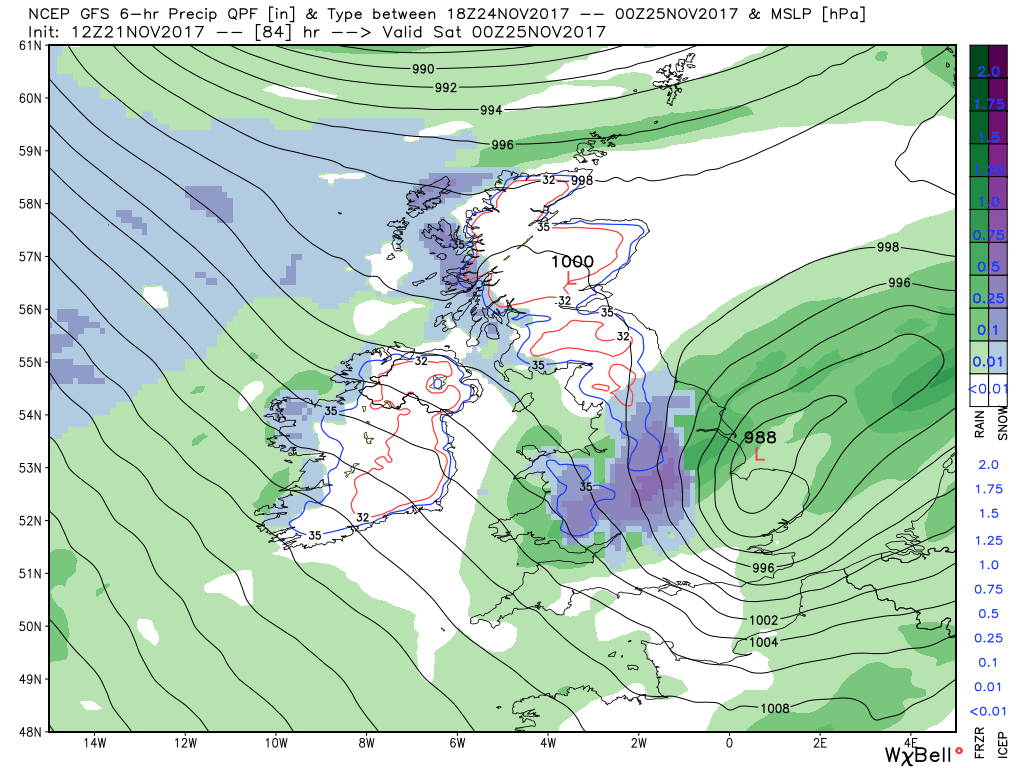
Looking further ahead into Friday, GFS indicates a ‘back-edge’ snow event still in the evening into overnight period across north Wales, Midlands and parts of northern England, as a developing area of low pressure moves up from the southwest and assocaited rain engages with and is undercut by cold air on its northern flank. ECMWF clears this rain through earlier and further south, confining snowfall to NW England and N Wales from wintry showers in the NW flow here. Given the uncertainty, may update on this potential nearer the time.
A cold northwesterly flow sets in across all areas over the weekend, bringing further wintry showers in places, mainly in the northwest, with some accumulations possible over higher ground in the north possible. Widespread overnight frosts will perhaps be the main hazard where ice forms on untreated surfaces. You can see the weather outlook for this week here.