A brief spell of colder air today and tomorrow. Milder air then returns for a time, but current signs are that colder weather will be a frequent visitor during the second half of November.
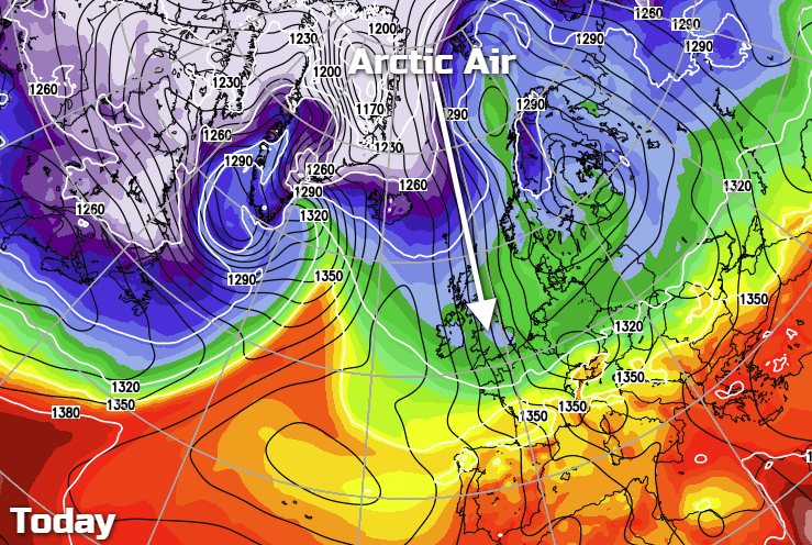
There's a distinctly fresh feel this morning, as colder air originating from the Arctic, is with us. It'll not be with us long, as it's going to get shoved away by milder Atlantic air during tomorrow, but not before giving us a widespread frost overnight tonight. Is this brief spell of cold just a starter for the main course later in the month though? Maybe... More on that below.
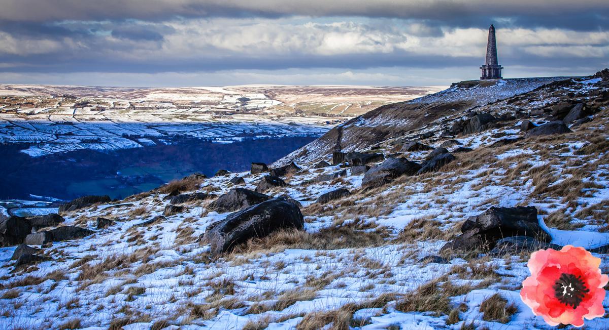
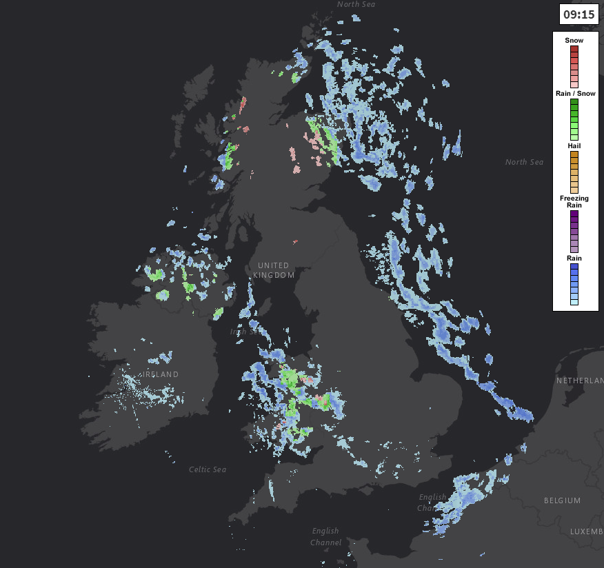
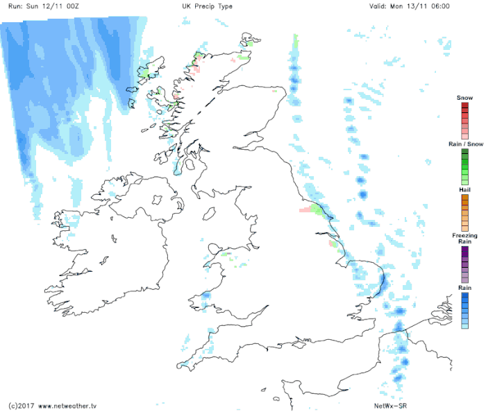
With the colder air, there's also a plenty of sunshine today, but there will be some showers as well. These are mainly going to affect coastal counties along with the northern half of Scotland. But there are also some running out of Wales and into the Midlands at the moment, which should clear through the day. Over the hills and mountains, the showers will be wintry with some accumulations of snow likely.
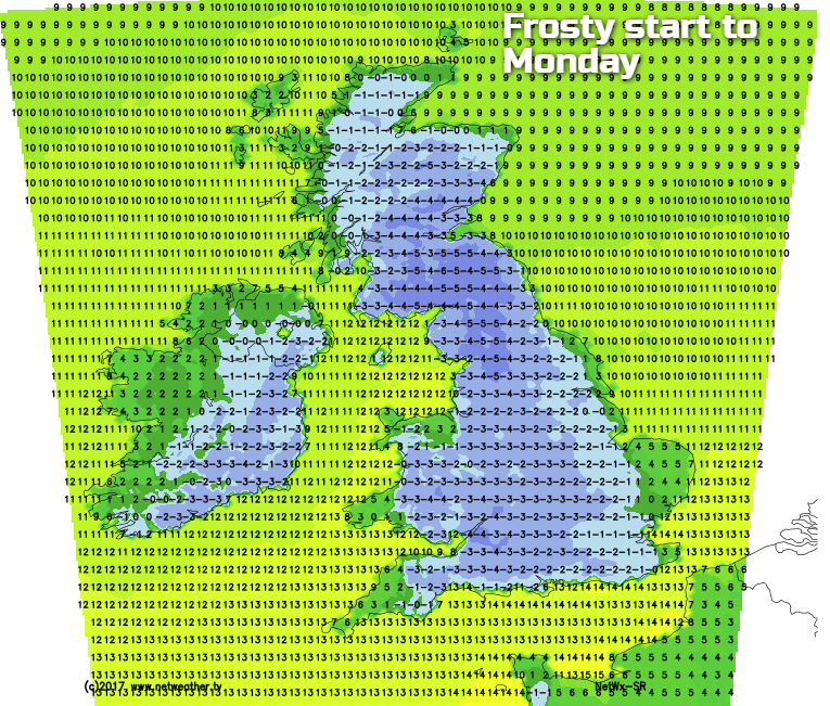
As the day wears on, it'll be the showers in the east moving further inland and becoming more frequent, whereas the showers in the west will tend to ease back and head closer to the coasts as high pressure edges in. Through the evening and overnight, although some of the coastal showers will keep going, in the main there'll be clear skies. That means it's going to be a cold one, with temperatures widely falling below freezing, bringing a frost for the majority of us by Monday morning.
During Monday, the high pressure which brought the clear skies overnight will sink south, allowing a weather front to move in from the northwest. This is going to introduce milder air eventually. But as it meets the colder air over Scotland and Northern England, the rain on it is likely to fall as snow for a time. For the remainder of the country, barring a few showers continuing in eastern coastal counties, it's a dry but still cold day. Temperatures will peak at 5-7c for the majority of England and Wales, 3-6c for Scotland and Northern Ireland, with SW England mildest with 9c.
The rain then continues to move southeast into Tuesday, becoming more patchy as it does so. By this point, milder air will be back with just the far southeast potentially seeing some frost in the early hours of Tuesday. It's then a cloudy picture, with only a few fleeting spells of sunshine to go with some showery outbreaks of rain at times. These mostly, but not exclusively in western regions.
Wednesday will be similar, with some more organised rain moving up from the southwest. The wind will also switch from westerly to southwesterly, strengthening through the day with gales in the far northwest later on, and overnight. It stays windy across the north and especially northwest of the country through to the end of the week, with rain moving southeast re-introducing some colder air again.
As we move through the second half of November, it currently looks likely that colder weather is going to be a more frequent visitor. Excitement levels are already rising in the model discussion thread, and it's easy to see why with temperatures forecast to dip below average for a good part of Europe.
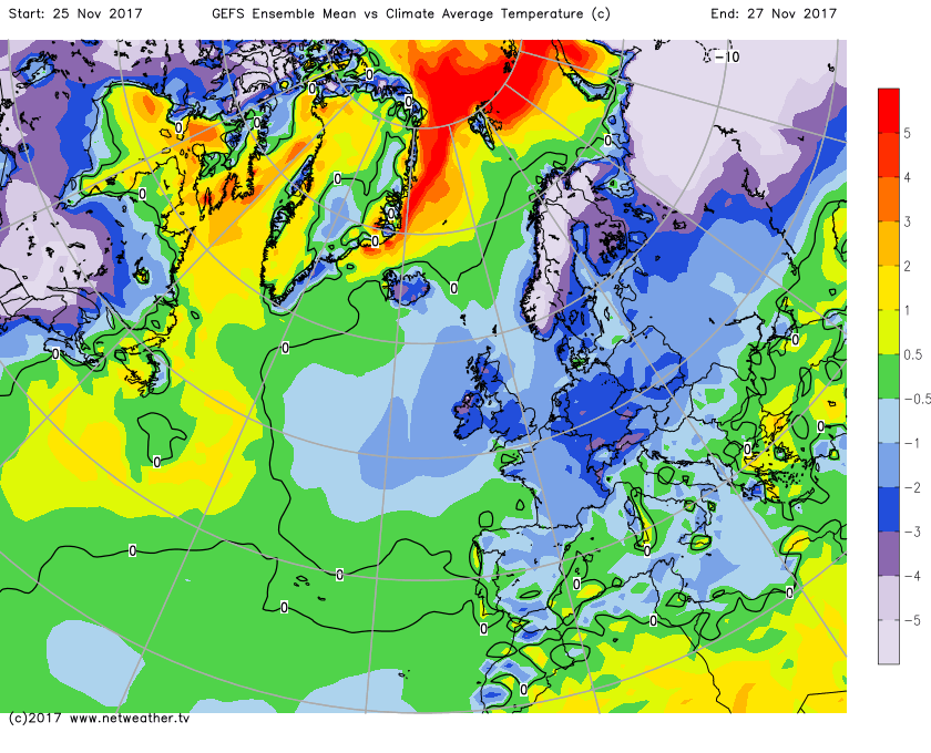 It's still all a long way off at this stage though, so lots of time for things to change, but it's worth keeping a close eye on.