Recent warmth on the way out over next few days, cold northerly wind developing Sunday, with a widespread frost Sunday night.
After another mild week for many, in what has been a very mild month countrywide, it’s going to turn colder through the weekend, with many places experiencing a frost by Sunday night. High pressure will bring fine weather for many this weekend, with much of the UK dry with sunny spells. However, the wind will change direction to come from a northwesterly direction on Saturday and northerly direction on Sunday, feeding in colder conditions. Many may wake up to a frost on Monday morning, not unusual for late October, but may come as shock after the recent very mild or warm weather. But don’t expect to see any snow away from Scottish mountains, which may see the first covering of the season, more particularly towards the east side of the Higlands.
Yesterday reached 19.6C in Wisley, Surrey, to SW of London, yesterday's temperatures against average for time of year
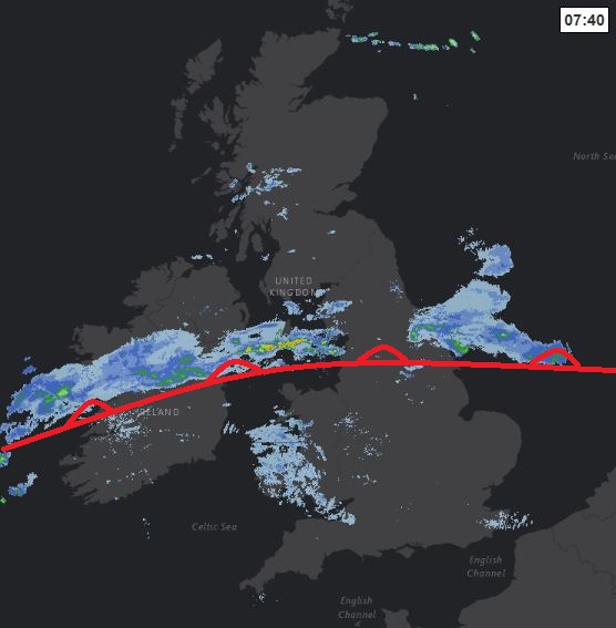
For now, a weak frontal boundary which pushed south to the English Channel yesterday returned north overnight, pushing cloud and a band of rain northwards. So we start the day mild and murky in the south, with cloudy skies across England and Wales with that band of mainly light rain for the morning rush hour across southern N. Ireland, Wales and northern England, patchy drizzle further south and east and some fog too across the south and west. Further north, clearer skies overnight means it’s a chilly, windy, but sunny start for Scotland, some showers still across the west of Scotland.
Through the morning and into the afternoon, the weather front across central areas will grind to a halt, so further light rain for N. Ireland, north Wales and northern England. While further south, the cloud may break up towards southern counties of England and Wales in the afternoon to allow some warm sunshine to develop. Staying dry and bright across Scotland, though showers affecting the far north of Scotland where it will be windy too.
Mild for the time of year across the south, temperatures reaching 14-18C, perhaps 19-20C in a few spots, to the north of the weather front moving north a cooler 12-13C at best.
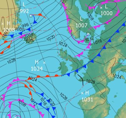
Then we start to see a change in the pressure patterns as we head into Friday, as pressure rises over Ireland while remaining low towards the east. This will allow winds to swing round to a northwesterly, pushing that weak front reaching northern England today back down to the south coast overnight, introducing clearer and cooler conditions from the north.
So Friday will start bright but on the chilly side compared to recent mornings, but it will remain dry as we go through the day, with good sunny spells, but feeling noticeably fresher in the south. Perhaps cloudy across the far southwest unitl the afternoon and windy in the northeast. Temperatures ranging from 11C in Scotland to 15C across southern England.
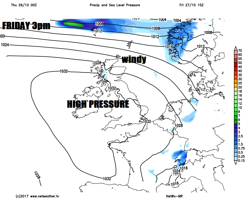
Staying generally dry as we head through Saturday too, though becoming rather cloudy and breezy for many as weak weather fronts push southeast. Cloud thick enough in the northwest to bring some light rain or drizzle at times. Feeling cooler than of late in the northwesterly wind.
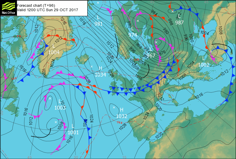
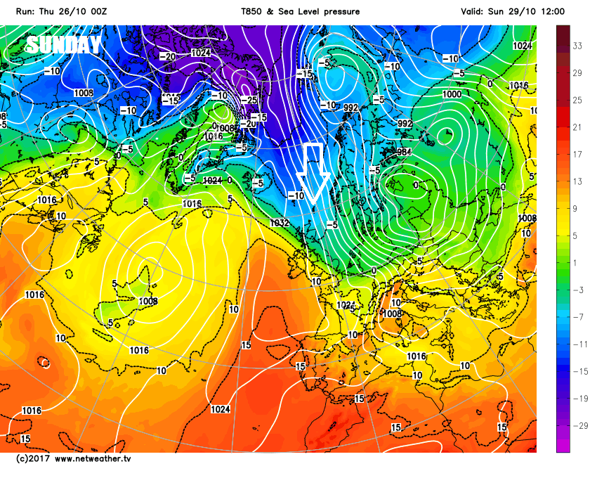
Then as we head into Sunday, a deepening area of low pressure drops southeast across Scandinavia towards the Baltic Sea, allowing northerly winds to sweep south across Britain, bringing cold arctic air to end the weekend. So although Sunday will be mostly dry and bright, apart from a few showers in the far northeast, it will feel noticeably colder than recently. Temperatures reaching 11-14C for England, Wales and N. Ireland, only 8-9C for Scotland. Wind strongest along eastern coasts.
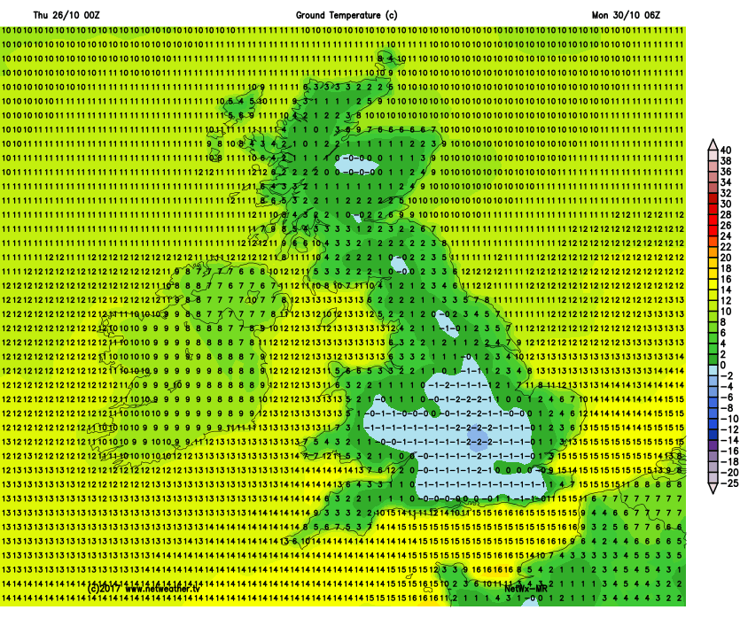
Cold Sunday night/Monday morning with a widespread frost
After a cold and frosty start for many on Monday, high pressure in charge across the south will bring a fine day here, but winds strengthening and turning westerly in the north will bring cloud and rain in from the Atlantic through the day. This cloud and rain in the north sinking southeast across southern parts on Tuesday, followed by brighter conditions across the north. Uncertainty grows from mid-week, but after a likely breezy and cloudy day on Wednesday, damp in the west, models have been indicating another northerly reload by Thursday, bringing another brief blast of colder arctic air. So chilly end to the week, with a risk of widespread overnight frost returning.