After warmth for much of October, the month ends on a chillier note, with colder conditions continuing into start of November.
October has experienced above average temperatures across the UK so far, the Netweather UK temperature tracker is running close to 3C above the 1971-2000 average. Temperatures continue to be above average for the time of year across the south this week, with close to 20C recorded at several location in the south yesterday and on Monday we saw 19C in Devon.
However, there is a change in wind direction later this week round from a southwesterly direction to a northerly direction by Sunday. So, it will turn much cooler and fresher across all parts over the weekend and we could see some snow over Scottish mountains with any showers on Sunday, before a widespread frost develops Sunday night across the north. And the chilly conditions, with risk of overnight frost, could last through next week.
Change to colder conditons from the north this weekend
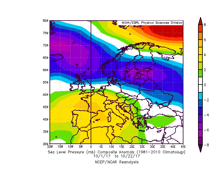
For much of the month so far, low pressure has been close to the north and northwest with high pressure dominating to the south over mainland Europe, with UK often unsettled, especially last week with 2 named storms bringing wet and windy weather.
MSLP anomaly 01-22 October 2017, shows low pressure anomaly over northern Britain.
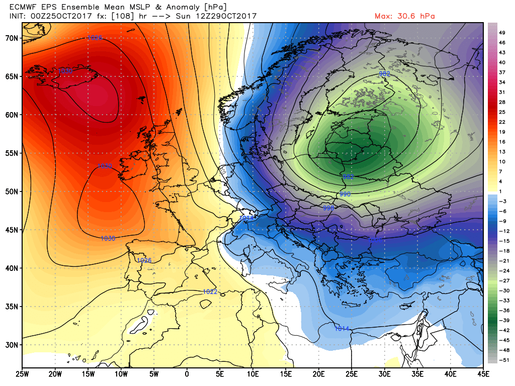
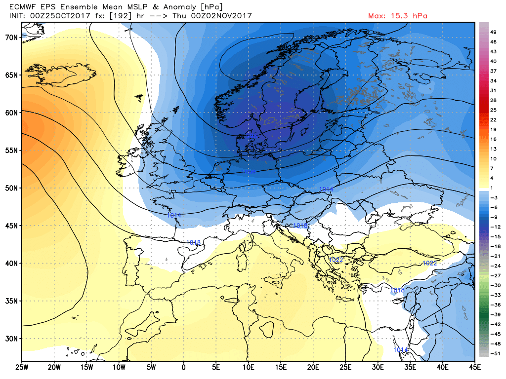
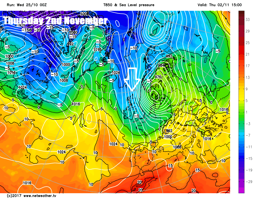
But from this weekend into to the start of November, it looks like a trough of low pressure will become a dominant feature to the east over Scandinavia and down into eastern Europe, while high pressure dominates to the west. This will mean winds are likely to be from a northwesterly or sometimes northerly direction as we end October and head into the first 5 days of November at least. So, a chillier more autumnal feel as we head into the last month before meteorological winter starts. Though overnight frosts look increasingly likely, snow looks to be confined to northern mountains.
EPS (ECMWF ensembles) and GEFS (GFS ensembles) MSLP mean/anomaly this Sunday and Thursday week
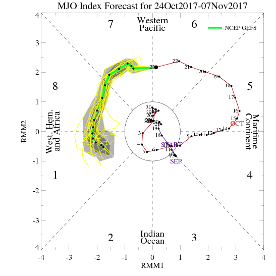
The change to a more ‘meridional’ jet pattern, which sees marked troughs and ridges develop in the jet stream, with the UK moving into the cold side of a trough to the east, maybe triggered by an atmospheric phenomenon known as the Madden-Julian Oscillation, or MJO. The MJO is an eastward moving disturbance of clouds, rainfall, winds, and pressure that traverses the planet in the tropics, but can have impacts on the weather patterns of the mid-latitudes of North America, North Atlantic and Europe. An ongoing strong pulse of the MJO, is surpassing 2008 and 2010 in terms of its amplitude as it passes through phase 7 and 8. The phases of 7, 8 and 1 are often associated with a greater chance of meridional jet stream and/or blocking highs in mid-latitudes of the northern hemisphere – which can lead to a greater chance of cold arctic outbreaks for the UK and Europe in late autumn, winter and early Spring. A displaced or elongated polar vortex can also aid these cold outbreaks, and this looks like the case as we head into early November.
MJO phase diagram shows MJO pulse going through P7, P8 and perhaps P1 - phases associated with a lagged response bringing more blocked pressure patterns for N Atlantic/Europe and greater chance of cold oubtreaks in late autumn and winter.
Early next week, high pressure looks to build in from the west, following the initial northerly on Sunday, tapping into the colder arctic airmass. So, we will experience some cool days, after a frosty starts. Temperatures on Monday, after a frosty start for some, struggling into double figures for daytime maxima even in the south and some cold nights with a risk of frost continuing next week, including Halloween on Tuesday.
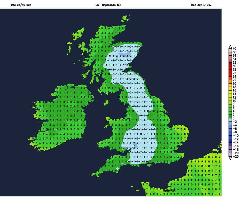
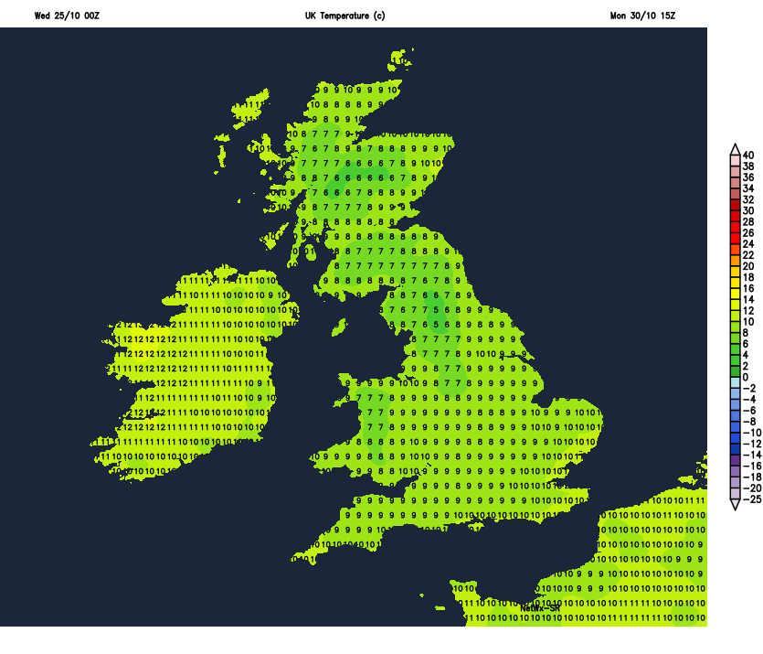
Monday 30th 6am and 3pm temperatures
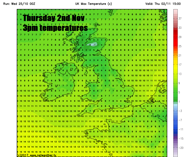
Both ECMWF and GFS weather models from the 00z run this morning then indicate another northerly wind blast later next week, around Thursday to Friday. This is also backed up by their ensemble means. GFS the most potent with the northerly, direct from the arctic, with daytime maxima reaching 7-8C at best in the south, colder still in the north, with a threat of widespread overnight frost.
So, certainly still looking colder and more seasonal as we start November. And, unlike recent years, Halloween will be chilly for those out trick or treating. 3 years ago, the UK saw the warmest Halloween ever, with temperature of 23.6C recorded in Kent in 2014.