There will be longer lulls today and tomorrow, in-between the showers. The winds will ease down at the weekend too. In the strong sunshine it will feel warm but not muggy.
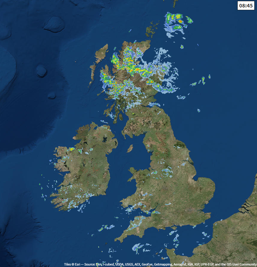
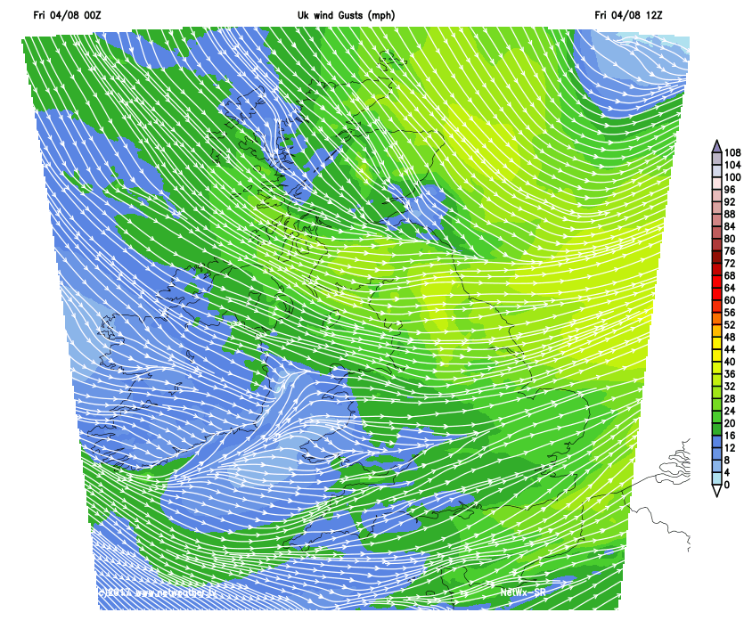
A bit of a change today with more sunshine and longer dry spells. It's not going to be as windy for Wales and the West Country but still blustery for much of England. There is a front over Scotland bringing morning rain, and this will continue over some parts into the afternoon. There will still be a few showers about, for SW Britain and maybe into Northern Ireland but overall there will be more fine weather as low pressure slips away towards Norway.
The winds today will be from the west or NW, so a fresher direction as we lose the slightly humid feel to the air. It will be windy over northern England with a brisk west wind, so Pennine ramblers take note.
Coastal location in the west will only reach 16C with the wind off the sea, but inland temperatures will reach the high teens with eastern Britain feeling pleasantly warm at 21-23C. The next few nights, over the weekend, will bring a nip in the air.
There are signs that the rain could turn heavy in the north later today with Lothian and the Borders looking prone, particularly down the A1 ready for Friday evening rush hour traffic.
Saturday is quite mixed across the UK. Again, there will be areas seeing plenty of fine, bright weather but showers for other spots. It looks like there will be a feed of heavy showers over Wales into the Midlands, with some reaching East Anglia in the afternoon. This feed could also clip Northern Ireland as it edges in from the Atlantic, with Co. Down looking prone in the south.
Scotland will also see more cloud and a scattering of showers from the west, but eastern England starts off sunny and promising. I think we know by now that a blue sky isn’t going to last and keeping a brolly or raincoat to hand is part of this summer.
A brief ridge of high pressure does start to suppress the showers, but I can't promise a totally dry Saturday evening, and it won’t feel as warm. Many areas will have a fine end to the day with just a few showers in the east and then overnight it will be dry, clear and cool with a glorious start to Sunday
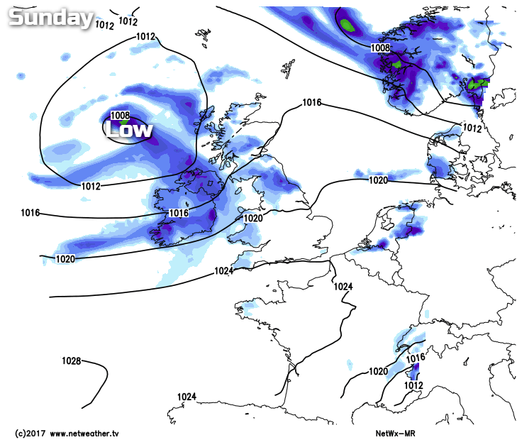
However, soon enough frontal rain will arrive over Northern Ireland with outbreaks for western Britain. A new low pressure system will be heading in from the Atlantic to bring wet weather over the NW half of the UK. The winds will turn back to south westerlies, yet SE Britain will see a fine Sunday with sunshine and warmth. Not back to heat and humidity but strong sunshine and a mainly dry picture.
For Monday, we’ll have to see where the frontal rain band reaches. It could be that parts of England and Wales sit under wet weather for much of Monday with brighter skies in the far SE and a cooler, showery picture over Scotland, N.Ireland and maybe NW England. There is uncertainty about where the waving frontal band will be or if it might just clear through. With low confidence, by Tuesday the frontal band could be over SE England, and then most of the UK is in a fresh NW flow with sunny spells and showers.
After that there are signs that the Azore's high could head our way, extending in from the west. That would mean more settled, steady weather and an end to these hefty downpours.