A quiet start on Monday before a band of rain sets in over Nothern Ireland, northern England and SW Scotland on Tuesday. Heat and humidity look set to return from midweek .
Wimbledon starts this week, so you would expect some rain in the forecast. It is also school summer holidays for Scotland and Northern Ireland and the start of the week sees weather fronts from the Atlantic. One band of rain will settle itself over Northern Ireland, northern England and SW Scotland on Tuesday. There are hints of more hot and humid conditions spreading up through the UK by the end of the working week.
Let’s hope Andy Murray and Johanna Konta get to enjoy the SW19 heat.
Today
Monday starts off quite mixed with an old fading cold front bringing more cloud and a bit of damp weather over Wales and northern England. Cloud is thick enough in other areas to give a bit of dampness first thing with quite a grey start. However eastern Scotland and counties around the Wash area are seeing sunshine. There is a westerly breeze today, which will be brisk over Scotland, and blustery at times for SE England and along the Channel coasts. Temperatures will struggle a bit today, around 15 to 22C. The next feature to head our way is a warm front from the SW.
Winds fall light over Britain overnight as rain sets in for Northern Ireland and the Isle of Man. Belfast will see a miserable start to Tuesday with rain and a brisk easterly wind. Currently, it looks like the frontal band will just sit over northern England for much of Tuesday.
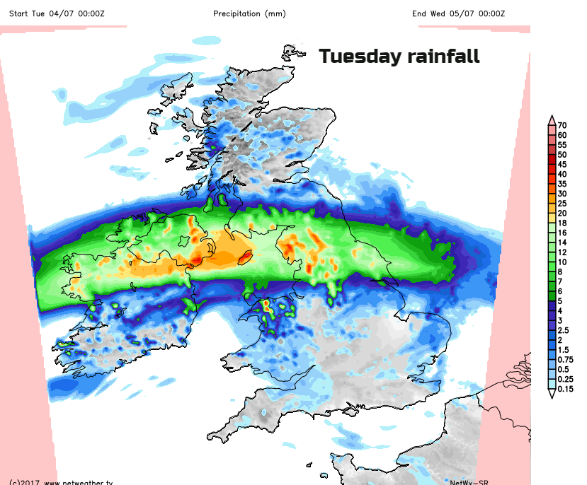
This shows the forecast rainfall totals for Tuesday; you can see how one part of the UK is affected by the rain, with higher totals in the 24 hours. It will affect SW Scotland too and could be encroach slightly further into southern Scotland, and the whole band will drift slightly further south during the day. To the north of the band, western Scotland will do well in the easterly breeze, up to 20C is possible with sunshine. To the south, with bright or sunny spells temperatures will be in the high teens or low 20sC. Under the rain, it will feel cool at only 14C
Northern Ireland will dry up later in the day, for western counties in the afternoon. Rain will fringe onto Anglesey as damp conditions and cloud cling to northern and eastern England well into the night.
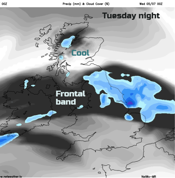
By midweek, the frontal band could still be bringing cloudy skies over southern Scotland and northern England with a few showery bursts. To the north it will feel warm, in the high teens with sunshine, for southern Britain, the heat will begin to build with some fine weather.
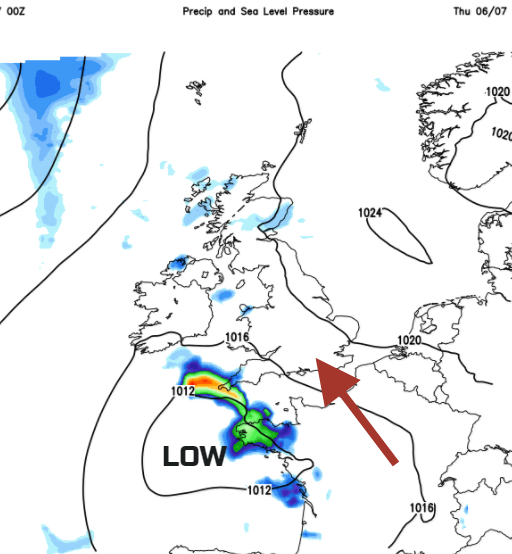
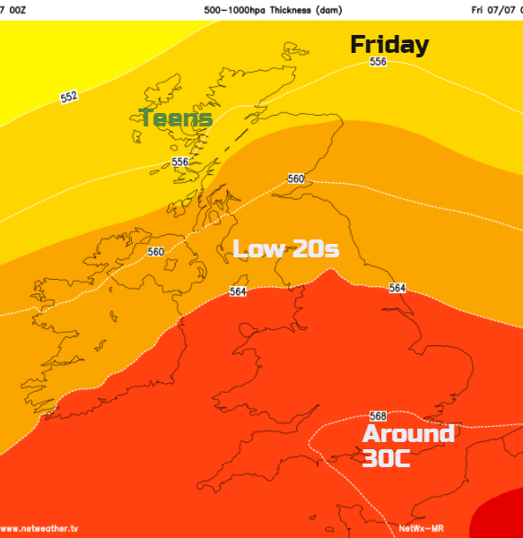
There are signs later in the week of heavy even thundery showers breaking out, linked to an area of low pressure edging up from the south. These look clustered over western parts of the UK on Thursday and more eastern areas by Friday. The heat will build as the humidity returns, and Gt. London could reach into the low 30s again. The detail on who will see a hefty downpour or thunderstorm is tricky at this stage, but that is the theme.
After a fresher feeling start to the week, heat and humidity returns, especially in the south with the threat of heavy downpours.