




This is what it looks like from space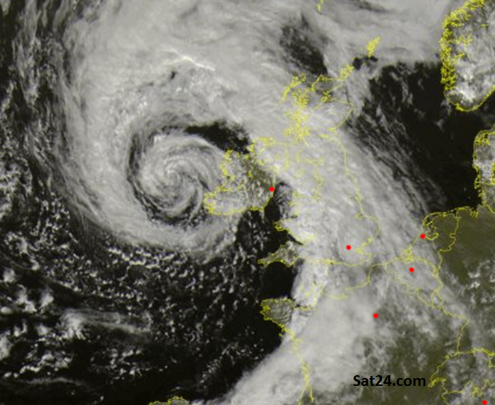
It will feel like Autumn
It’s going to be rather windy, quite a change from earlier in the week. All thanks to a deepening area of low pressure.
The Met Office has issued at Yellow wind warning.
This low isn’t expected to cause major disruption but it will bring a lengthy spell of windy weather over the weekend. So with lots of people out and about, activities and events planned and with it being such a change from earlier in the week they have issued a ‘Be Aware’ warning to let the public know these winds will continue through Saturday
This Low doesn’t have a name, as we’re still in summer.
Will the Met Office and Met Eireann continue with naming autumn/winter storms this coming season after last year’s trial? Will the public get to suggest names again this time, will the list continue with Lawrence, as the last one was #StormKatie at Easter 2016?
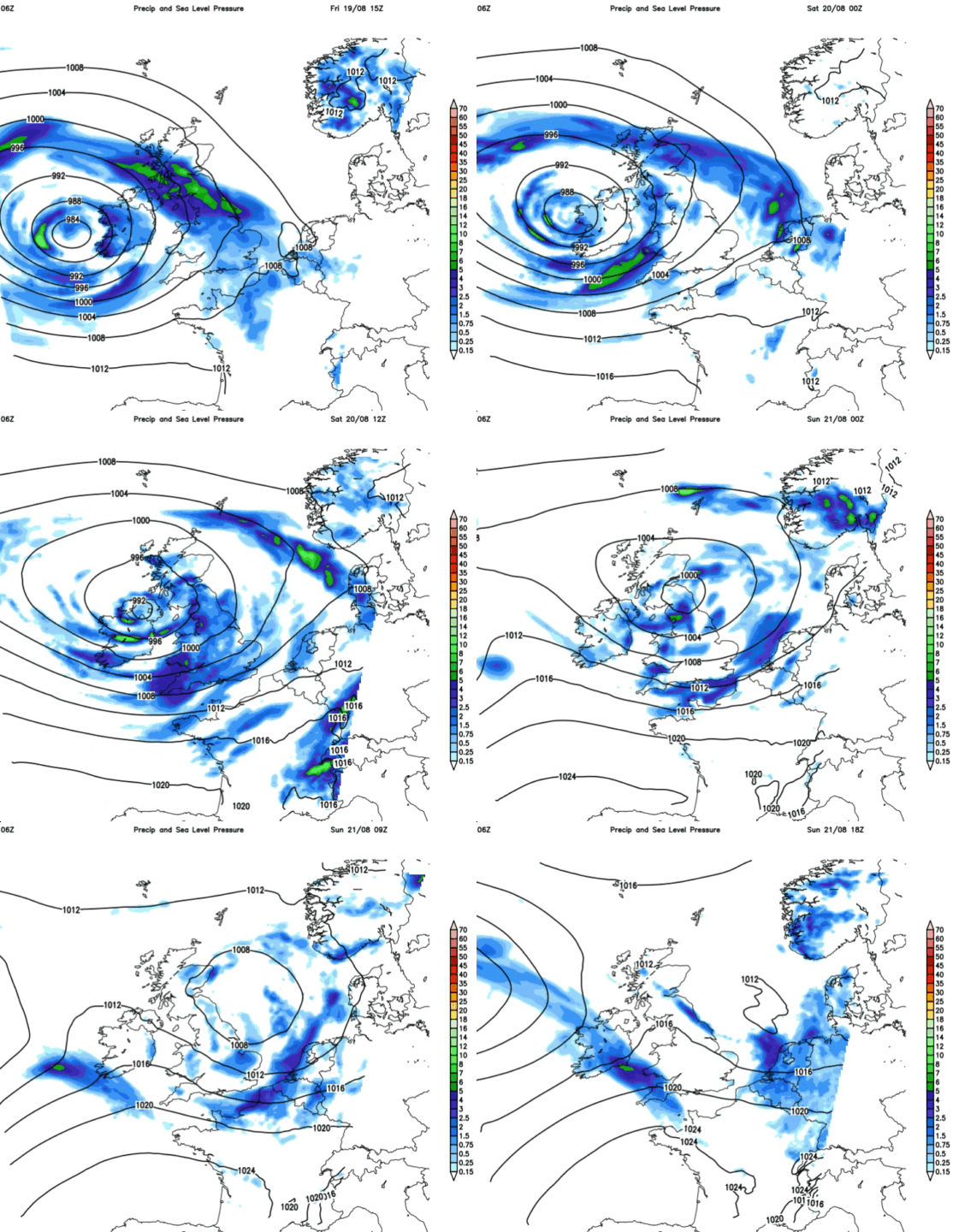
Strongest winds
It’s already blustery on Friday but the strongest winds will approach the UK around the south and SW side of the low, so on Saturday. Strong to gale force SW winds are forecast, up the Irish Sea, the Bristol Channel and the English Channel. Fresh to strong SW winds will affect inland England and Wales. Strong winds could clip Co. Down for a time on Saturday and a brisk easterly will blow into NE Scotland. Lightest winds over N.Ireland AM and Central belt of Scotland PM. Increasingly windy for NW England during Saturday evening as a Westerly sets in from Irish Sea.
Blustery start Sunday for Wales, England and N.Ireland but the winds do ease off during the day
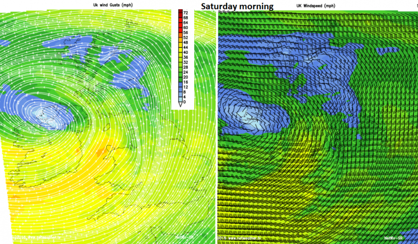
Top gust
60mph is possible along an exposed coastline of western Britain. Mean wind speeds are observed over 10 minutes whereas a gust can be a sudden higher speed over recorded over a 3 second interval. 30mph mean = strong 40mph mean = gale. Gusts are over quickly but can knock you off your feet.
It’s not going to rain all weekend
There will be a blustery showery mix over the next few days. Hefty, even thundery showers rattling by in the winds, but broken up by bright and sunny spells. Just to keep you on your toes. Fewer showers on Sunday and temperatures of 17 to 21C
There will be big waves.
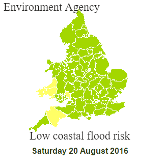
Friday night for Cornwall particularly expecting large waves. The Environment Agency is warning about the risk of coastal flooding for North Devon, south and west Wales and tidal river Wye. there are Spring Tides as well, so adding to the higher water levels.
What about my barbeque/christening/marquee/summer fete?
Where ever you are it will be blustery, very windy in places. Check the details for your location here.
Summer is not over
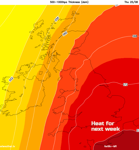
Next week has the potential to become very warm, even hot. Still a way off at the moment but don’t worry too much about this autumnal blip
Loading recent activity...











