Wondering why UK summer 2016 seems to be so changeable, with any proper warmth or heat fleeting? Blame it on the jet stream, it just won't leave us alone.
It’s a seemingly familiar culprit for the lack of ‘summer’ in recent UK summers, an active stream, which normally stays over or north of Scotland during the summer drifting further south bringing Atlantic low pressure systems across the UK, rather than passing to the north. June was cool and showery, July mostly indifferent apart from a brief spell of hot weather early last week, that brought one day of nationwide heat last Tuesday. Blame it on the jet stream stuck over or near the UK for much of the summer so far. This week features a pair of lows tracking across the UK riding on the jet stream, one that brought cloud and rain yesterday morning, another passing across central Britain bringing more cloud and rain today.
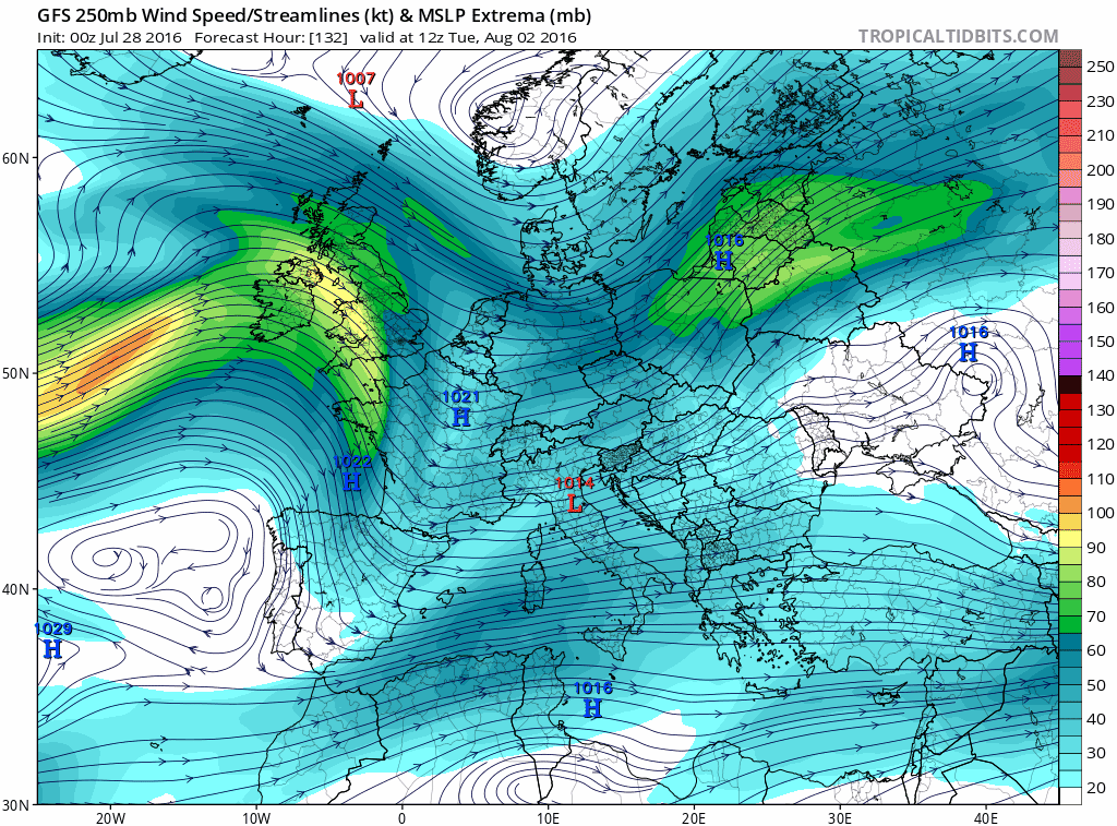
Active jet stream this week bringing Atlantic systems across the UK, sinks further south by weekend to allow a cooler and showery NWly flow:
The second system of this week, trundles east across northern Ireland later this morning, before crossing the far north of England during the afternoon and evening. It will bring a soaking to EIRE, N. Ireland, SW Scotland and Wales this morning – before spreading east across southern Scotland and England late morning and into the afternoon. The frontal rainfall will be fairly light south of northern England, but following will be brighter and showery conditions that could feature a few heavy and thundery downpours.
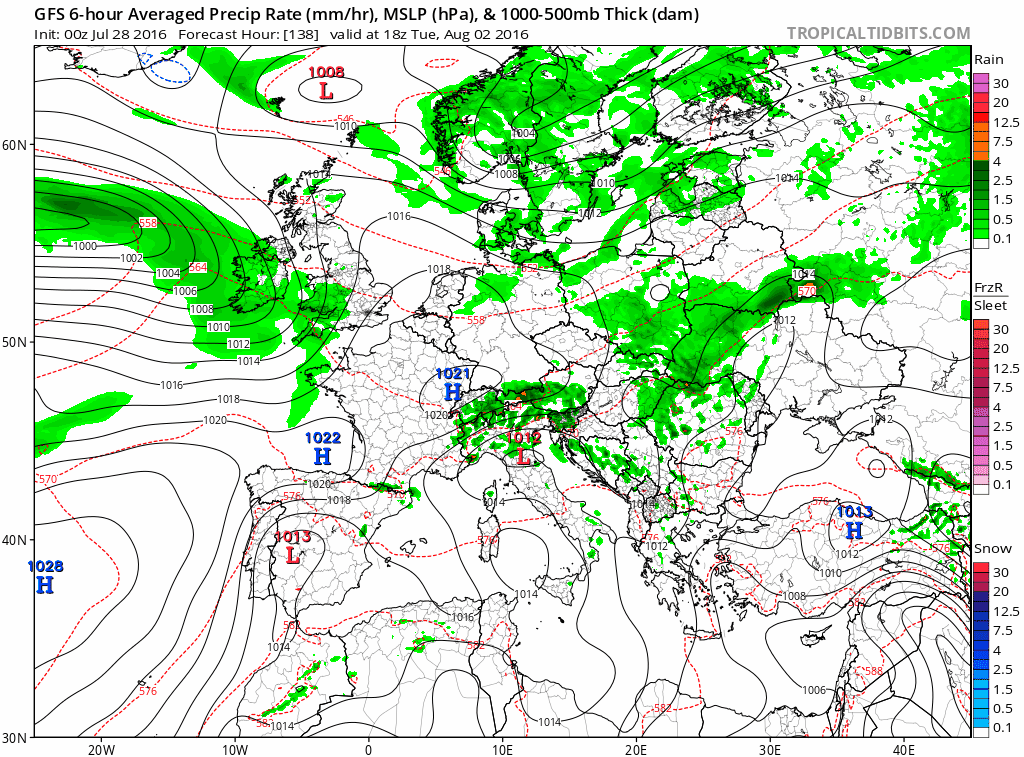
Atlantic system brings cloud and rain across all parts Thursday before clearing Friday to be followed by cool and showery NWly flow this weekend
Rain lingers across central parts today and tonight before slowly sinking south and clearing southern parts later tomorrow. Then a break from Atlantic systems on Friday and over the weekend, as the jet sinks even further south and a ridge builds to the west over the far north Atlantic – to allow a cooler but still showery northwesterly flow to affect all parts through weekend into early next week. So some well-scattered showers around, though not everywhere will see one, most frequent in the north, but if you do catch a shower, it could be on the sharp side. There will be a good deal of dry weather and some decent sunny spells around, pleasant in the sun out the cool northwesterly breeze. Daytime temperatures reaching the low 20s in the south, mid to high teens in the north. Not really a day on the beach weather, but at least it won’t be a washout. Could be chilly at night though, as skies clear in the polar maritime flow.
The ridge to the west then slides SE across the UK around Tuesday, to bring probably one the driest days of next week other than Friday, before another jet streak (a maximum of jet stream winds) moves in off the Atlantic across the UK for mid-week. So Atlantic systems return mid-week, bringing outbreaks of rain across the far west Tuesday evening before rain and showers accompanied by strengthening winds spread across all parts on Wednesday before clearing east on Thursday.
Jet stream with renewed vigour returns next week, bringing more wind and rain to dampen the summer holiday plans.
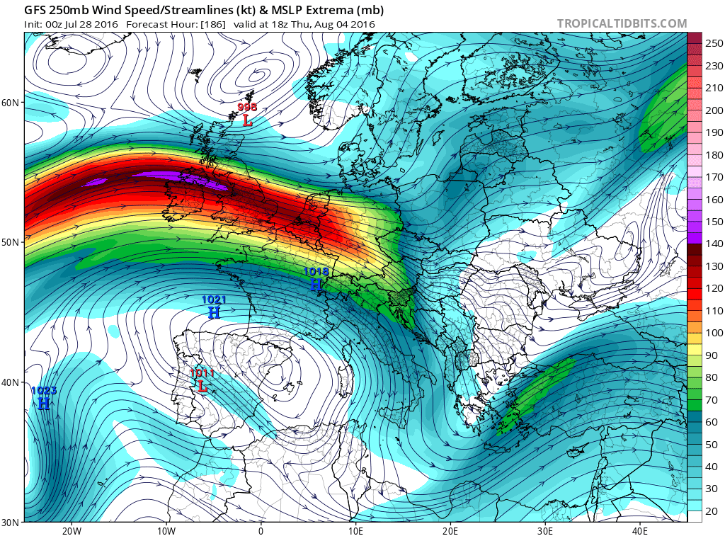
Towards the end of next week, some uncertainty, as would be expected this far away, but recent GFS and ECMWF runs suggest a brief ridge building on Friday and for the start of next weekend as the jet shifts north a bit – bringing drier and more settled conditions to central and southern parts, though a risk of wind and rain in the NE. But with the jet stream over northern Britain and a generally cyclonic westerly flow aloft, there is a risk of Atlantic systems moving in to affect all parts next weekend, with any high pressure ridges transitory.
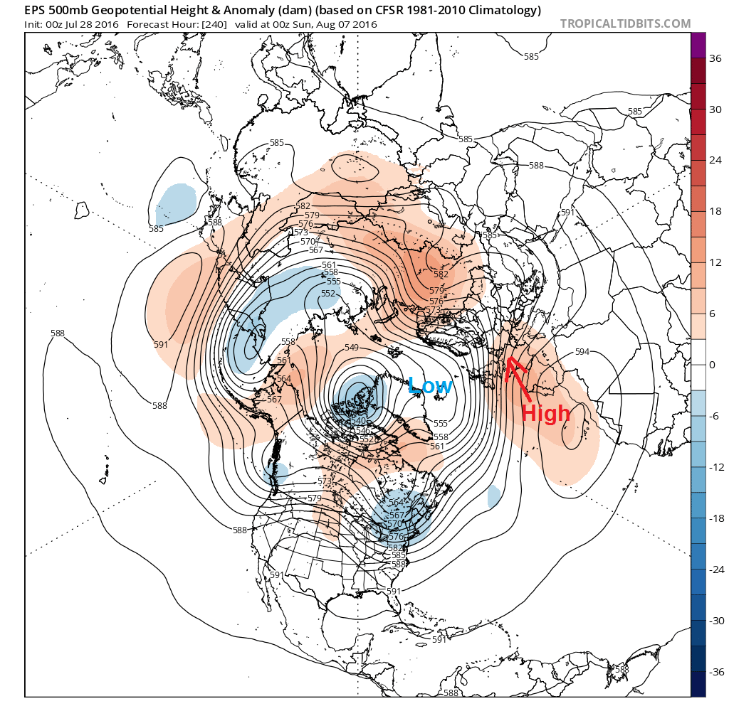
So it looks as if we just can’t shake off that pesky jet stream as we head into early August next week. So no strong signs of the weather settling down for 10 days at least, though tentative signs from GEFS and ECM ensemble mean for high pressure to perhaps become more prominent across the south at least, as we head into the second week of August. The jet stream maybe finally retreating further north to where it should be in High Summer, but don’t hold your breath!
Hints that pressure may rise across the south towards 2nd week of August: