Blog update looking at a fairly deep low formed from the remnants of ex-TS Henri that crosses southern Britain on Wednesday.
This is an update of the Blog I did Sunday evening looking ahead at this unsettled and autumnal week with a look at more detail in the arrival of a low pressure system on Wednesday that was spawned from the remnants of ex-Tropical Storm Henri.
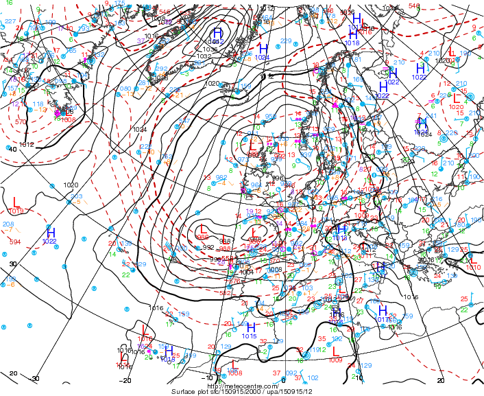
Models now in general agreement for a deepening low pressure system to the SW of the British Isles to move NE across England on Wednesday, exiting out into the North Sea late Wednesday evening. The low pressure system Tuesday night has 2 centres, a deeper one NW of Spain and shallower one off the NW coast of France. The low nearing NW France pushing a band of rain NE across northern France and SE England during the night. The low further southwest can be seen as a 'cloud head' with some convective thunderstorm activity with it and will merge with this low over the next 12hrs while introducing persistent and locally heavy rain across S Britain on Wednesday as the low pressure system continues NE.
2 lows in a low pressure system to the SW of the UK Tuesday night.
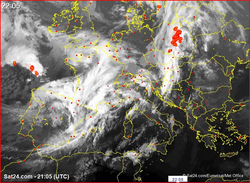
Satellite image, cloud head NW of Spain is the low that brings tomorrow's wind and rain, red dots are lightning (courtesy of www.Sat24.com)
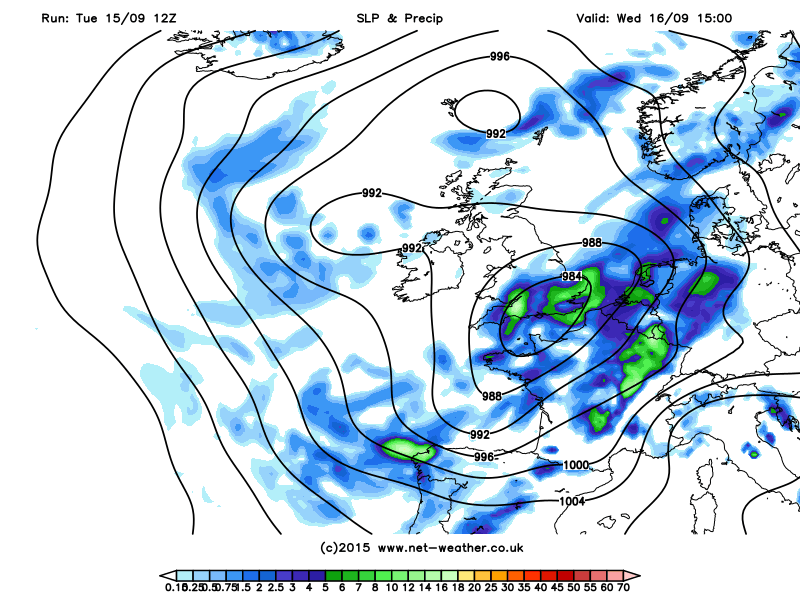
12z GFS has the low move NE across central pressure around 982mb has it moves NE from IoW (15z) up to the north Norfolk coast (19z). UKMO and ECMWF similar in track if slightly deeper by a few mbs. Quite a deep low for the time of year, though winds don’t look to be too much of an issue and perhaps toned down a bit from previous runs, still gales with 35-45mph gusts possible, these winds across southern England where the low passes initially easterly in the morning before veering southerly than eventually NWly as the low clears north.
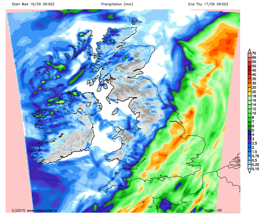
Rainfall perhaps more of an issue for southern Britain, given ground is already saturated, though again rainfall amounts toned down a bit from previous runs. GFS and ECMWF shows persistent and heavy rain moving north into S England from mid- morning ahead of the low, before spreading as far north as northern England into the afternoon. 12z GFS shows 15-30mm widely across east Wales and England from the north Midlands south, perhaps some locations in excess of this. Euro 4 has totals of 6-12hr 30-50mm across parts the West Country and the south Midlands. Netwx model 20-30mm in a swathe from West Country to Lincs:
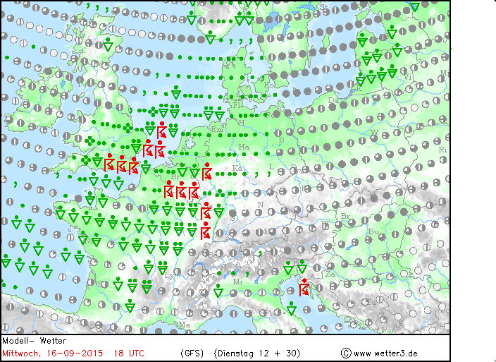
A pool of unstable air in the warm sector on the eastern side of the low pushes north across France and is indicated by 12z GFS to clip SE England in the afternoon/early evening, GFS indicates 400-800 j/kg CAPE, so here we could see some thunderstorms bringing some torrential downpours bringing as much as 15-20mm in a short spaces of time.