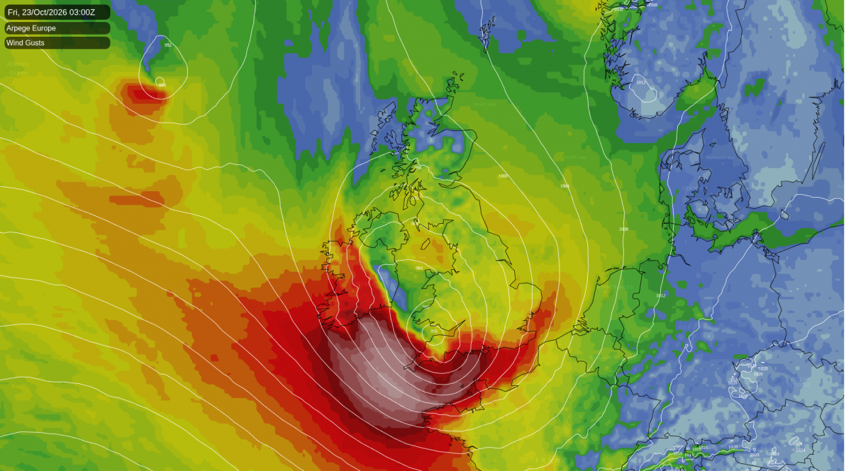
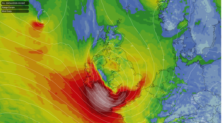
Storm Austen was named this morning, the first named-storm of the 2026-27 season, and is forecast to cross southern England on Friday morning - bringing risk of disruptive winds across SW England, the Channel Islands and northern France, 50-60mph widely here, but 70mph+ gusts possible with exposure. Winds easing early afternoon. Areas of heavy rain will wrap around the low across England & Wales too, with rain also pushing north across Scotland.
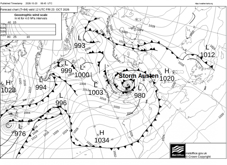
The Met Office named Storm Austen for the risk of disruptive winds across the southwest Friday morning, having issued a yellow wind warning which will be in force from midnight Thursday night through to midday on Friday and covers south Wales, south-west England and along southern coastal counties of England. Gusts in excess of 70mph are possible on the most exposed coasts, while gusts of 50-60mph are forecast widely in the warning area. The warning highlights the chance of travel disruption, power cuts and a chance of injuries from debris in places across south Wales and SW England and rain for some from late Thursday and into Friday.
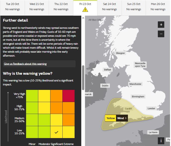
An area of low pressure forming on a frontal wave this afternoon over the Northwest Atlantic south of New Foundland is the embryonic stages of Storm Austen. It can be seen on the noon synoptic analysis below (circled) and also on the infrared satellite loop.
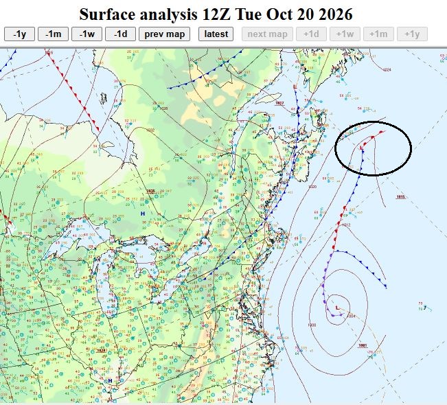
This low will rapidly deepen from Wednesday as it tracks east over the North Atlantic and is engaged by a trough moving out of eastern Canada in the same direction, while the low’s deepening accelerates as it initially moves into the development right entrance to a stong jet streak in the jet stream moving east over the Atlantic, then deepens rapidly on approach to Europe on Thursday as the trough sharpens and the low moves into the left exit of the jet stream.
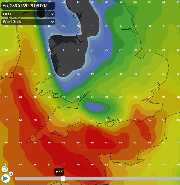
The general consensus from models is for the low to cross over or just south of southern England, northern most path from GFS entering across Cornwall, across southern most counties of England and exiting somewhere over East Anglia, southern most path from 06z ECMWF through the English Channel and across the northern most tip of France.
This 100-150 mile difference in track will make a difference to where the swathe of most damaging winds will be. Further north like GFS and gusts of 50-60mph could move into southern coastal counties of England as well as across SW England. Either way, Channel Islands, exposed parts coastal parts of Cornwall and Devon along with northern coasts of Britanny and Normandy over in France could see 70mph+ gusts.
Rain, locally heavy, will be an additional hazard from Storm Austen, with 20-30mm in many places and higher totals possible over higher ground in the west and further north on Friday
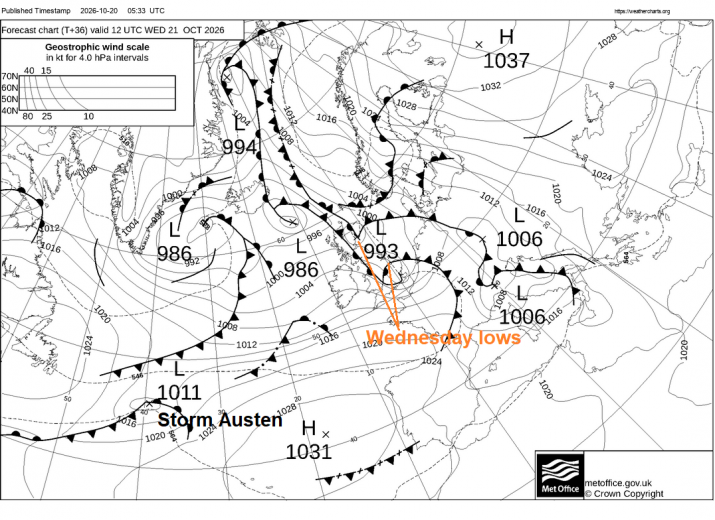
Before Friday: Wednesday and Thursday will bring further outbreaks of rain and showers before the storm arrives. On Wednesday, one area of low pressure will move north across Scotland, bringing showery rain here, while a small low across the southwest in the morning moves northeast towards the North Sea by early evening, bringing outbreaks of rain eastwards across England and Wales, giving another 5-10mm in places, also some strong wind gusts developing as the low clears, perhaps 45-50mph gusts across the southwest and south coast.
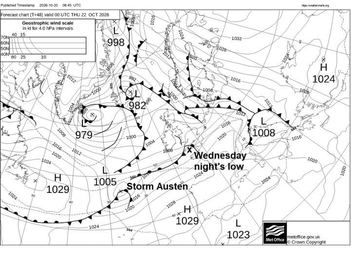
Wednesday night: a frontal wave looks to zip across southern England, bringing some heavy showery bursts of rain, perhaps with a few thunderstorms mixed in along coastal areas of SW and southern England.
A slack ridge of high pressure builds in on Thursday, a cold start in the north as skies cleared overnight, with a frost, leading into a cool but mostly sunny morning, but heavy rain and strengthening winds moving in ahead of Storm Austen looks to sweep in from the southwest across England, Wales and N. Ireland by late evening, starting in the southwest in the afternoon.
Heavy rain will move in across England and Wales through Thursday night with strengthening winds. The storm will move from west to east through Friday, with winds generally easing later in the day. The weather won’t settle right away, though. After Storm Austen moves away later on Friday, another deep area of low pressure moving in to the northwest this time will bring more wet and windy weather east on Saturday and early Sunday, before a cooler but windy northwesterly flow spreads in on Sunday.
The exact track of Storm Austen is still uncertain, and warnings could change as confidence in its movement and intensity improves. Check the Met Office warnings page on Thursday for the latest.
Loading recent activity...