A cold spell of weather has arrived - Nick looks at how it's likely to pan out in his latest synoptic outlook.
A cold W to NWly flow covers the UK today, an occluded frontal system embedded in this flow brought enhanced bands of wintry showers across many areas this morning. One band of showers, now clearing the far SE of England brought a mixture of sleet, snow and freezing rain. The rain bought some hazardous driving conditions across SW and central S England this morning, falling on frozen surfaces. Drier and sunnier conditions for many this afternoon, though rain showers continuing across SW England and Wales, falling as snow over the top of the Moors and Welsh Hills. Further sleet and snow showers continue across northern and western areas though, particularly across western Scotland, NW EIRE, N. Ireland and NW England, where they will continue to fall as snow even to lower levels away from coasts, topping up the snow already on the ground across these areas.
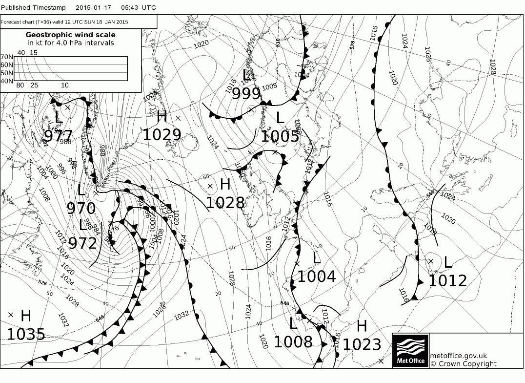
Clear spells across northern areas tonight leading to a widespread frost, with temperatures well below freezing over the snowfields, however, as winds turn northerly we will see a few troughs or fronts moving south, bringing bands of snow showers south at times. Cloudier across southern areas overnight, keeping temperatures generally a few degrees above freezing. Also, we will see outbreaks of rain/sleet spread in overnight from the west across S Wales and southern counties of England (as far N as Midlands and Sern E Anglia) – turning to snow on its northern edge – particularly, but not exclusively over higher ground, so we could see a light covering in places by dawn.
Overnight rain, sleet and snow clearing the far south by mid-Sunday morning, then a cold northerly flow spreads south across all areas, bringing sunny spells but also some wintry showers – these becoming confined to northern and eastern Scotland and NE England by the afternoon. Generally cold, more particularly in the north. Sunday night is looking particularly cold though across many areas under clearing skies. Towns and cities in the north down to-3 to -4C, in the south 0 to -2C. But in rural areas we could be looking at as low as -10 to -14C across the snow fields in sheltered parts of Scotland, N England and N Ireland ... -4 to -7C across inland rural parts of Wales, central and S England.
Monday’s looking generally dry, bright or sunny across the UK, though a shallow area of low pressure across the North Sea looks to create enough instability and frontal activity for some wintry showers towards eastern coasts.
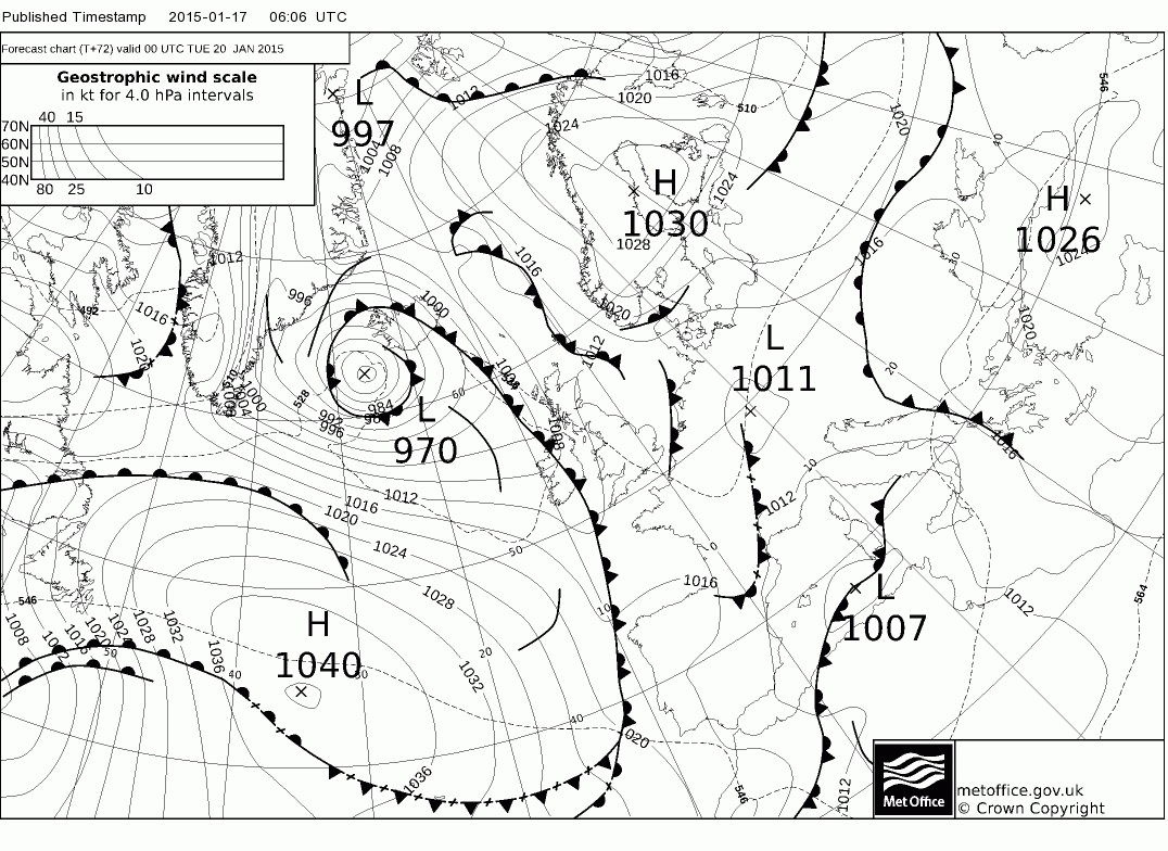
Then Monday night/Tuesday morning, we see an Atlantic frontal system push in from the west , and as this bumps into the cold air in place, rain/sleet looks to turn to snow across Scotland, N England and Wales. A bit less clear cut further south, perhaps falling as rain/sleet initially across S England and E Anglia but *maybe* turning to snow as it clears. Given the uncertainty over how far east the front progresses and also the potential for a low to develop along it across southern England (as per UKMO fax and 00z ECM deterministic), all of which may not be modelled too well this far off, given cold air in place and model difficulties at handling trough-disruption, confidence is low by Tuesday where rain/sleet and snow will be.
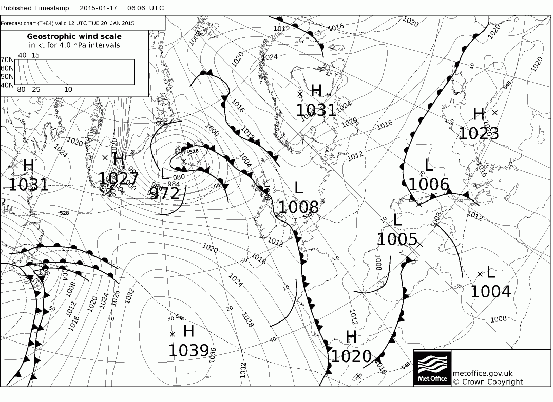
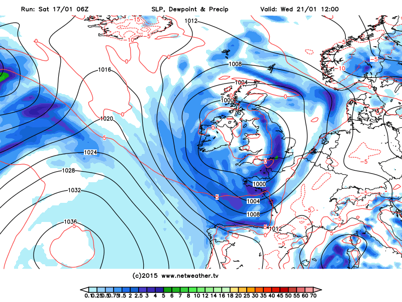
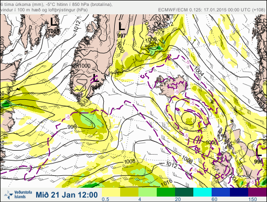
On Wednesday GFS and ECMWF show another Atlantic frontal system push south and east off the Atlantic ahead of a low pressure system dropping SE from Iceland area. With cold air in place but less cold air perhaps getting entrained into the circulation of the low dropping south, again some uncertainties of where will see rain/sleet/snow. To complicate matters, 06z GFS and 00z ECM differ on depth and track of the low moving SE. Shallower 00z ECMWF solution would bring less mixing and perhaps more of a snow than rain signal. A deep low as per GFS, would drag less cold air into thecirculation.
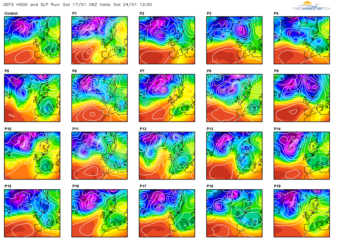
Beyond Wednesday, the models diverge too much to have confidence, perhaps a brief easterly to end the week between weak ridge building north of the UK and low pressure over mainland Europe. Operational guidance of NWP models so far today and last few days attempt to return the UK to a more mobile (and milder) westerly regime by the end of the week or next weekend. But there is enough spread in the GEFS ensembles and lack of confidence in resolving even mid-week trough disruption to suggest a return to milder conditions is a dead cert. A look at some 06z GEFS shows the Azores high still ridge NE near Nern UK next weekend – which would keep the more mobile Atlantic return at bay.