September has continued the succession of very warm months. According to the Met Office, it ranked as the joint 4th warmest September on record for the UK (in a record from 1884), behind 2006, 2023 and 2021. In the Central England Temperature series from 1659, it ranked 6th warmest. Unlike the summer months, which had some remarkable heatwaves, for most of September the daily warmth was consistent rather than outstanding, though some unusually high temperatures, especially by night, were recorded via a southerly near the end of the month. For many regions, thundery activity was well down on most recent Septembers. The southerly at the end of the month had potential to bring widespread thundery activity, but in the event it ended up localised.
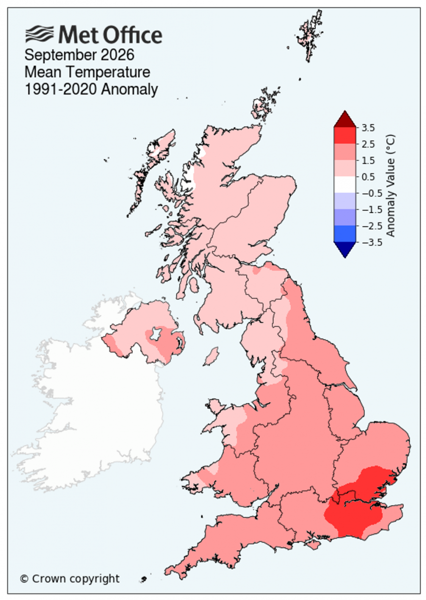
As has been typical in recent months, there was a heightened northwest-southeast split across the UK. September was a dry sunny month over most of England (except the north-west), but a cloudy and wet one in western Scotland and Northern Ireland, while much of Wales and south-west England had a cloudy month but with near average rainfall. The month was also warmest relative to average towards the south-east.
Judging by the temperature graphs from Climate Reanalyzer, which are based on the ERA5 reanalysis, September 2026 is looking set to not quite be the record warmest September globally, despite the developing record breaking El Nino event in the tropical Pacific Ocean. September 2023 was a remarkably warm month globally, and September 2026 looks set to slot into second place behind 2023. October to December 2023 were less remarkably warm globally, so there is a greater chance of October, November and December 2026 setting new record highs for the mean global temperature.
The reason for September 2026 having generally come out below September 2023 is that the land masses, on average, were not as warm. Sea surface temperatures were comfortably at record highs in September 2026, boosted by the remarkable El Nino.
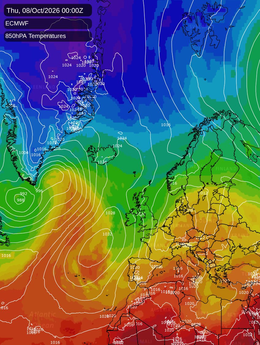
In Britain, temperatures are set to remain unusually warm for the time of year through to Monday, and extending into Tuesday in the southern half of England, with temperatures widely reaching the low 20s Celsius. High pressure and south-westerly winds are the main culprit, along with exceptionally high sea surface temperatures to the west and south-west of the British Isles. However, we look set to move into a west to north-westerly regime from midweek next week, which should bring temperatures much closer to the seasonal average, which may feel like a marked change after recent warmth.
Despite the change to a more changeable weather pattern, it still looks set to remain predominantly dry in the south and east of England. The El Nino conditions suggest a shift towards wet and windy weather as we head into November, but it is quite common for October to have spells of quiet weather in years with a strong developing El Nino.
The ECMWF forecast model is currently suggesting a cold northerly originating from a long way north for Wednesday and Thursday, which would be a real shock to the system for many, but the GFS and Met Office models are currently suggesting a more sluggish northerly which would bring temperatures only down to around average.
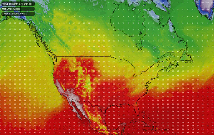
Although we are now into October, there is a severe heatwave ongoing in California in the south-western USA, and it is looking unlikely to subside substantially during the coming week. Los Angeles is forecast to reach the high 30s Celsius, perhaps nudging 40C in places, with temperatures in excess of 40C in some nearby valleys. This is particularly remarkable for the time of year. There are signs that the heatwave may begin to subside around 8-10 days from now, but this is a long way off and subject to change - some forecast model runs have the heat sticking around for longer.
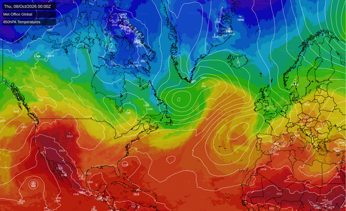
Conversely, temperatures will often be below average in the north-east of North America, with persistent low pressure to the east and north-east bringing in northerly and north-westerly winds. It looks unlikely to get cold enough for snow in the north-eastern USA, but snowfalls look probable over much of eastern Canada.
Loading recent activity...