Following a showery spell over the last few days, high pressure looks set to build across the UK this weekend, bringing drier and more settled weather - which will continue into early next week. Though unlike previous anticyclonic spells this summer, it won’t come with heatwave conditions. Temperatures reaching the mid-20s in the south on Sunday the highest we’ll see, with nights on the cool side.
The high pressure system building across the UK from the west this weekend then looks to drift northeast across Scandinavia by the middle of next week. This will allow low pressure systems to move in from the southwest or south across Ireland and the far west of the UK, bringing more unsettled conditions with spells of rain or thunderstorms, but also warmer and more humid air too - with potential for temperatures to reach the mid-to-high 20s in southern England in any sunny spells on Wednesday.
Turning more unsettled with low pressure taking charge next week following high pressure building in this weekend
Heavy thundery showers forecast to push up from the south from Tuesday
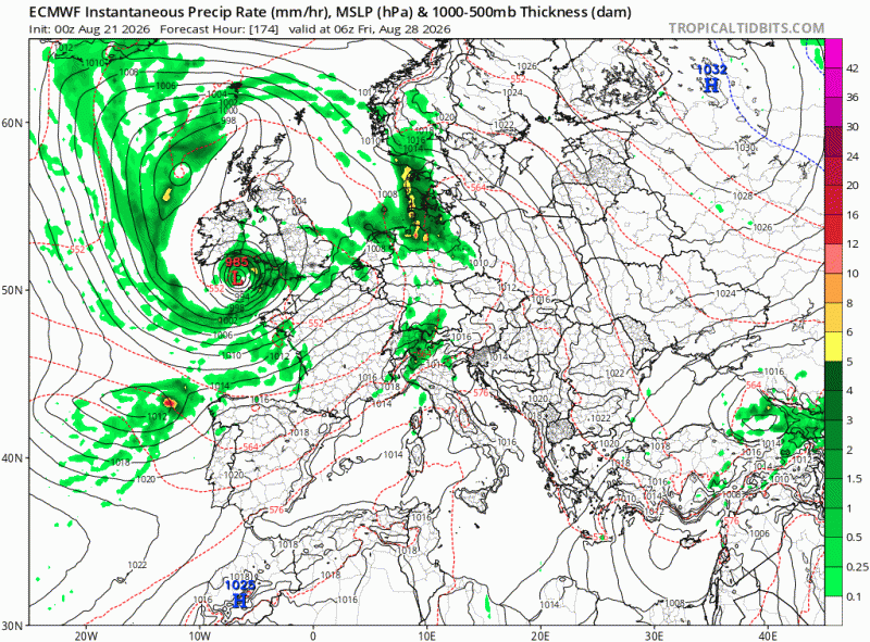
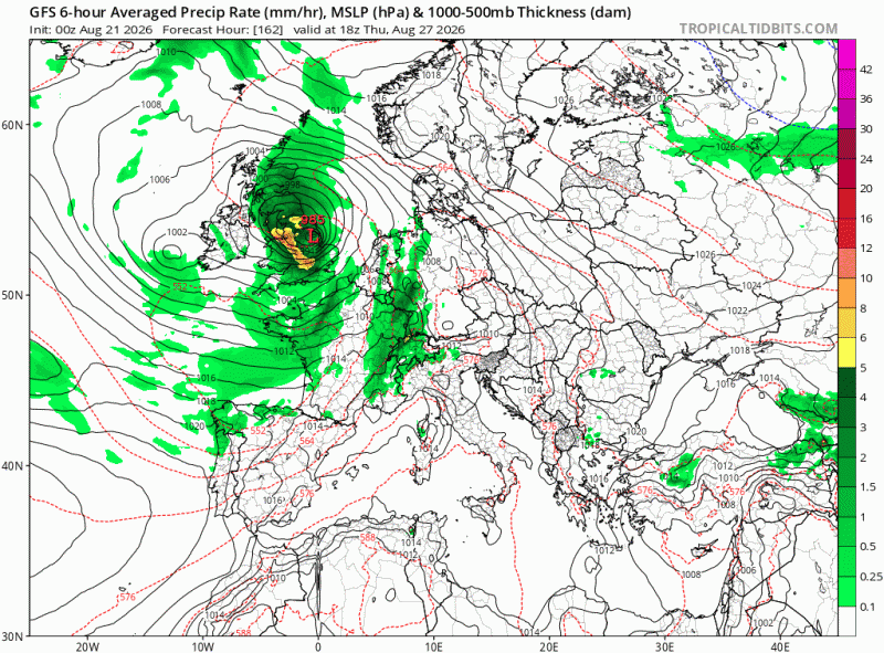
The weather models this morning are highlighting the potential for a spell wet and windy weather either Thursday or Friday though, with potential for gales to develop, especially around coasts. But there is uncertainty this far off if a deep enough low to bring strong winds will develop and, if it does, its track. But something to keep an eye on - especially those planning or participating in outdoor activities and those camping.
Potential for a deep low to affect England and Wales later next week, but uncertainty this far out
ECMWF
GFS
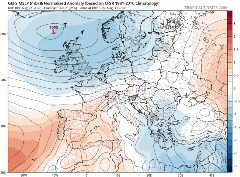
The unsettled conditions look likely to linger through the Bank Holiday Weekend too, with current model forecasts - with areas of low pressure close to the UK bringing spells of rain or showers at times, but also some sunny spells and drier interludes, temperatures likely to be around the average for the time of year in the southwesterly or westerly flow. Certainly no sign of a heatwave before the end of the month.
GFS ensemble mean indicates low pressure in charge over the Bank Holiday Weekend
The low-pressure system responsible for bringing heavy showers and thunderstorms over the last few days has now moved on over Scandinavia. However, the cool northerly flow in its wake will still bring some scattered showers today across England and Wales, though generally lighter than yesterday, perhaps the odd heavy and thundery one in places. Scotland drier and sunnier.
A few light showers possible Saturday morning, especially towards coasts, but generally becoming dry and settled, with sunny spells, for all over the weekend - as high pressure builds in.
With the jet stream has shifted south and a northerly breeze, forecast daytime highs of 14°C to 17°C in the north and up to 19°C to 21°C in the south are expected today, a little below average for the time of year. Daytime temperatures a little higher over the weekend, reaching 16-20C in the north, 21-23C in the south Saturday and 23-25C on Sunday.
With clear skies and lighter winds over the weekend, overnight temperatures will be on the cool side though. Rural parts of northern England and Scotland will feel distinctly autumnal, with temperatures dipping into single figures.
Potentially quite warm Tuesday and Wednesday next week across southern and eastern England, but also turning unsettled.
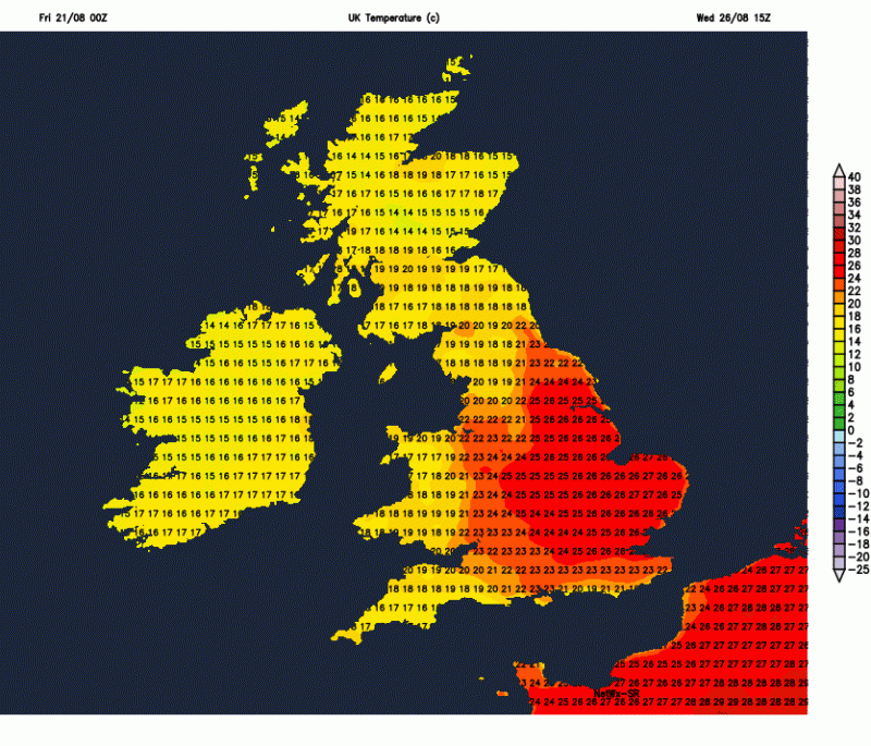
After a generally dry and sunny Monday, thundery showers look to spread up from the south across England and Wales through the day, Scotland and N. Ireland likely staying mostly dry. Showers, perhaps thundery or longer spell of rain spreading across most areas Wednesday to Friday, but with drier and sunnier spells in between, very warm in the south Wednesday before temperatures drop Thursday. Potential for a spell of wet and windy weather Thursday or Friday - but uncertainty, so watch this space.
Loading recent activity...