London Heathrow reached 29C on Monday 17th, but will be closer to 21C later this week. There was even a bit of rain overnight for England, just a little, but still! There is more rain in the forecast, but not significant amounts for the dry, yellow-grassed regions of England. Wales will see a bit more rain over the hills, but the drought continues here. The week will turn cooler as low pressure moves over the UK, bringing showers and a northwesterly flow. There will be some nippy nights for northern areas by the end of the week.
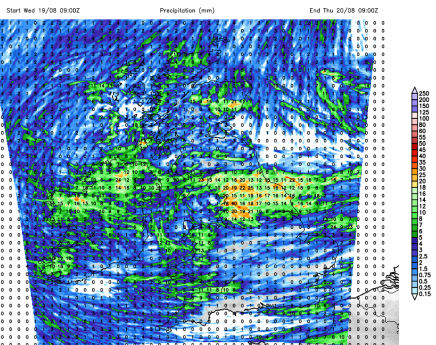
24 hour forecast rainfall totals UKV model Weds into Thursday
After the weeks of heat, humidity and no rain, this may be a welcome change for those finding the nights too warm or worrying for gardens, streams, crops and creatures. The change follows a shift in the jetstream, no longer away to the north, with High pressure firmly over the UK and the near continent.
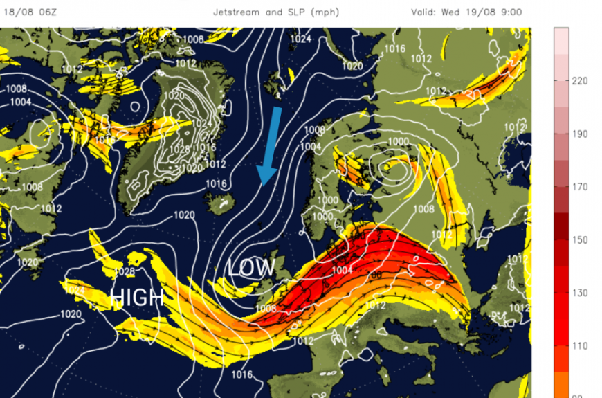
With a more southerly jet, low pressures are able to approach from the Atlantic and bring frontal rain or showers and a change in the wind direction. High pressure begins to build out over the north Altnatic and between one low pressure and this high the UK will feel the cooler northerly wind for the end of the working week. Pressure will build over the UK by Sunday, settling the weather down again but with temperatures in southern England around 21 to 25C.
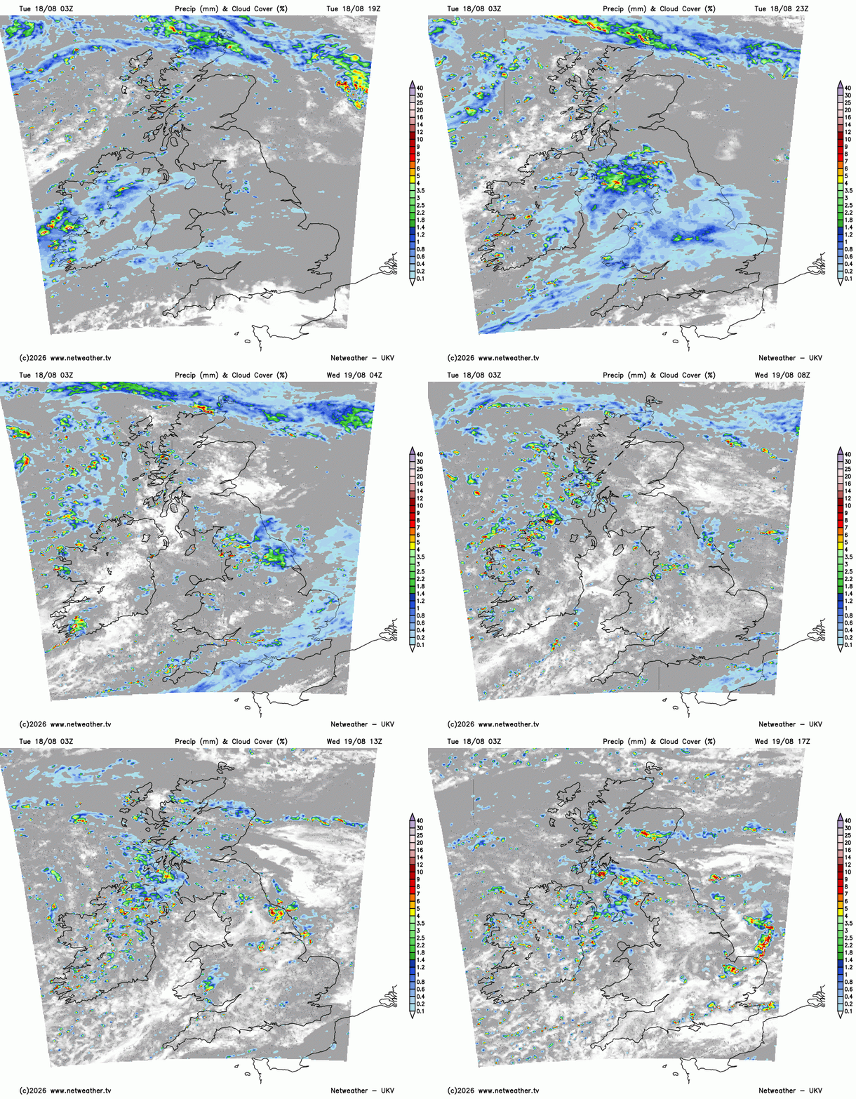
Orkney will see a wet Tuesday night as a frontal band lingers. A small feature will bring rain and cloud over Northern Ireland, the Irish Sea, Isle of Man to the Solway Firth into the Lake District (UKV), although the GFS model brings it further south, just about missing Northern Ireland, so over Ireland towards Morecambe Bay and Anglesey and north Wales. A trailing front from this could bring heavier rain through the English Channel. The ECM model takes the main pulse of overnight rain towards NW England, but with the frontal bands bringing rain over more of Wales and central & southern England early on Wednesday. It’s something and it is a change, but it’s not going to make much of a difference for southern Britain.
Wednesday
By Wednesday morning there will be brighter skies with a mixture of sunshine and clusters of showers. As the low centre moves over Scotland and Northern Ireland, there will be more showers and some heavier bursts here. These heavier showers over northern Britain could bring hail and thunder. Eastern England around the Humber to the North York Moors, and Northern Ireland, look prone.
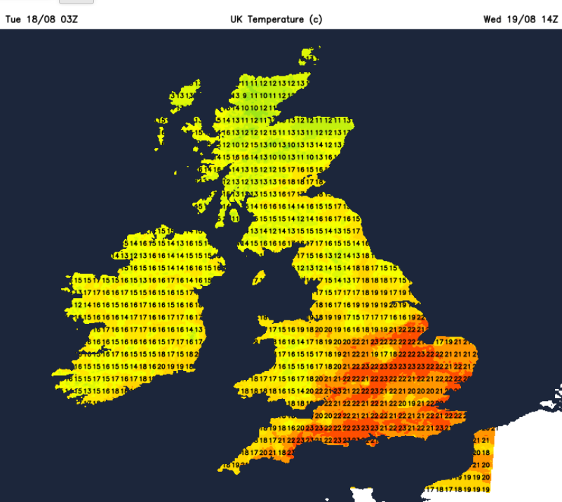
The far north of Scotland will feel cool at only 14C in a northeasterly breeze. For inland central and southern England, around 22 to 24C will feel pleasant but cooler than recent weeks with a light westerly breeze.
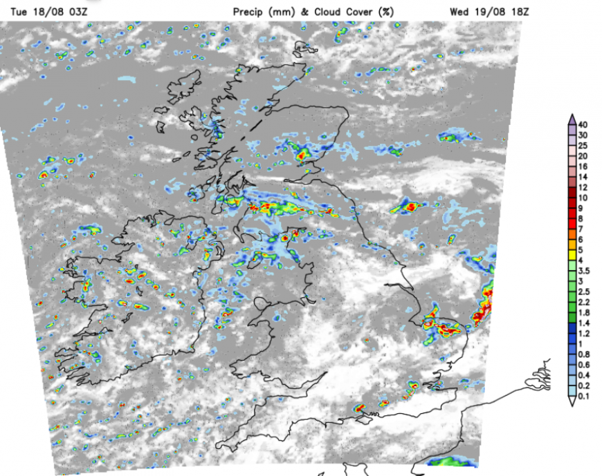
By Wednesday evening, under the low pressure there will be a mixture of fine, dry and sunny weather but a scattering of heavy showers. These could deliver some sharp downpours locally. The ground is hard and very dry so under any of these there could be issues with surface water. Anyone with water butts at the ready to catch a rain shower will be glad, but for parks and gardens the water may just run off and down the drain.
Loading recent activity...