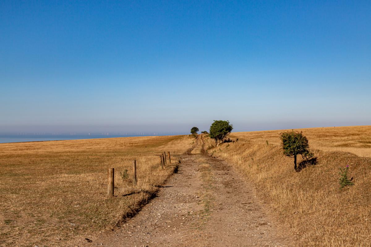
Temperatures reached 38.1C at Kew Gardens this afternoon, provisionally the UK's fifth hottest day on record, with forty places across central and southern England at 36C or more. Amber warnings of extreme heat run until 11pm tonight across seven English regions, and amber heat-health alerts cover all nine. Tonight will stay warm in the south-east. Central London should hold close to 24C and the Weald around 20C.
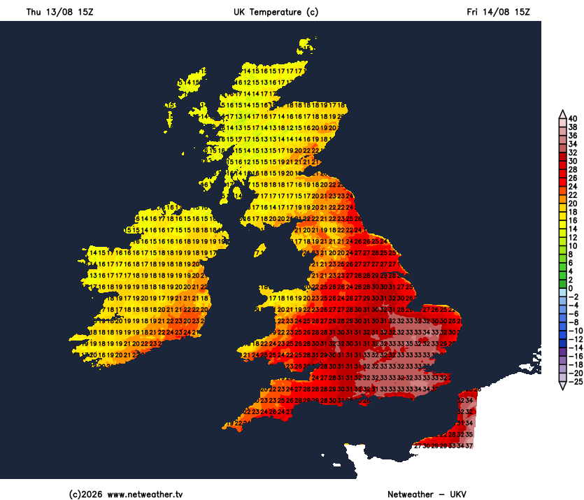
Friday will still be hot, but only the southeast. 34 to 35C is possible, ten to twelve degrees above the mid-August average. It falls away steadily from there: 31 to 33C in the Midlands, 25 to 31C in Wales, 22 to 27C from the Lancashire coast into Cheshire, and 15C in Shetland against 24C in Dundee.
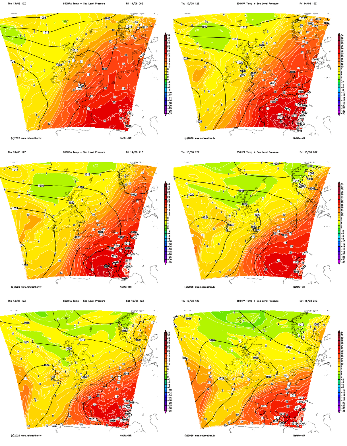
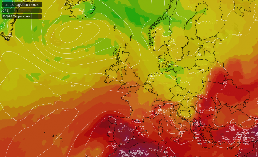
Low pressure south of Iceland leaves the pattern over Britain almost flat. The light north-westerly with it will feed fresher Atlantic air in behind, squeezing the hot airmass south-eastwards rather than sweeping it away.
Rain on Friday will fall where it is least needed. Showers will break out over the Highlands, the Great Glen and Argyll before dawn and fade by early afternoon. Better than an 80% chance of catching one on Skye, and a 50 to 60% risk from Argyll to Caithness, with a few millimetres at most. A yellow thunderstorm warning covers Northern Ireland until 5am. England and Wales will stay dry in daylight, though heavy showers could form overnight over the Wash, coastal Lincolnshire and north Norfolk, with lighter ones into the Midlands. That is a 20% risk at best, genuinely uncertain, and a similar chance carries into Saturday across East Anglia and the Thames area.
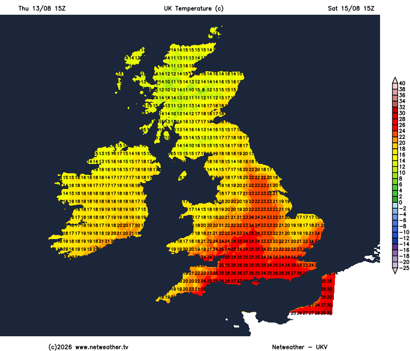
Saturday should feel different everywhere. A ridge of high pressure will build across the country from Biscay to Scandinavia. The warmth should shrink back towards the coast: 28 to 29C along the Sussex and Dorset shores, 25 to 27C around London and into Kent, 21 to 25C in the Midlands and 14 to 19C in Scotland.
Sunday morning is likely to be the colder of the two weekend mornings, about 7C in Highland glens and the sheltered valleys of mid-Wales and the Borders, and near 10C at Cambridge under a clear sky. Sunday afternoon should bring the whole country within a couple of degrees of normal for the date. An organised band of rain should reach Northern Ireland, the central belt and the Solway during the afternoon, a 30 to 40% risk from Belfast across to Dumfries and Carlisle, and it stops at the Border country.
Monday will be dry through the day in the south and east, and wet in the north-west by evening. An Atlantic low is likely to deepen as it comes east, packing its isobars against western Ireland and the Hebrides. The first rain should arrive in the Western Isles and Argyll in the afternoon, then spread across Northern Ireland, southern Scotland and into Cumbria through the evening. Expect a 60 to 70% chance of rain from Belfast to Perth. Southampton should still manage 27C.
Tuesday is the day it crosses the country. The band may lie over northern England at dawn, from Anglesey through Lancashire to the Humber. Rain is 80 to 90% likely from Ayrshire to Greater Manchester, though the day's total will be only about 5mm. It should work south-east through the day, with a 50 to 70% likelihood of rain across Wales, the west Midlands and the south-west by mid-afternoon. London and Essex may stay ahead of it at 28 to 29C, with perhaps a millimetre and a 40% risk. Gusts of 35 to 45mph are possible on and off the exposed south-west and Channel coasts, strongest out over the water.
There is real disagreement about how hard that low bites. ECMWF and the American GFS both run it deeper and closer to north-west Britain than the Met Office's global model does. This forecast's figures come from the Met Office side of that split, so Tuesday could be wetter and windier in the north and west than the numbers here suggest. This morning's forecast had the split the other way round.
None of it will touch the drought. Officials declared almost three quarters of England in drought last week, after the driest July since 1836. The wettest corner of the country is Argyll, and even there a 90% chance of rain on Tuesday brings under 5mm with it. Nowhere in southern or eastern England is due more than a millimetre or two.
Loading recent activity...