Wednesday will be hot across England and Wales, with 34 to 35C from the Bristol area and the Severn valley across the west Midlands and into south Wales. That is about six degrees up on today, when the warmest spots in Cheshire should manage 29C. High pressure over Denmark will feed a light south-easterly across Britain. That air will have travelled a long way overland by the time it arrives, so the heat concentrates well inland, and the coasts facing the flow stay much cooler at 25 to 27C from Norfolk round to south Devon. Sunshine will be more or less unbroken away from the far north-west.
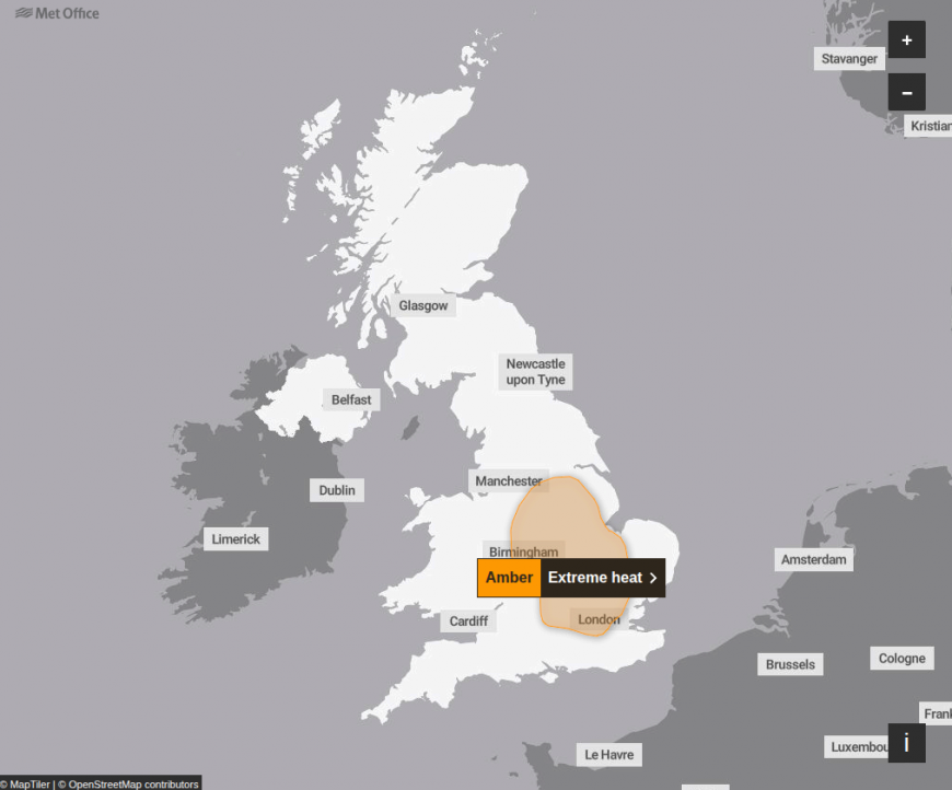
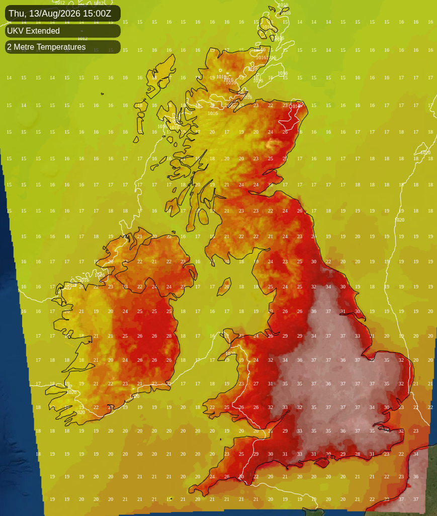
Thursday is the peak, and the day the warnings cover. The Met Office has amber warnings of extreme heat in force from 8am to 11pm for the East of England, the East Midlands, London and the South East, the West Midlands, and Yorkshire and the Humber. Somewhere well inland within that area should reach 36 to 38C, though exactly where is not resolvable this far out. This is a broad plateau of heat rather than one hot corner, and much of the warning area will run twelve to fourteen degrees above the mid-August average.
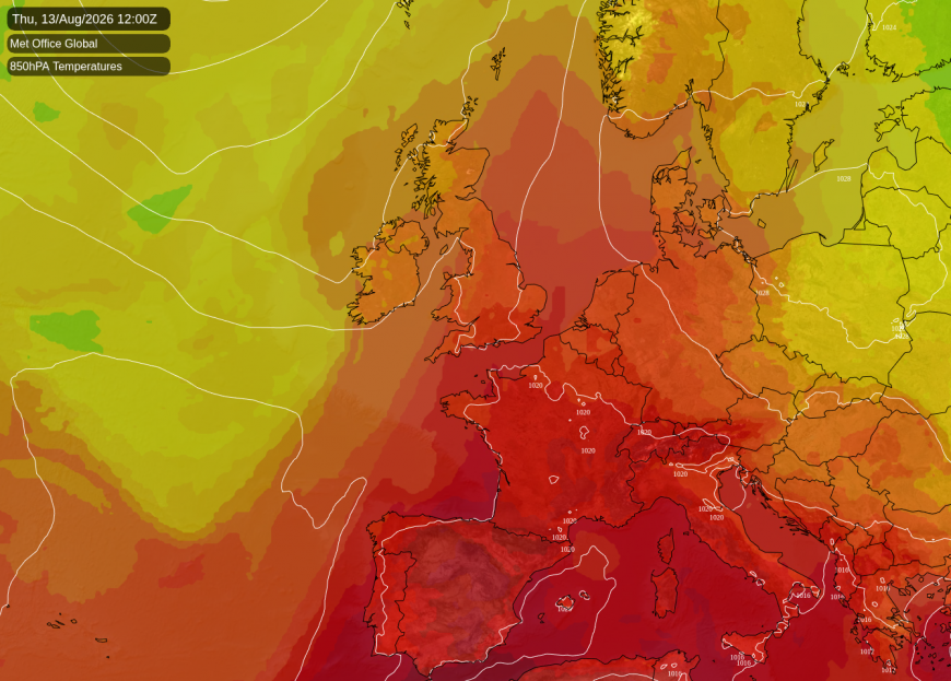
The flow will have backed into a straight southerly between an Atlantic low near Iceland and that continental high, drawing air north from France and Iberia under a cloudless sky. ECMWF, the Met Office's global model and GFS all place the pattern the same way, so the shape of the day is settled. How hot it gets underneath is less certain. The Netweather medium-range model runs two to three degrees cooler than the high-resolution one over the south-east.
Nights bring little relief. London is likely to hold at 21 to 22C on both Wednesday night and Thursday night, with 22 to 23C along the south coast on Wednesday night, while Scotland sits between 13C and 18C. The UK Health Security Agency has amber heat-health alerts covering every English region except the North East, which is yellow, and they run until 9pm on Friday. The air will be very dry with it, so what it feels like is no more than a degree or so above the temperature itself. This is not close, muggy heat.
The change will begin in the west while the east is still climbing. Bristol will reach about 35C on Wednesday and only 30C on Thursday, as the wind swings from south-east to west through the afternoon. Cardiff does the same, and Truro and Blackpool will not get beyond 25C on Thursday at all.
Friday is likely to split the country. An Atlantic ridge building in from the south-west should turn the wind west to north-west, pushing the boundary between the continental air and the Atlantic air south-east across the Midlands. Essex and the Thames estuary could hold about 30C into the afternoon under the last of the clear sky. Stafford may drop from about 36C on Thursday to 22C, and Scotland, Northern Ireland and north-west England expect 17 to 22C with much more cloud. All three models agree on the ridge and on the turn in the wind, though not to the hour.
Rain will be confined to the north-west. The Hebrides and the north-west Highlands carry around a 60% chance of catching a shower on Wednesday and again on Thursday. Elsewhere in Scotland, and in Northern Ireland on Thursday, the chance runs at 20 to 30%. Friday should be the showery day, with about a 40% chance across northern Scotland. Showers are likely to scatter through Argyll, the Highlands and Northern Ireland and reach the Irish Sea coasts by afternoon. Amounts will be small wherever they fall, and England and Wales should stay dry on all three days.
Thursday has not moved as the peak day since this morning's forecast, and neither has the 38C. The longer story for England and Wales is the dry. The National Drought Group declared more than 70% of England in drought on Monday, after the driest July since records began in 1836, and the next three days will not change it.
Loading recent activity...