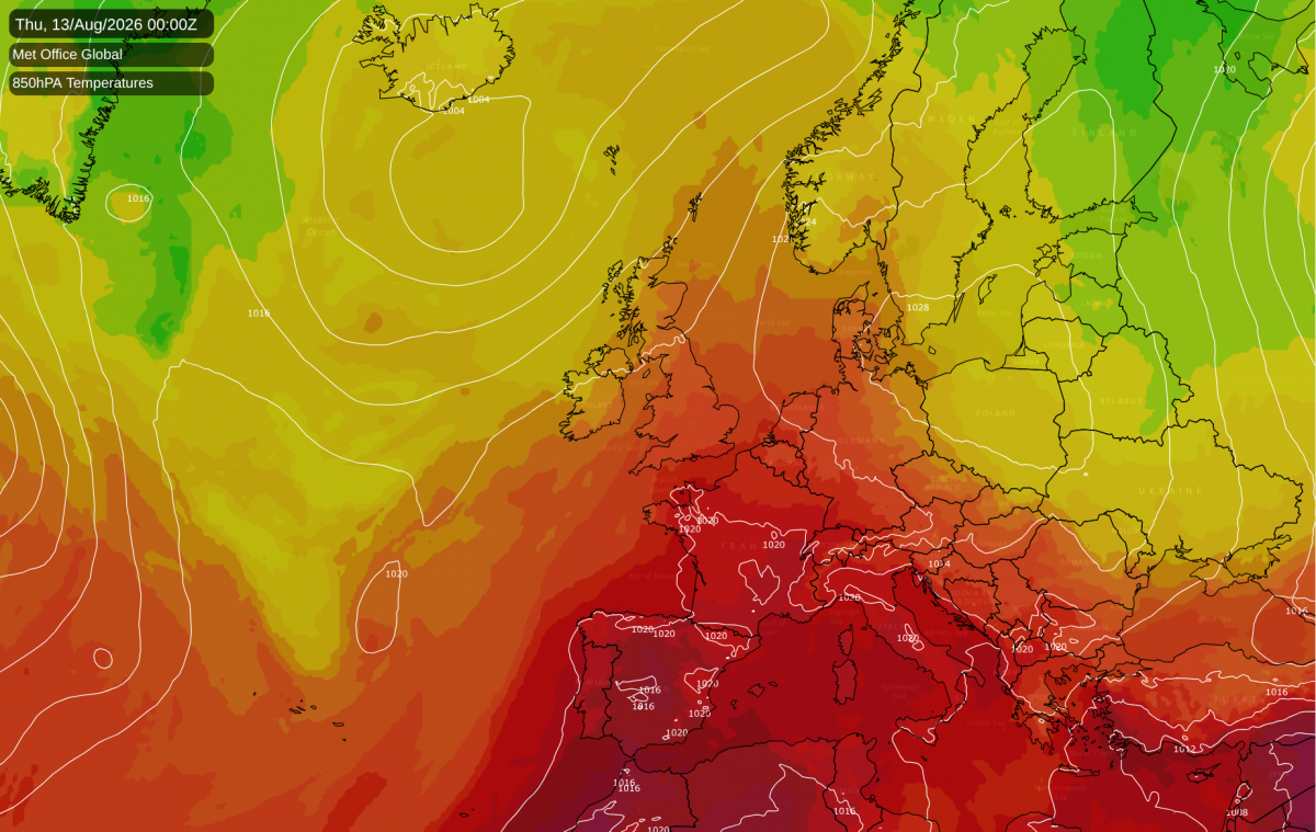
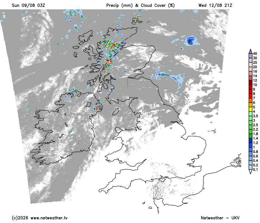
Monday will feel a few degrees down on today across England and Wales, with 27C about the best on offer in central southern England. Northern England holds in the high teens and low 20s, and Scotland is cooler still, Lerwick managing only 12C. Showers stay limited to the far north of Scotland and the Northern Isles, where a 30 to 40% risk keeps them going. England, Wales and southern Scotland will be dry.
Tuesday begins cold in Scotland. Clear skies and light winds under a ridge will let cold air pool in the Highland glens, taking the temperature down to about 5C before dawn. The day then turns warm, and the warmth sits in the west: 28 to 29C from the Welsh Marches through Cheshire to the Bristol area, against 22C at Canterbury and Southend on the other side of the country. The Hebrides keep their showers, at a 70% risk through the day, while the far north-east of Scotland carries a lower 40% risk.
By Wednesday the high will have transferred east to sit over Denmark. With low pressure well out in the Atlantic, that leaves Britain in a light southerly on the high's western flank, drawing warm air north off the continent. The warm core is still a western one: 33 to 34C through the Severn valley, south Wales and the west Midlands, with Crewe and Doncaster at 30 to 31C. Skies over a good part of England and Wales will be clear, which should suit anyone hoping to see Wednesday's eclipse. North-west Scotland and Northern Ireland keep their cloud and their showers, with a 60% risk in the Hebrides.
Earlier in the week the models put the peak on Wednesday. It has since settled a day later, and hotter. Thursday afternoon could reach about 38C across the Fens, Cambridgeshire and the Thames valley into Essex, over a broad area rather than a single hot spot. London is likely to be up there too, with Swindon nearer 36C.
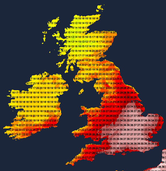
The pattern that delivers it is settled. The figure itself could still move a degree or two either way. The coasts will be nothing like it, a colder North Sea holds the eastern shoreline down: expect 26C at Sunderland, and further southwest, no better than 24C at Truro. Across most of England and Wales Thursday looks hotter than Wednesday, though not everywhere, and Crewe may be four degrees down on its Wednesday figure. Scotland stays out of it, Stornoway near 16C with a low risk of a shower in the west.
The night that follows may not let go either. London could still be above 21C at dawn, on ground that will have spent the afternoon in the mid thirties and under a sky that stays clear. Yellow heat health alerts from the UK Health Security Agency currently cover seven English regions, from the East Midlands and Yorkshire and the Humber across to London and the South West. They are timed to end at 9pm on Tuesday, so as things stand they run out before the heat peaks .
Friday brings the change, and it arrives from the north-west rather than the west. Cloud will spread across Scotland, Northern Ireland and northern England overnight, reaching the Midlands before any rain does. Showery rain follows, on a 90% risk in Shetland and a 60 to 80% risk elsewhere in Scotland and in Northern Ireland. Amounts stay small at a few millimetres, and Aberdeen will be the wettest of them. Through the Midlands, eastern England and the South East there is a 50% chance of catching one. Wales and north-west England sit lower, on a 40 to 50% chance. The south-east looks likely to hang on to the heat, near 33C around the Thames estuary, and a heavy or thundery shower is possible there late in the day.
All three models agree on the shape of Friday. They part company only on the Atlantic ridge building in behind the rain, which GFS holds further south-west than either ECMWF or the Met Office's own global model. If GFS has it right, the showers over Scotland and northern England will clear more slowly, and Friday evening in the north will stay damp for longer.
Loading recent activity...