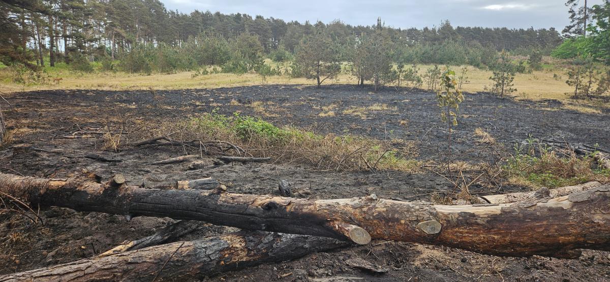
Fresher air is now across all of the UK, a real change for those parts that have experienced heat all week. A pulse of warmer air will return from France for the start of the new week, but it doesn’t look as intense as the recent heatwave episodes. There is rain in the forecast over the next week, but the heavier pulses seem focused on northern Scotland, with just scattered showery bursts for southern Britain by midweek. There remains a severe risk of wildfire spread.
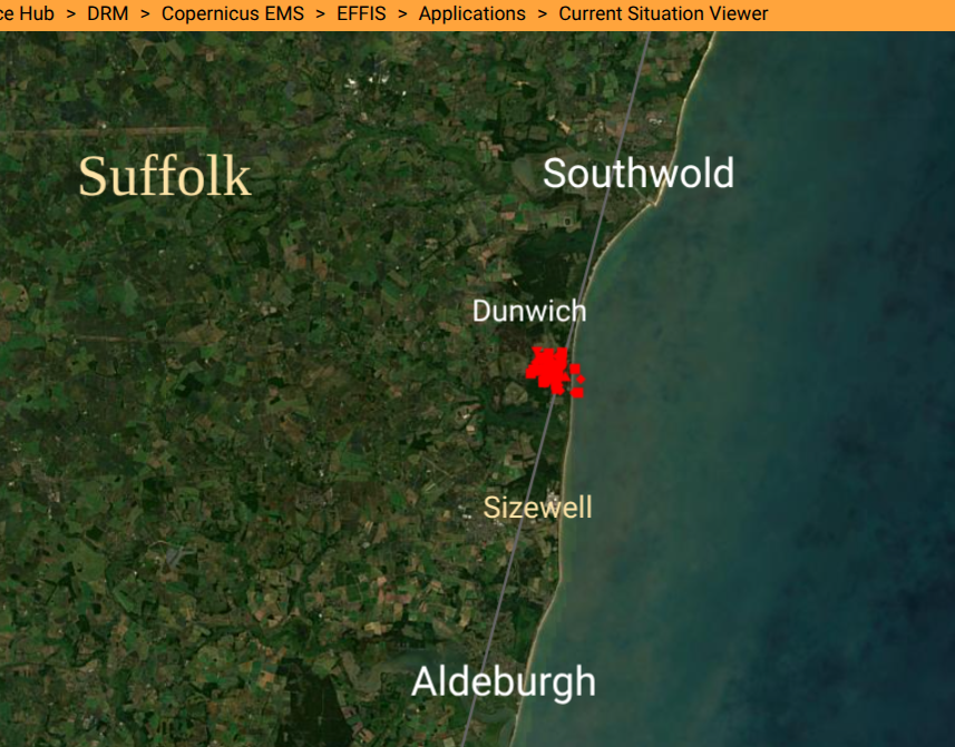
Active fires on EFFIS current situation viewer
In this hot and dry weather, a wildfire on Dunwich Heath in Suffolk has been causing terrible damage, and local disruption.
Suffolk Fire & Rescue (late Thursday) “The area affected by the wildfire at Dunwich Heath has now grown to around 150 hectares. Changing wind conditions continue to affect the direction and behaviour of the fire, making it difficult to predict how it may spread...The helicopter is still in use and will be available tomorrow. Each pass drops 1,000 litres of seawater.
Members of the public are being advised to avoid the area and keep the roads clear for emergency vehicles. For those living in the area, residents should keep their doors and windows closed if possible and motorists should close any air vents and turn the air-conditioning off.
National Trust Dunwich Heath "We have been left heartbroken by the total devastation we are now seeing due to the fire at Dunwich Heath, which is one of the UK's most important coastal heathland landscapes.
Although it’s still too early to say what the true impact has been, to both RSPB Minsmere where the fire started and at Dunwich Heath, it’s becoming clear that the fire has torn through the entire National Trust reserve and the landscape that we know and love is now unrecognisable."
This lowering of temperatures will be good news for those tackling the Suffolk fires with light NW to NE winds forecast today. These winds will pick up early afternoon for a time before a change to a southeasterly wind by Saturday then a light easterly by Sunday, which would blow smoke further inland. There isn’t any significant rain forecast for the region this weekend.
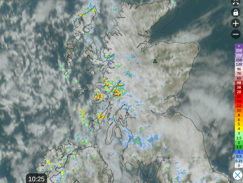
Netweather Radar from 10:25 with Nethy Bridge marked
Scotland has seen rain this week and there are showers again today for the west coast which will spread eastwards, hopefully reaching the areas south of Nethy Bridge, where the Cairngorm wildfires continue to burn, often deep in the peat.
"There is decidedly less smoke from the burnt area today." Friday “Without sounding like a broken record, the fire is still burning…The Community Centre and the village is still dominated by fire service vehicles…Water was being dropped throughout the area on stubborn hotspots. The wind has this evening dropped away completely.” Thursday Nethy Bridge Village Community Council

The fresher and cooler conditions arrived over more of Scotland and Northern Ireland on Thursday.
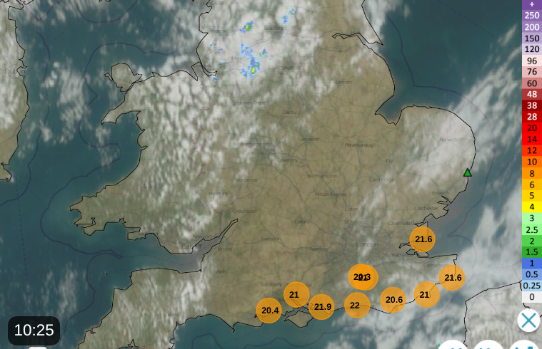
Netweather Radar with Dunwich marked, showing top ten temperatures at 10am
Charlwood near Gatwick Airport in Surrey saw the top temperature on Thursday with 30.7C, so another 30+ day in this long-running hot spell for southern Britain. Today will be the end of this run with more comfortable temperatures of 20 to 26C for England. It’s still dry for many with warm sunshine, just a band of cloud over northern England with showers in the northwest.
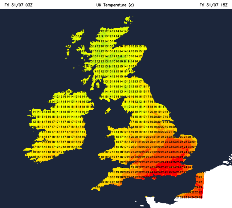
For Wales today, temperatures will be around 17 to 22C, Northern Ireland 17 or 18C. Edinburgh will be around 17C in the cooler air.
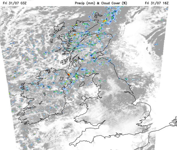
The showers will spread over Northern Ireland, more of Scotland with another scattering of showers moving eastwards over the Pennines to NE England. It will be a cooler night across Britain with showers over northern and northeastern Scotland continuing into Saturday morning.
Saturday looks fine and warm for most with sunshine. No longer hot, with a cooler start and evening. It will be a fine weekend for all the thousands in Girlguiding and Scouting heading to Lincolnshire for Poacher International Jamboree. Ideal conditions for pitching all the tents: warm, dry and not too windy. The ground will be very hard; you’ll need those storm pegs.
There will be a few showers over northern England, perhaps a cluster from Kent to Essex, maybe even for the Suffolk coast on Saturday morning, with more cloud but overall it will be a fine and warm day. Temperatures will be around 18 to 25C, so a change from midweek and that hot, humid air. It will be colder overnight, well down into single figures
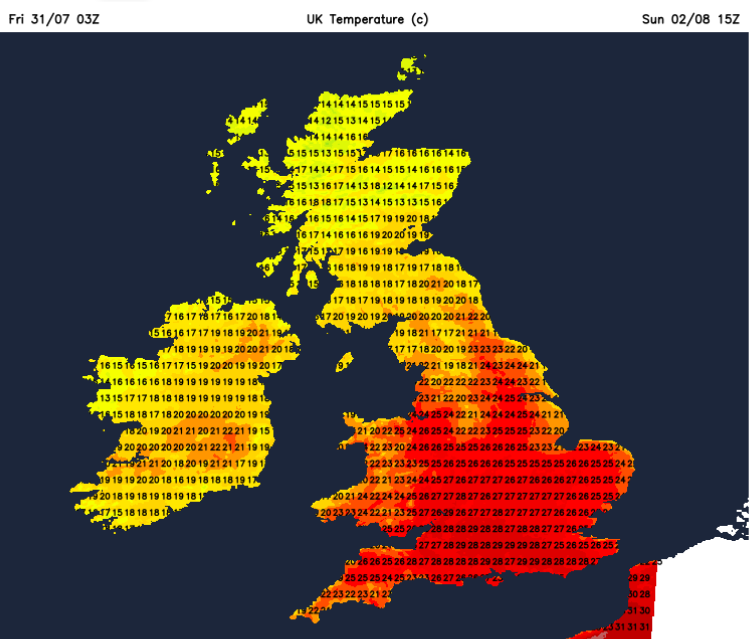
So a cool start for many but warm air from Europe will surge over southern Britain on Sunday. A messy Atlantic low pressure will be edging towards Ireland on Sunday, bringing more cloud and outbreaks of rain to Northern Ireland and the Irish Sea by Sunday evening. Ahead of this, it will be a fair day and warm in the south at 24 to 28C.
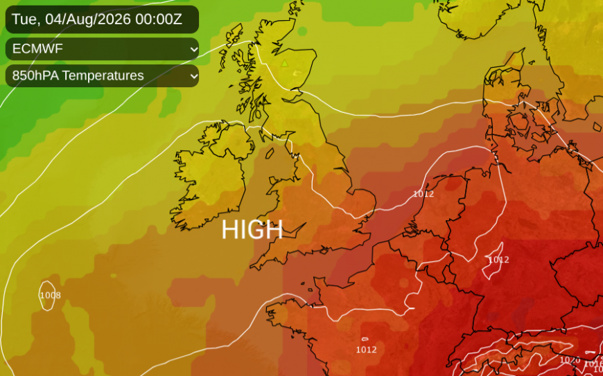
Britain will start the working week with an easterly flow off the North Sea but that drops out as the warmer air spreads over southern Britain. This warm air will stick around for Monday and Tuesday, but edge eastwards over more of England, then fade once more. Temperatures could move back over 30C but not too much higher.
Netweather community forum 2026 wildfire season thread
Loading recent activity...