It’s been a warm and humid night with a peak in temperatures for England forecast on Wednesday. On Tuesday, Cavendish, Suffolk reached 31C as Lerwick, Shetland stuck at only 7.9C.
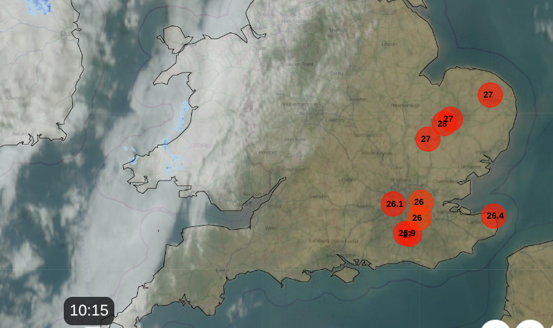
Netweather Radar showing top ten temperatures at 10am
Today temperatures will be widely over 30C in SE Britain, with 33 to possibly 35C for inland East Anglia and London, northern Home Counties into north Kent. A southwesterly wind off the English Channel will just temper the highs for Sussex and those waiting at North Sea ferry ports.
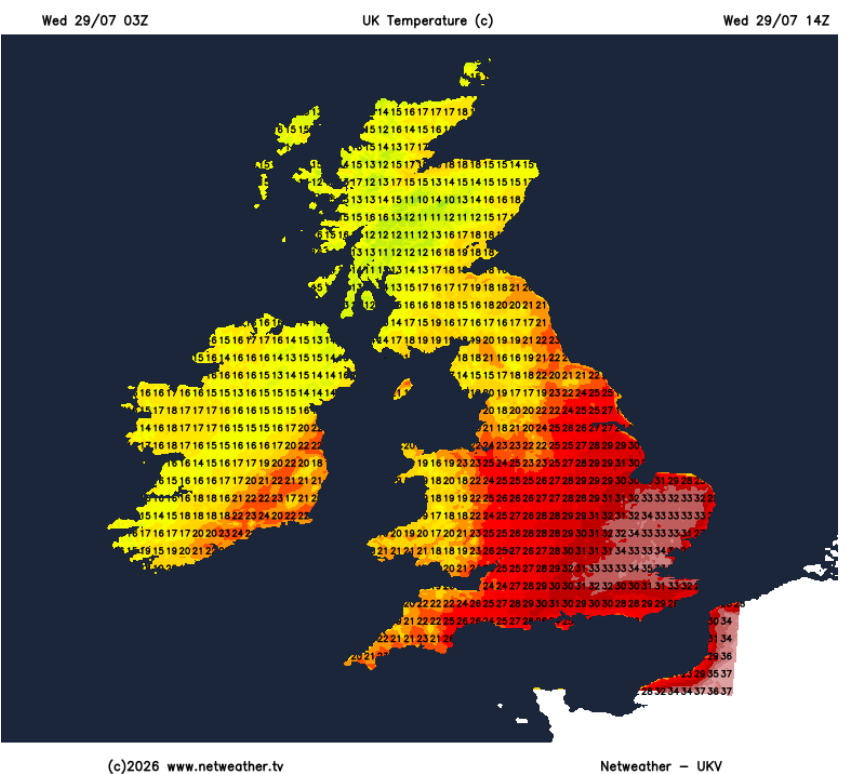
Today will be the 31st consecutive day when somewhere in the UK has seen 30C or above. Eastern and SE England will be hot and humid today; it will be very warm across a good part of England. Elsewhere, there will still be a close warmth where the skies are more cloudy until the frontal bands begin to edge over Scotland and Northern Ireland. It will be another close, uncomfortable night for the far southeast of Britain. For the far northwest, it will feel fresher with an airflow off the north Atlantic. It is this same air that will gradually work its way down the UK, ending the short hot spell.
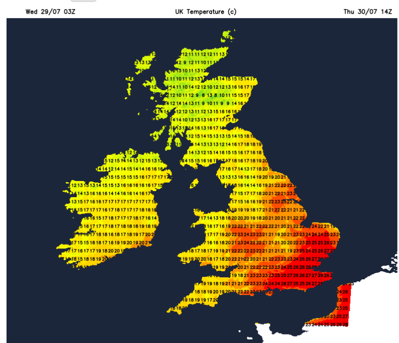
Thursday could see 30C again, with the heat holding on in the far southeast; London looks likely to reach 29 or 30C. Thursday night will be much cooler, with temperatures down into single figures in the north, even a chance of frost again for Scottish glens. London will just take longer to cool down due to all the stored heat in the concrete and very light winds.
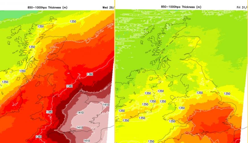
There will be fresher air from the northwest to end the working week but it might seem like a slow change if you find the heat too much.
By Friday, Edinburgh and Belfast 18C, Manchester 22C and London around 26C, which will still be warm but not hot nor humid. Saturday looks similar. If you are in sheltered sunshine, it will still feel very warm in England, but not as muggy and hot as midweek. There will be a lot of fine, dry and bright weather to start the weekend. Further north it will be fresher but still with a scattering of blustery showers on Saturday.
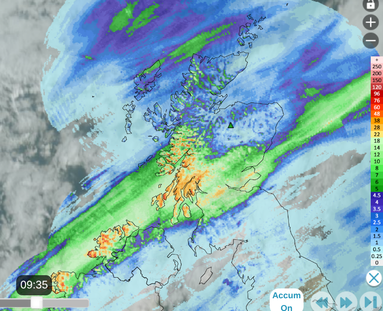
Tyndrum on the West Highland Way saw the most recorded rainfall on Tuesday with 32.4mm. That's over an inch of rain; imagine that southern Britain! You can see where the main rainband was Tuesday into Wednesday morning from the 24-hour rainfall accumulation on Netweather Radar. The red triangle marker is where the Cairngorm wildfire continues to burn deep in the peat.
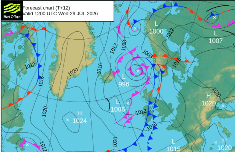
The main rain area will be under the frontal bands. This will pulse over Northern Ireland today, into western Scotland again. By this afternoon there could be some heavy, even thundery bursts along the southern edge for the Central Belt, Edinburgh and the Southern Uplands. Also into the early evening, with wet weather reaching E/NE Scotland. This will be very welcome rain. Elsewhere, another dry day with glaring sunshine.
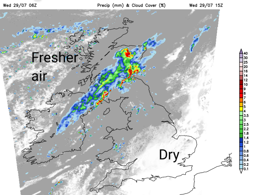
Overnight, this frontal band will bring more cloud and a few showery bursts over the high ground of northern England and north Wales. A new circulation will form to the northwest of Scotland, throwing lots of showers over the NW Highlands. On Thursday, around this low pressure, the winds will freshen for the Central Belt and western Scotland and with all the showers and the cooler air, it will seem rather autumnal as the blustery downpours pass by. These showers will continue on Thursday across the Northern Isles and northern mainland Scotland.
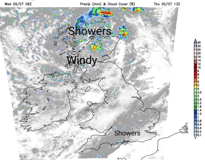
Along that frontal band, there will be more cloud and just a few well-scattered showers. This will just be a change from the blue skies of Wednesday, and if there are some raindrops, it will cause brief excitement for southern Britain. That band of cloud with a chance of a shower will be over East Anglia and SE England by Thursday evening. Nothing to help the “prolonged dry spell”, “significant water scarcity”, “temporary use ban” situations nor for the North Wales declared drought.
Worryingly dry - netweather community forum
Loading recent activity...