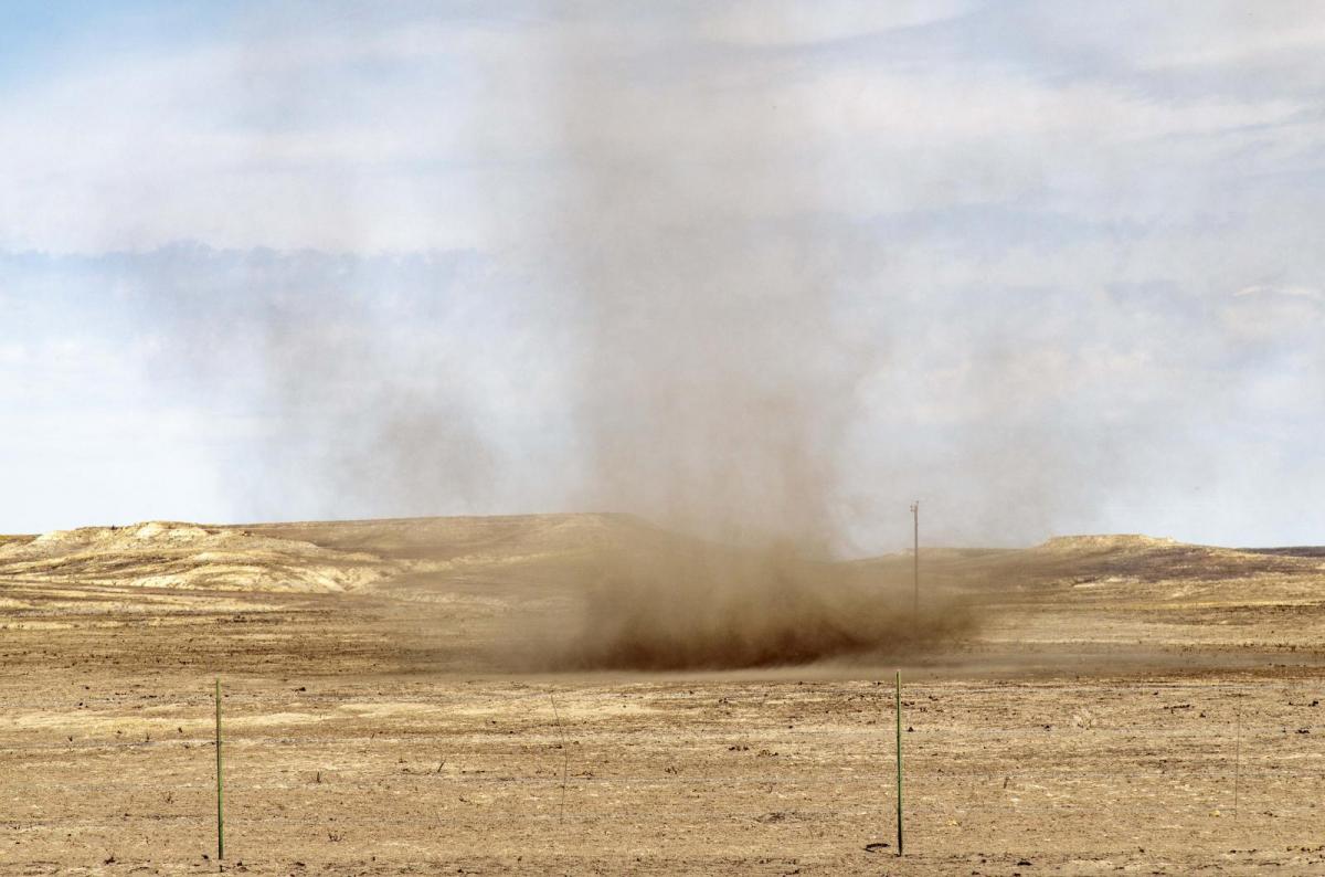
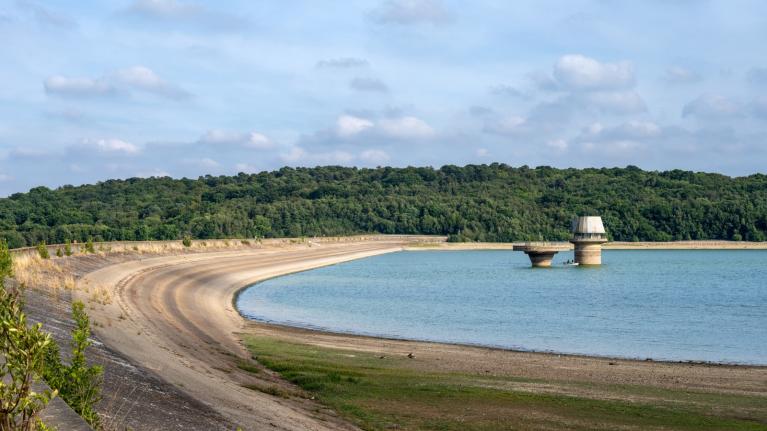
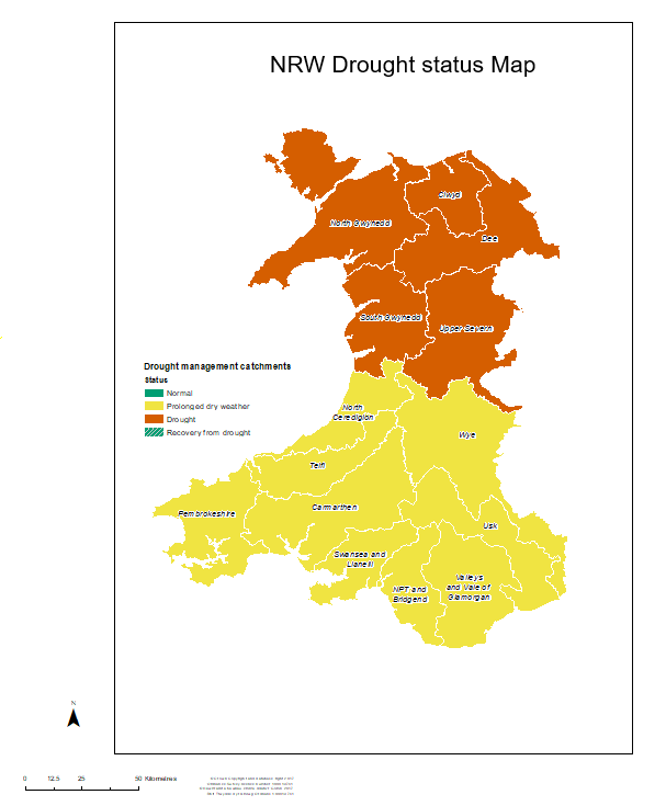
An official drought has been declared in North Wales and the Upper Severn region by Natural Resources Wales (NRW), following a period of record-breaking heatwaves, wildfires, and critically low river levels. While these are the first parts of the UK to enter official drought status this year, much of southern, central, and eastern England remains on the brink, sitting in "prolonged dry weather" status—the final step before a formal drought declaration.
Despite June being wetter than average in all four UK nations, most of the rain fell in the first half of the month, with little or no rain since then for many areas, with a record-breaking heatwave later in June accelerating drying out of the land. For July so far, the UK has received just 3% of its average rainfall for this month and is on track to become the driest July in almost 190 years. Hosepipe bans are in place for some 23 million residents.
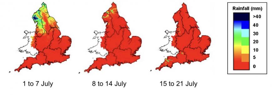
The areas in Official Drought are North Gwynedd, Ynys Môn, South Gwynedd, Dee (Wales), Clwyd, and the Upper Severn catchment (which extends across mid-Wales into parts of the English West Midlands).
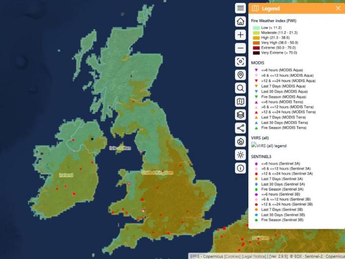
The increasingly dry conditions mean wildfires have been raging in several places in England and Wales, while a major wildfire broke out recently in the Cairngorms of Scotland. The Republic of Ireland sees a national housepipe ban come into force on Friday too.
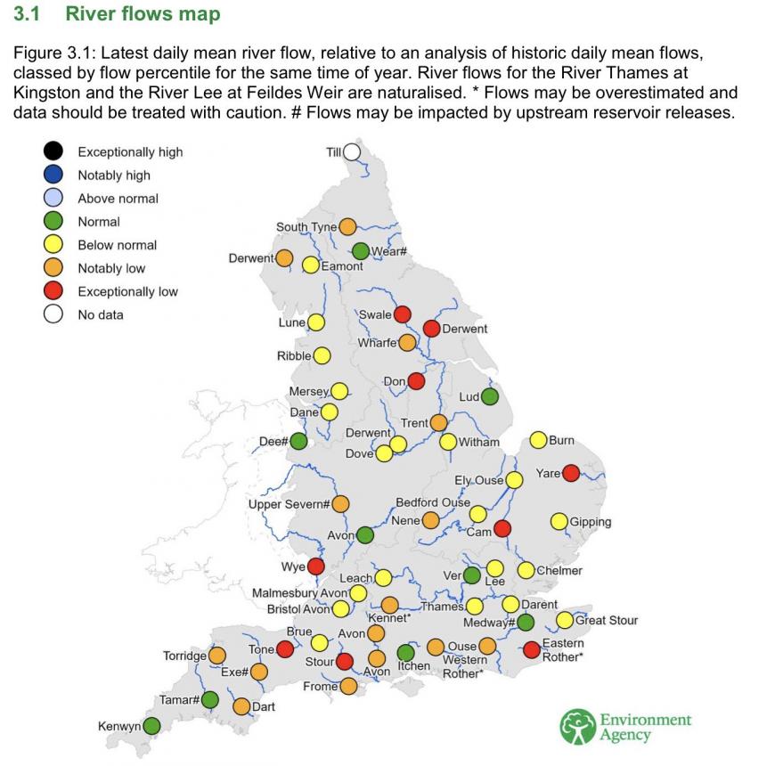
National reservoir storage across England has dropped to roughly 78.8%, which is about 5% below the long-term average for this time of year.Environmental Strain: The Environment Agency notes that only 13% of rivers are at normal levels. Rivers such as the Wye, Cam, Yare, and Hampshire Avon are experiencing exceptionally low flows, trapping migratory fish and triggering widespread algal blooms.
Farmers have been forced to harvest cereal crops weeks ahead of schedule. Abstraction of water for irrigation bans are increasing too. The Environment Agency has restricted many farmers from extracting water from depleted rivers, threatening the yields of spring crops like barley.
There is rain in the forecast for the weekend, as high pressure retreats to allow Atlantic frontal systems spill down from the northwest, bringing showery rain. But for many it won’t be enough to make any difference, other than dampening the ground and settling the dust, before drier and increasingly hotter conditions look set to resume next week.
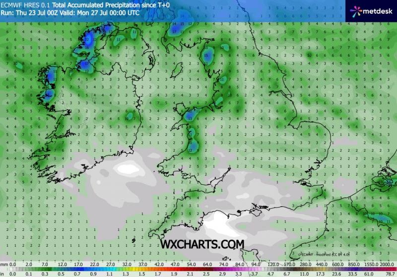
Scotland, NW England, Wales, far SW of England and much of the island of Ireland should see 2-5mm widely, perhaps 10-30mm over some western hills. Central, southern and eastern England may only 1-4mm at best, though very local heavy showers or even isolated thunderstorms could bring this higher.
Rainfall totals through to midnight Sunday night
.jpg?w=800)
It looks to remain unsettled across Scotland, northern England and N. Ireland early next week, with cool, cloudy and breezy conditions off the Atlantic and further spells of showery rain at times. Meanwhile, a ridge of high pressure looks to quickly build back further south across England and Wales, with a return to drier conditions. These drier and more settled conditions perhaps extending further north across Scotland from mid-week too, meanwhile, it looks to become hot again across the south, with 30C forecast by a few models as early as Wednesday in SE England, then high 20s and perhaps 30C or so more widespread across southern UK Thursday and Friday. Cooler and cloudier across northern England and Scotland though, high teens or low 20s at best, still a chance of some showers too.
So, unfortunately, it looks like the wait continues for any meaningful rainfall for areas already in drought or on the brink of drought.
Loading recent activity...