Some places in the UK have gone more than a month without a drop of rain, large areas of England and Wales have seen no rainfall so far this month. So are there any signs of rain on the way?
Before the weekend, only really the far northwest likely to see some rain, though the odd light shower can’t be ruled out across the north and east if cloud becomes thick enough. It’s on Saturday that we start to see a change, that will see increasing chances for rain, as high pressure close to the west retreats west to allow Atlantic frontal systems to spill southeast bringing showers or longer spells of rain over the weekend.
Showery rain for many over the weekend, but not bringing much to dampen the ground for most
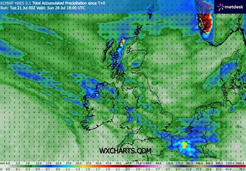
However, even the most generous model forecasts only give 2-5mm widely, 5-10mm at best in some areas by the end of the weekend, some models such as UKMO and GFS only give a few mm widely away from coasts in the northwest exposed the northwest to westerly flow.
Rainfall totals by the end of the weekend
There is some uncertainty between models whether the more changeable conditions with chances for rain, will continue next week - as ECMWF model suggests, or the Azores high pressure system extends back northeast across the UK - as GFS suggests. However, a look at the majority consensus of 00z ECMWF ensemble clusters suggests low pressure may hang around next week, so it may stay unsettled.

Before the much-welcomed chance for rain for many this weekend, as little as it may be, it’s a mostly dry picture, thanks to high pressure in charge, and a case of chasing areas of cloud with some seeing clear sunny skies making it very warm or hot, while others are cooler under cloudier skies.
Today has seen cloud spreading down in the northerly breeze stubborn to clear eastern England, Northern Ireland, northern and western Scotland - keeping temperatures suppressed here in the teens or low 20s, while clearer skies across Wales, the Midlands and SW England have allowed temperatures to reach 25-27C inland.
Wednesday is likely to feature a cloudy start in the north, with the odd spot of drizzle across northern Scotland and northeast coasts, though sunny spells developing later away from the far north - allowing temperatures to reach 19-23C. Southern areas seeing any early cloud break up to lead into a fine, sunny and very warm day - temperatures reaching 22-26C inland.
Thursday will see a weakening cold front approach the northwest, bringing thickening cloud and patchy drizzle to northern and western Scotland along with N. Ireland and perhaps Cumbria. Otherwise any early cloud breaking up - with most seeing sunny spells and becoming very warm or locally hot in the south. Temperatures reaching 24-28C across England and Wales inland.
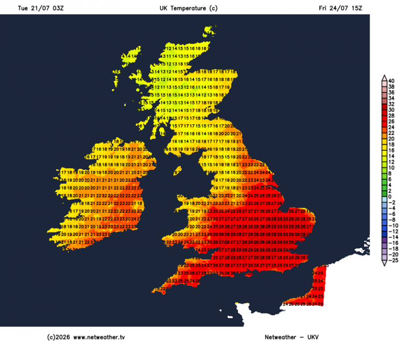
Friday could be the warmest day of the week, with light winds and widespread long spells of sunshine across much of England and Wales, locally hot in the south of England with temperatures reaching 27-29C. Cloudier, cooler and breezier for Scotland and N. Ireland, cloud thickening into the evening to bring some patchy rain or drizzle in from the west.
Hot in the south on Friday before temperatures come down over the weekend
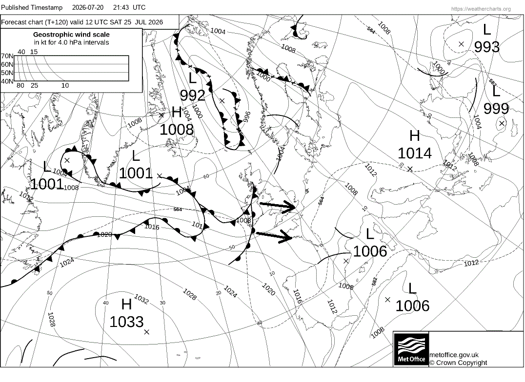
High pressure looks to retreat to the southwest on Saturday, allowing a series of frontal systems to slide southeast across the UK and Ireland, bringing areas of showers or longer spells of rain southeast over the weekend, rainfall amounts greatest across the northwest. Perhaps still very warm towards the southeast on Saturday - where it will be sunniest longest, temperatures more average for all on Sunday - as the wind turns northwesterly. Temperatures reaching the low 20s in the south, mid-to-high teens in the north Sunday.
Loading recent activity...