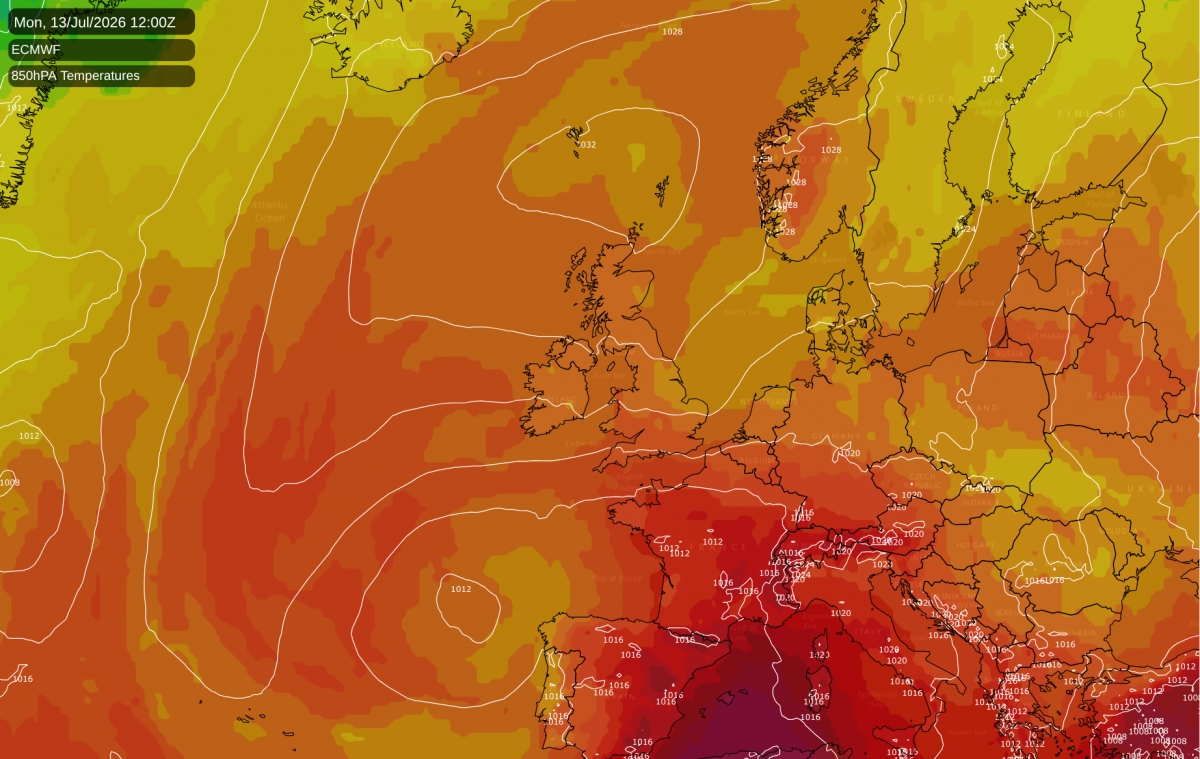
The temperature has once again exceeded 35C in some parts of the country during the last few days, making it three consecutive months with exceptional heatwaves. The current hot spell is proving to be less exceptional than the May and June ones in terms of the absolute maximum temperatures - we haven't come close to approaching the UK national record of 40.3C on 19 July 2022 - but it is proving notable for duration.
A consequence of the three heatwaves is that we have already set a new record for the number of days surpassing 34C in the UK in a calendar year, despite not having even reached mid-July yet. The run of three consecutive months where somewhere in the UK recorded 35C, which included unprecedented readings of 35C in May, is also a new record. The legendary summer of 1976 only saw 35C breached in two months of the year, during late June and early July.
Due to the wind direction, the hottest weather during the coming week will often be found in south-western Britain, with east to north-easterlies bringing cooler weather into eastern Britain. This morning we have seen plenty of cloud moving in off the North Sea into Scotland and the eastern side of England. There is potential for the heat to intensify for a time early to mid next week, again probably not threatening national temperature records but with potential for temperatures of around 35C in south-western Britain, which may set records locally because traditionally the highest temperatures tend to be towards the south-east, rather than the south-west.
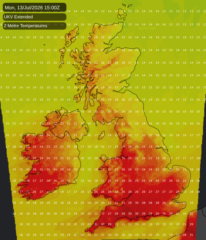
For some regions of eastern England, a region often particularly affected by heatwaves in recent years, it can feel like a struggle to get moderately warm and sunny weather - it was sunny and hot for most of last week, and then the cooler weather today has so far been accompanied by a sheet of stratocumulus from the North Sea.
This year's hot weather appears to have crossed a threshold whereupon many people have opted to seek air conditioning units for their homes. There are reports that the UK is in danger of running out of air conditioning units altogether, as demand has soared to such an extent that many sites are now completely out of stock.
There will be some rain in northern and eastern Scotland today, but after today the outlook is predominantly dry through to the middle part of next week. There is potential for some parts of the south to see showers and thunderstorms during the mid to latter part of next week, and potential for the low pressure to drift northwards and to give rain more widely, possibly with a thundery breakdown for many regions. However, this is not a certainty, and for example this morning's ECMWF ensembles point to the possibility of high pressure hanging on in northern Britain and restricting the northward extent of any rain, with central regions of the country having potential to stay dry.
Some parts of the country have seen a marked shortage of rainfall in recent weeks, resulting in the ground turning very dry, and a risk of flooding. I travelled across a fair part of England last week and at both locations the ground was very dry with a marked lack of vegetation, bringing back memories of the very dry spell that many of us had in June and July 2018.
The longer term outlook has the high pressure transferring to the west of Britain, bringing in northerly winds, which should prevent a continuation of the high temperatures, but with high pressure close by, it will probably remain mainly dry. With exceptionally high sea surface temperatures around the British Isles, the northerlies will probably not be particularly cold, with the most likely outcome being that temperatures drop close to the long-term normal. There are signs that the weather could turn more unsettled with greater potential for substantial rainfall towards the end of July, conforming to the stereotype that the dry sunny weather breaks down as the majority of children break up for the summer holidays, but this is a long way off and subject to change.
The likelihood of some cooler weather later in the month means that there is a possibility of July 2026 not coming out quite as hot overall as the record hot Julys of 2006 and 1983 (2006 was generally the hottest July on record in northern and eastern Britain, while 1983 was generally hotter in the south-west). However, generally hot weather looks set to continue through to next week and the extent of subsequent cooler weather is not as easy to predict as it is still a fair way off.
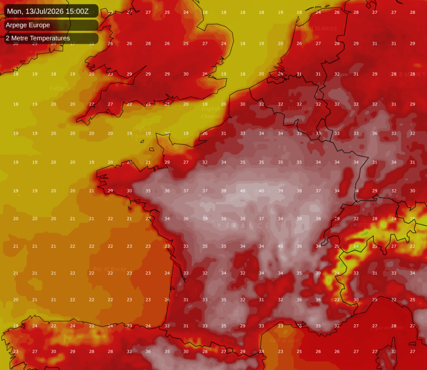
Although not quite as extreme as the one in late June, another "heat dome" has been setting up over western Europe, especially covering France and Spain, and there is potential for parts of France to again reach 40C next week, most likely around the middle part of the week as another sluggish southerly flow brings another plume of hot air northwards. There are reports that in France many people have been leaving their homes and seeking to cool off in canals and other similar spaces. There have been a number of drowning-related deaths, as well as deaths attributed at least partially to the excess heat.
Loading recent activity...