Amber heat health alerts will be in place from 9am Wednesday 8 July until Sunday 12 July at 9pm across central, southern and eastern England, as the third heatwave of the year brings a prolonged spell of hot and dry weather across England and Wales.
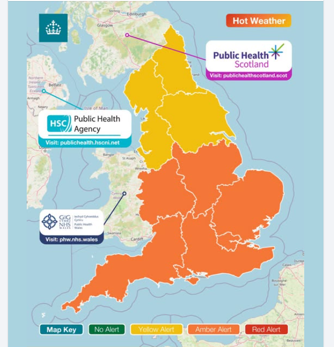
Alerts for England from UKHSA, see other Health Boards for information
Monday saw a highest temperature of 34C at Teddington in west London, with temperatures widely reaching the low 30s across SE England and East Anglia. Today will see highest temperatures reach 30-32C across SE England under clearer skies, not as hot elsewhere, with more in the way of cloud spreading southeast off the Atlantic - though still warm or very warm where the sun comes out.
Upper level ridge builds north across the UK this week, with a corresponding expansion north of heat across the UK
The heat builds north again from Wednesday, as an upper level ridge builds north and surface high ridges northeast across the UK. The large-scale subsidence of dry air from aloft as the upper level ridge builds will ensure clearer skies spread further north across England and Wales from mid-week, with a corresponding rise in air thicknesses at the surface seeing a rise in temperatures over a wider area of England and Wales towards the end of the week. Low 30s across central and southern England on Wednesday, then further north, west and east across east Wales, southern Northern England and eastern England Thursday and Friday. We could see temperatures reach 34-35C either day.
Thankfully this heat comes with lower humidity than the June heatwave, so although it will be hot by day and nights will be warm, it will at least feel more comfortable with the drier air.
Then over the weekend, it stays dry and sunny for most - with high pressure firmly in control centred close to northern Scotland. However, the heat becomes increasingly confined to SW England by Sunday, as a northeasterly wind develops on the southern flank of the high pressure system. Then temperatures in the 30s disappear on the latest ECMWF run next week as the northeast wind continues to dig in across the UK, though GFS hangs on to 30s in the southwest early next week.
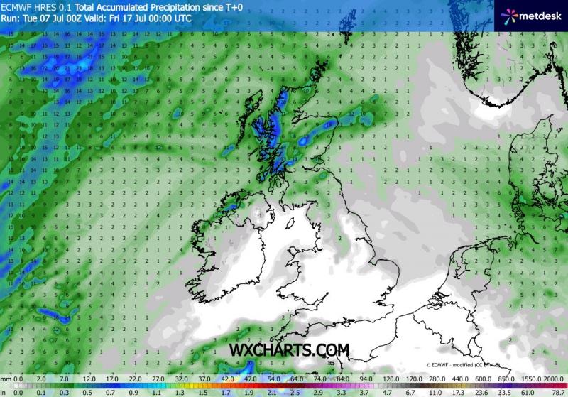
Although northern Scotland could see a little more rain for the rest of the week, no sign of any rain for most of England and Wales this week and potentially throughout much of next week too, thanks to high pressure in charge close to the north. Low pressure is forecast to lurk close to the south and southwest though through next week and may encroach far enough north to threaten some showers or storms across southern England, particularly later in the week, but uncertainty over this. Likely any rain from these if they do occur with be very hit and miss anyway. The general picture is dry for the next 10 days for England and Wales, Scotland becoming dry and settled too from the weekend and through next week after recent damp weather at times off the Atlantic.
Little or no rain for England and Wales over the next 10 days, Scotland becomes dry too from the weekend
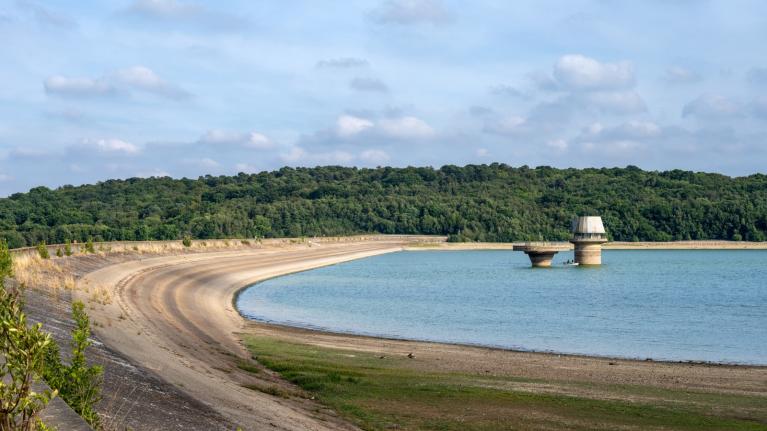
After a dry spring, particularly in the east, despite unsettled weather and rainfall in early June bringing close to average rainfall for the month, the record-breaking high temperatures during half of June, no rainfall and increasingly high temperatures so far this month means below normal or notably low river levels in central, eastern and northeast England. Soils are also drying out quickly in these areas thanks to recent extreme heat in late June and no rainfall since after a brief improvement in early June. Groundwater levels are declining seasonally and are notably low in some limestone and chalk areas, though normal elsewhere after a wet winter.
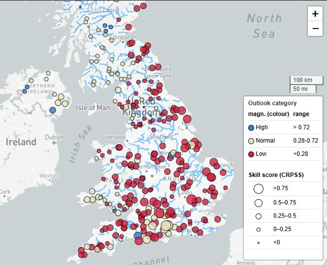
This third heatwave of the year will continue to drive high water demand. Most water companies remain in business as usual, but some have moved to early drought response. South East Water has announced a temporary hose-pipe use ban in Kent effective from the 3rd of July to help manage demand on its distribution network, rather than a drought response.
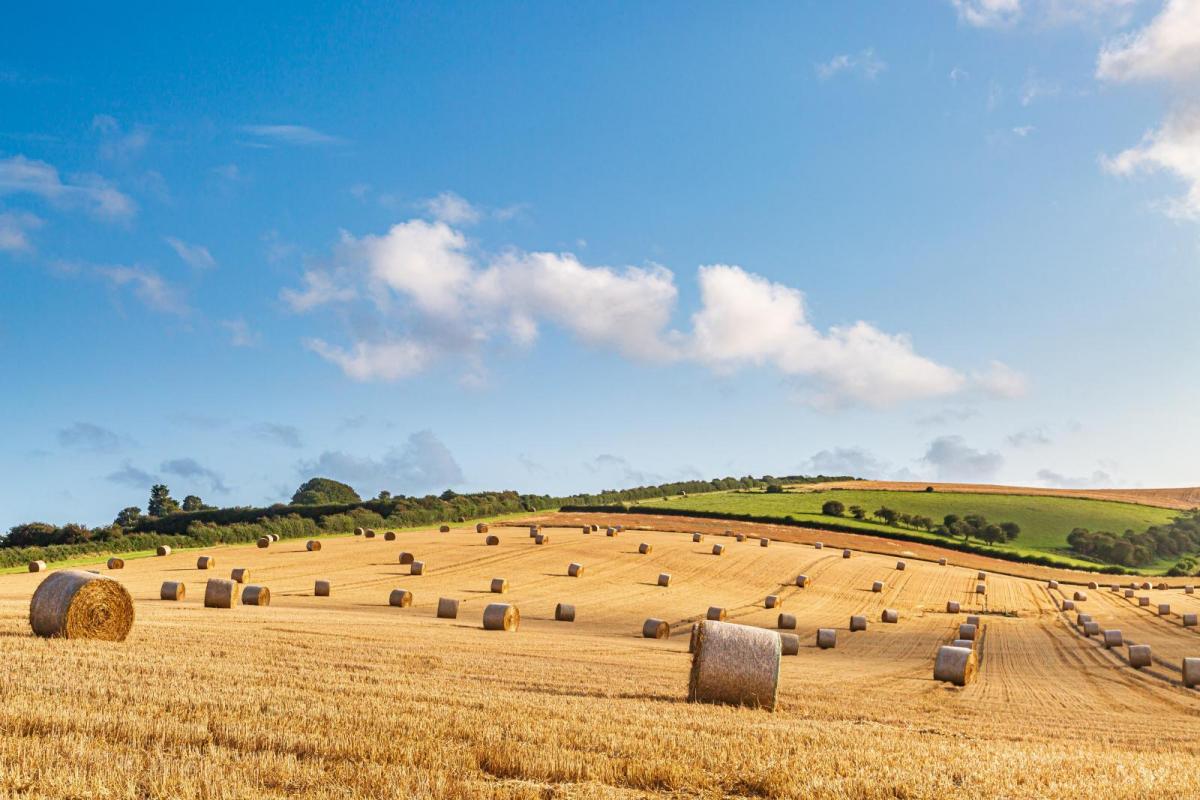
Early June rain helped the agricultural sector; however, the dry spring has already impacted crops, particularly in the east and southeast. Irrigation demand is high with reservoirs in some areas only 50% to 60% full as of late June. Heatwave conditions again will only increase pressure on water use and livestock needs, with little sign of much in the way of rain on the horizon for most.
Loading recent activity...