




The UK Met Office has issued a rare red Extreme Heat warning for midweek within the existing wider amber Extreme Heat warning, which runs from today, Monday 22nd, through til Thursday. It will be very hot but also muggy and humid in southern Britain. This will make this heatwave very wearing, and potentially dangerous.
The advice is to adjust your behaviour and slow down.
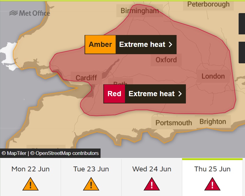
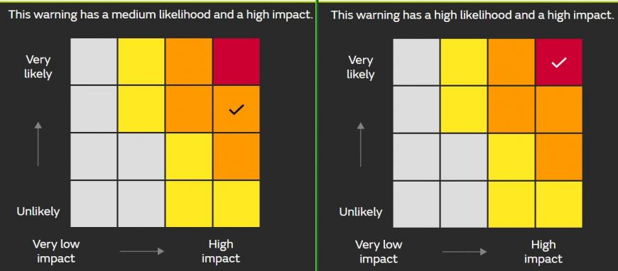
Although the red warning will grab attention, all of the warned areas, red and amber highlight the risk of High Impacts during the heatwave conditions. The amber warning shows Medium Likelihood of these High Impacts, the red warning combines High Likelihood of these High Impacts.
The red warning represents the persistence of the heat and humidity with building strain on people and infrastructure. Further north, it will be hot but not quite as humid and the highest temperatures will last for a day or so, not several like in southern Britain
Temperatures in the coming days are expected to reach into the mid to high 30s Celsius, smash the UK June record and cement this second heatwave event of 2026. Exceptional heat is expected.
Met Office Deputy Chief Forecaster Mark Sidaway,
“As well as very high daytime temperatures, there will be consecutive nights where temperatures do not drop below 20°C, which is called a Tropical Night. This will make it very hard for people to recover from the daytime heat, exacerbating the heat stress impacts.”
The top temperature on Sunday was 31.8C at London Heathrow. The Channel Islands have already reached 33C tapping into the intense heat over France, which will send the already hot parts of Britain into this exceptional heat event.
The UK June record is 35.6C from 1976, with the UK record being 40.3C from July 2022. There is little doubt that the UK June record will be broken but it seems that 38 to 40C is possible. It is not just the heat, there will be higher humidity, higher than in 2022. We have only just passed the Summer Solstice so there will be many hours of sunlight, more than in July and little opportunity to recover at night.
We have hot air from France, moisture causing the humid air, direct heating from sunshine and high pressure keeping the situation steady with slowly descending air continuing to heat up over the warm land.
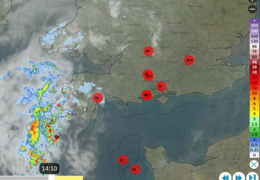
Netweather radar from Monday 2:10pm- top ten temperatures with sferics (lightning strikes near Cornwall)
What is expected? (Met Office)
Businesses, local authorities, and organisations should all have policies to respond to severe weather, including heatwaves, especially as these will occur more often as our global climate continues to heat. The weather warnings highlight what is expected to happen, the likelihood of that, and the potential impacts so that people and organisations can make informed decisions for their own situation. Is keeping pupils in school safer than concerns of being outside in direct sunshine, perhaps heading to waterways?
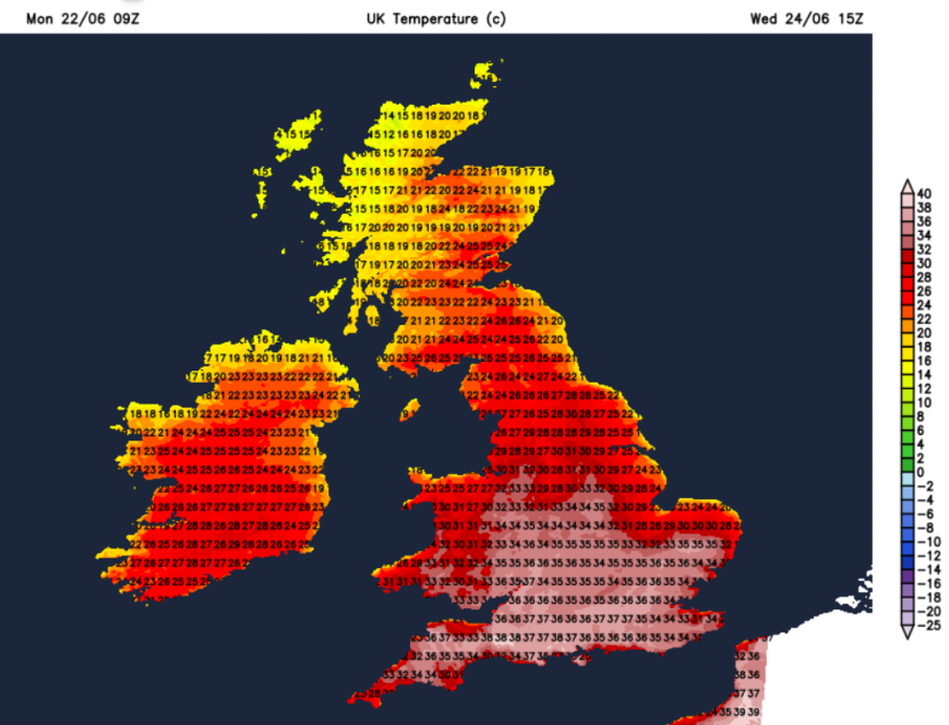
Tuesday temperatures in England and Wales will be in the high 20s to mid 30s Celsius, with 37C possible. Wednesday could see 38/39C. This is day on day heating, with nights staying in the high teens or low twenties.
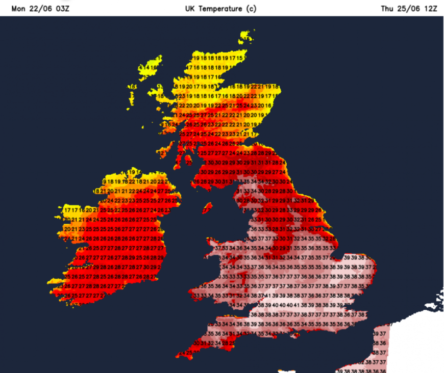
Thursday looks to be the peak of the heat up to 39C possibly higher, with a slow decline from the west by Sunday.
The reason for the warnings is to help people prepare; to think about adjusting plans and their daily activities. Further advice.
Loading recent activity...











