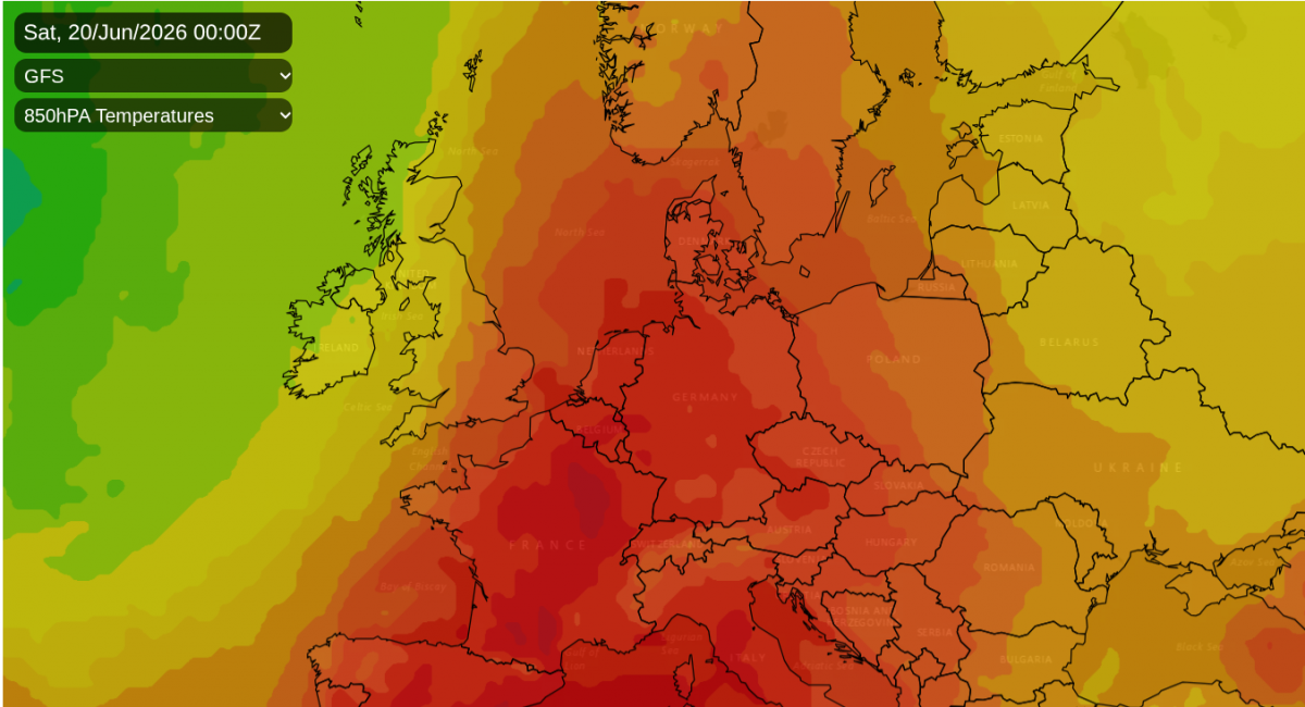
There is heat and high pressure over mainland Europe. Where skies are clear, the sunshine is lifting temperatures into the 30s Celsius. The UK is on the cusp of this hot air. At times later this week, it will nudge over southern or eastern Britain. However, there will often be a frontal boundary wavering about intruding more cloud, with fresher conditions to the northwest and pulses of rain from the Atlantic.
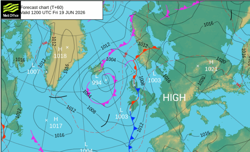
There are the ingredients for thunderstorms too but confidence is low around those at this time. Everywhere, the warm air is seeping through. Yesterday, London Heathrow reached 27.1C. At the other end of the UK, Shetland dipped to 5.5C in its brief night, but saw the highest amount of sunshine with 9.7 hours at Lerwick.
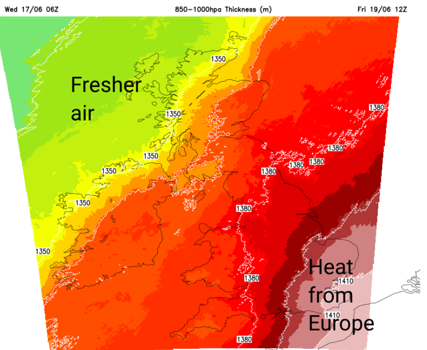
There is warm air over the UK but also cloud and patchy outbreaks of rain. In Scotland today and on Thursday, temperatures will peak around 18 to 20C. Northern Ireland 18 to 21C. Wales 17 to 24C and on Thursday, for England, temperatures will move up into the mid to high 20s Celsius. Later this week, the 30s Celsius beckon for the southeast.
For mainland Europe, there has already been a hot spell with warnings for heatwave conditions. In northern Switzerland there is a red warning for extreme heat on Wednesday as temperatures range from 33 to 37C, with 30 - 45 % humidity. By night, temperatures are only dipping to 18 - 23C.
There are also heatwave warnings for Belgium, France, parts of Germany, Spain up to 38C, Austria and Italy, all available on the Meteo Alarm European website.
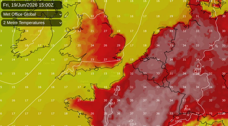
This hot air will sway across the English Channel into SE Britain on Friday and over more of southern Britain by Sunday into Monday. Temperatures for East Anglia, London and the Home Counties and more of southern England will move into the high 20s C and for some the low 30sC. This means that the UK heatwave threshold temperatures will be exceeded, and over the weekend into Monday, the qualifying ‘three consecutive days’ looks very likely.
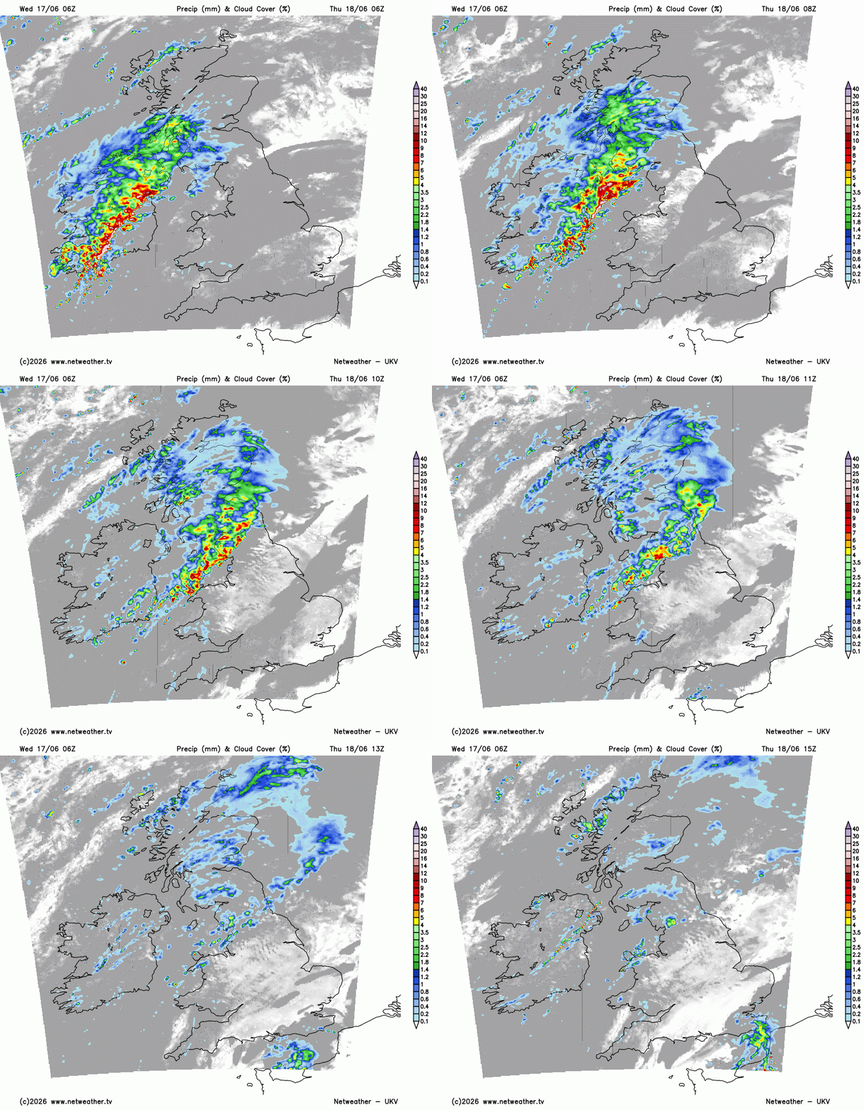
Further north, the Atlantic still has more of an influence with a fresher airflow from the west and frontal bands bringing rain at times. Early on Thursday looks wet for Belfast then the Lake District during the day. Kent might see thunderstorms later, and there is the risk of thundery showers for County Down, perhaps SW Scotland by the evening.
During Thursday night, a waving frontal band will bring heavy and persistent rain over Northern Ireland into western Scotland with a wet spell for Scotland on Friday. This will be welcome rain in the east as water scarcity alerts continue to appear. For England and inland Wales, there will be warmth and sunshine.
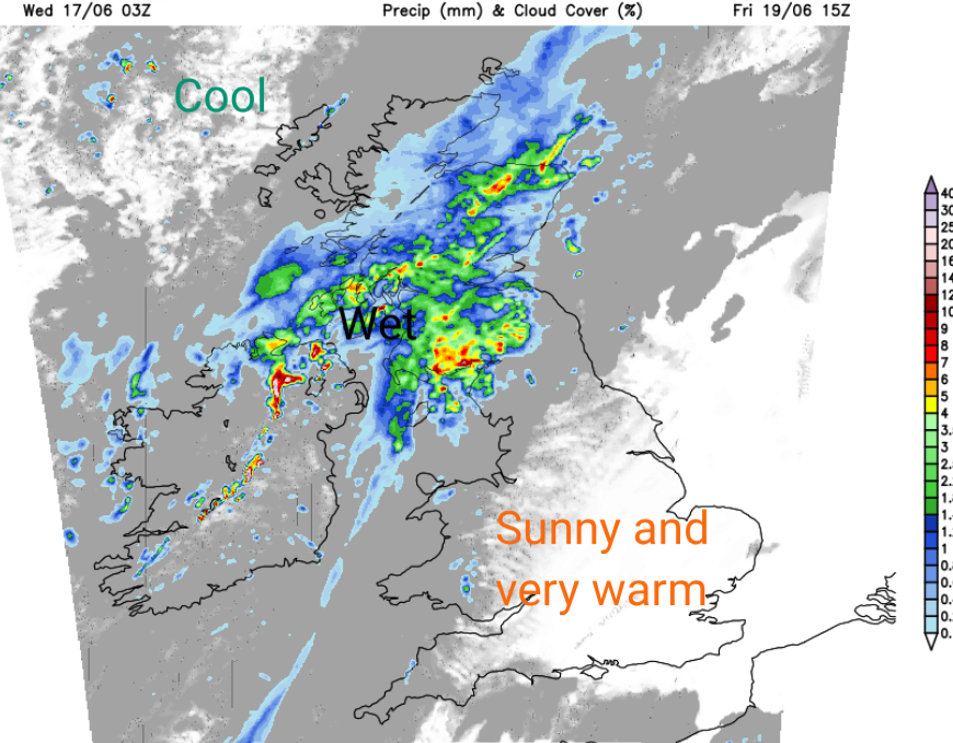
Although there will be some residual cloud and a bit of showery rain left by Saturday morning, the weekend is looking fine and warm. It will soon dry up where there is any early rain, maybe just a few showers over northern mainland Scotland. Sunday looks sunnier and dry as high pressure builds over the UK. Temperatures in the south could be 27 to perhaps 32 or 33C later this week, into Monday
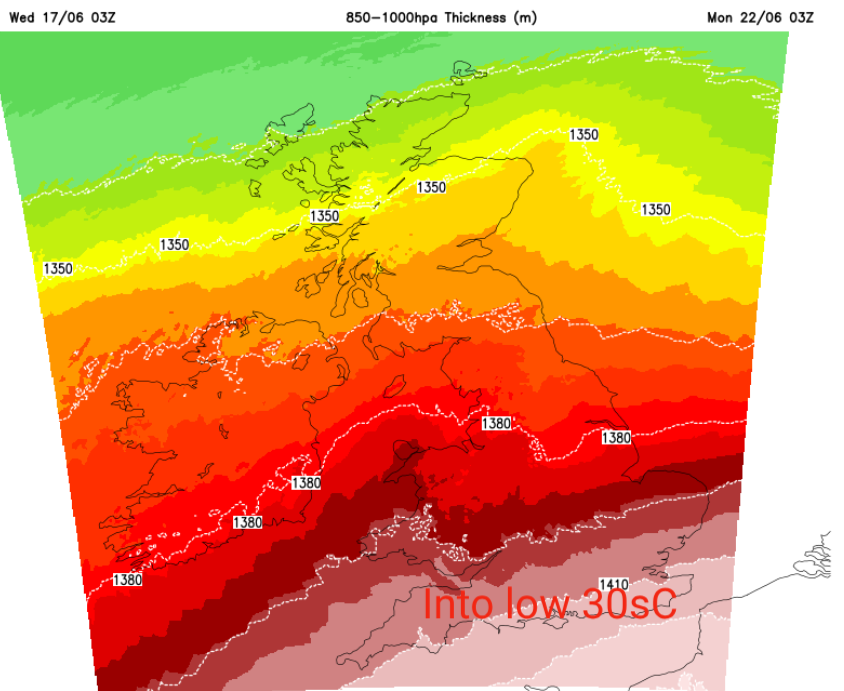
The combination of very warm air and clear skies with sunshine will allow the temperatures to leap up. We are nearly at Midsummer. It will also make it more uncomfortable to sleep at night for the start of the new week.
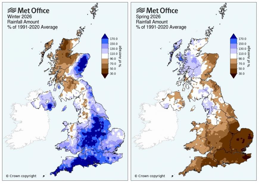
There is a strong signal for growing heat later this week, lasting into next week. This put extra demands on our water supply in a hot and dry mid-summer spell. The National Drought group will meet tomorrow, 18th June as government, regulators, water companies and partners assess the latest position. The National Drought Group includes the Environment Agency in England, Met Office, government, regulators, water companies, the National Farmers’ Union, Canal & River Trust, anglers, hydrologists, and conservation experts.
Although there was a very wet winter in parts of the UK, there was almost a reverse in the spring months with very dry weather. As Anglian Water remind us “ Love every drop”
Loading recent activity...