Low pressure close to the north and the wind generally from the west during the past week has brought cool and often cloudy conditions with showers and longer spells of rain for many. However, although low pressure brought more showers to the north on Saturday, high pressure has been building north since the start of the weekend, bringing sunnier and more settled conditions to the south yesterday and also to the north today.
Most of the rain this coming week will fall across W Scotland, N. Ireland, Cumbria and W Wales:
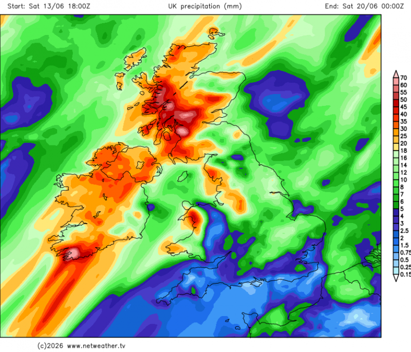
The new week promises to be warmer than last week, thanks to a tropical maritime flow from the southwest, though not without some rain. However, most of the rain looks to fall across Scotland, Northern Ireland, Cumbria and west Wales. Much of England and east Wales should see plenty of dry weather and warm sunny spells most of the time, could turn hot later in the week across SE England and East Anglia, as here taps into hot air building over France.
Warm in the week ahead, especially in the south. Heat building over France may reach the southeast later in the week.
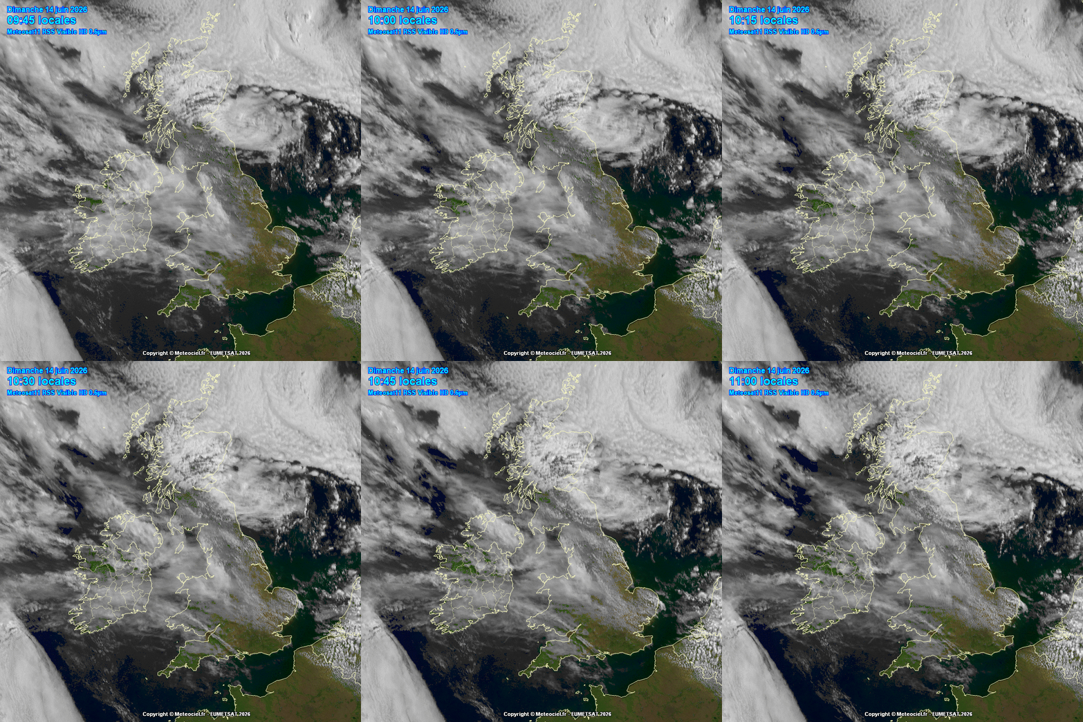
A ridge of high pressure will keep the weather generally dry and settled on Sunday, after a sunny start, cloudier skies over Ireland, Wales and western areas of England will spill further southeast towards eastern England through the day, though parts of southern England may stay sunny. Cloud and some showers spreading down across NE Scotland blown in by the northerly wind here, western Scotland could stay sunny. Temperatures reaching 18-22C generally, cooler across northern Scotland.
After a dry night with clear spells, Monday will see sunny spells but also some scattered showers drift east across southern areas of England and Wales. Drier elsewhere, before Atlantic fronts arrive off the Atlantic towards the northwest, bringing thicker cloud and outbreaks of rain east across N. Ireland, Scotland and the far north of England through the evening.
After a dry and bright morning on Tuesday, turning cloudy from the southwest across most parts in the afternoon, with a waving Atlantic frontal system moving northeast bringing outbreaks of rain across England and Wales through the afternoon and evening, locally heavy in the west, while showers move in across Scotland. A warm and humid day, could see temperatures reach 22-24C across eastern England before thicker cloud arrives from the west late afternoon, 17-21C further north and west.
Chance of rain by mid-week for many areas, though rain becoming confined to the north and far west Thursday and Friday
After perhaps a cloudy start on Wednesday, with early outbreaks of rain or some showers in places, turning drier and brighter from the southwest through the day across England and Wales, cloudier with showers or longer spells of rain continuing across Scotland and N. Ireland. Warm, temperatures reaching 24C across SE England and East Anglia, 17-21C elsewhere.
Cloudier skies with outbreaks of rain, locally heavy and persistent, spreading northeast across Ireland, N. Ireland, Scotland, west Wales and Cumbria on Thursday. Drier, sunnier and very warm or hot elsewhere across England and Wales, temperatures reaching 26-27C across SE England and East Anglia, 22-24C elsewhere with sunshine, high teens with the cloud and rain.
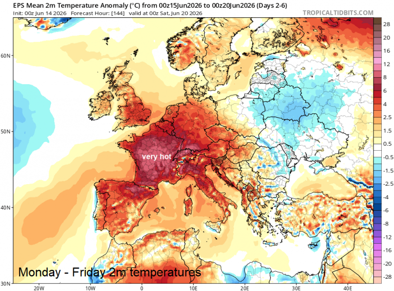
A heat dome looks to build over mainland Europe during the second half of the week, as a strong upper level ridge builds north from the Mediterranean - with temperatures reaching the mid-30s Celsius over a wide area of Spain, France and into Germany on Friday.
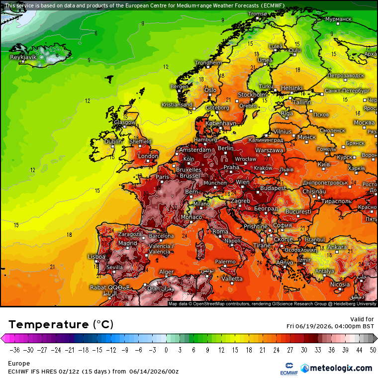
Southern UK looks to escape the worst of this heat, though we could see the high 20s Celsius on Friday across SE England and East Anglia with another sunny and dry day for most of England and Wales. Scotland and Northern Ireland cloudier and cooler with further rain here, perhaps heavy and persistent over western hills, with potential high rainfall totals for the western Highlands by the weekend, with risk of flooding here.
Hot on Friday across eastern areas of England?
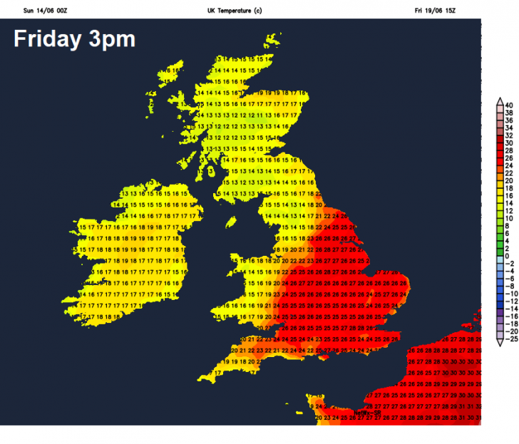
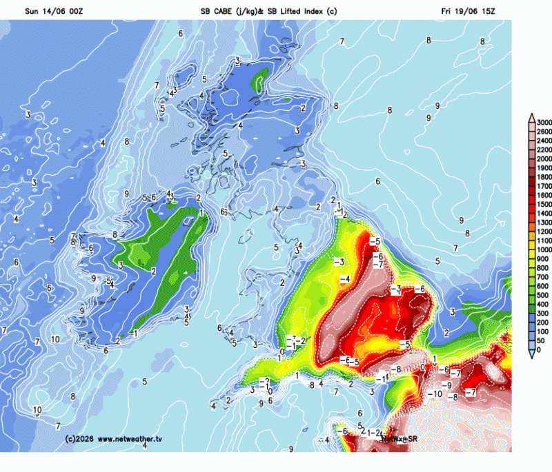
There is a risk of some thunderstorms developing and spreading northeast across southern and eastern areas of England later on Friday, as the edge of the hot and humid air over mainland Europe tries to destabilise as cooler air from the Atlantic tries to nudge in aloft, though uncertainty over this.
Atmosphere could become quite unstable across eastern and southern England by the end of the week - increasing the risk of thunderstorms here.
It may stay sunny, very warm or hot across southern and eastern England next weekend, warm and sunny elsewhere across much of England and Wales, as high pressure builds in from the south, cooler and more unsettled across Scotland and N. Ireland initially, with showers or longer spells of rain, though Sunday may turn drier and sunnier and pressure build from the south.
Loading recent activity...