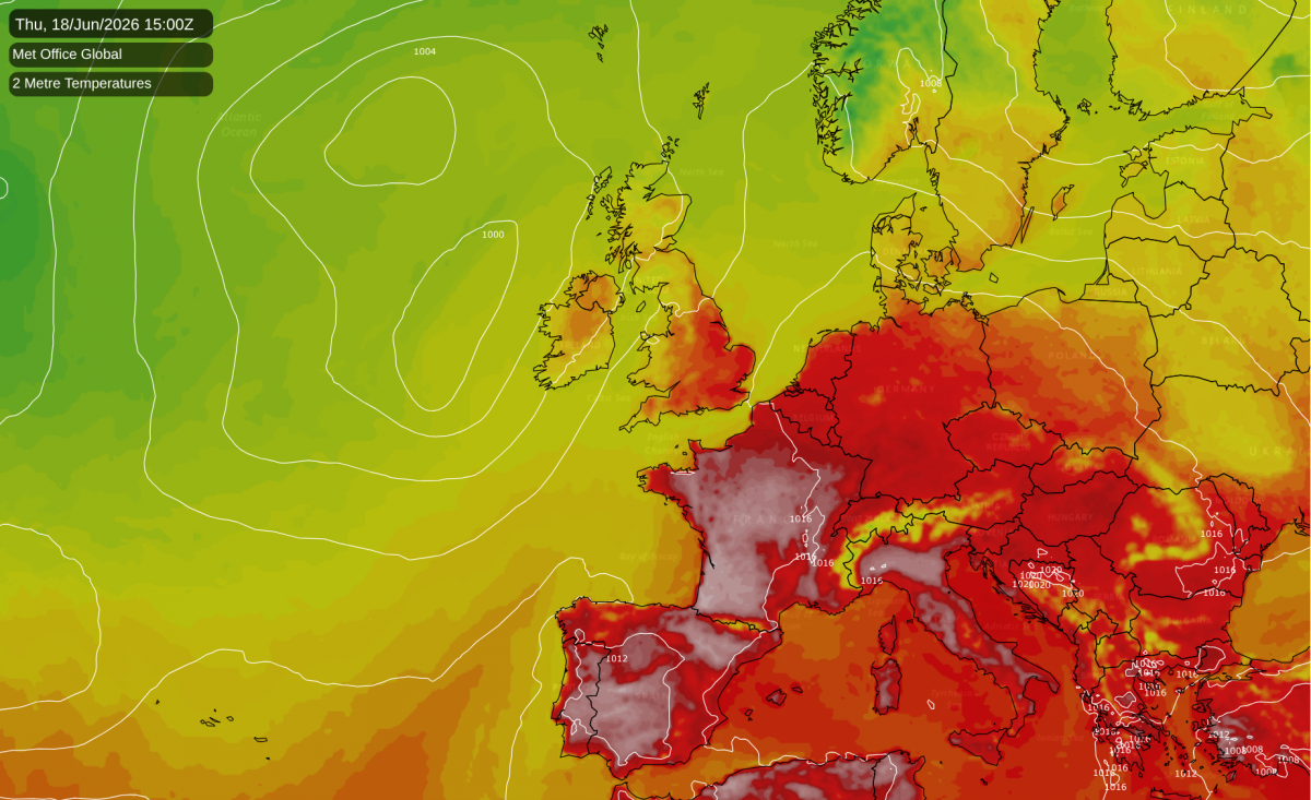
The onset of hot weather has repeatedly been delayed in the medium range forecast model runs. Many earlier forecast model runs had suggested that this weekend would be a hot one, showing a ridge of high pressure pushing slowly north-eastwards across southern and eastern Britain. Indeed, the projected setup looked similar to the one in the third week of July 2022, which sent temperatures above 40°C for the first time in recorded history in the UK and smashed a lot of records.
In the event, however, the ridge of high pressure is tracking further south than previously modelled, keeping the hot weather bottled up to the south, where large areas of southern and western France are expected to record highs of around 35°C tomorrow. In Britain it will be an ordinary weekend with average temperatures, some sunny intervals and a scattering of light showers.
During next week, we will see an Atlantic trough/Euro high setup develop, which will bring frequent southerly winds to the western half of Europe. This is set to result in the heat intensifying over France and Spain. By the end of next week, temperatures are likely to have reached or closely approached the 40°C mark in parts of France.
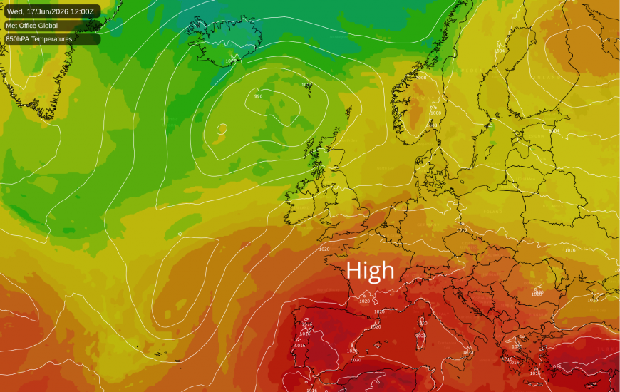
Some of this hot weather could come into Britain towards the end of the week, particularly into eastern England, but it is currently unclear whether this will happen or whether it will end up staying out in the English Channel and North Sea, with Britain just getting a "glancing blow". It is looking probable that next week will see warmer weather, when it will also be humid at times, with tropical maritime air and south-westerly winds coming in off the North Atlantic. However, Tuesday has potential to be on the cool side in parts of Scotland, with cloud and rain moving through prior to introducing the warmer air. Towards the end of next week, there is a likelihood of thunderstorms breaking out widely, as the hot air over France approaches and collides with cooler air pushing in from the west.
Again, this hot weather has been toned down in the latest set of forecast model runs. Some earlier runs had the hot weather over France making a direct hit in southern and eastern Britain, which could have seen the UK June 1976 temperature record of 35.6°C in Southampton come under threat. That temperature record looks very flimsy, especially with May 2026 having recorded temperatures as high as 35.1°C, but for now the June temperature record remains the one set during that legendary hot spell in 1976.
There are hints that high pressure may start to build beyond next weekend, with a weak ridge spreading in from the Azores up towards Scandinavia, but it looks quite tentative. Hot weather is likely to persist in France well into the following week, creating further potential for some of that hot weather to make it into southern and eastern Britain, although it is again possible that it could stay just away to the south-east.
Earlier I had noted that some summers with oncoming El Nino events started off with warm but wet Junes, with 1966 and 1982 being the prime examples. June 2026 is increasingly looking likely to also fall into the warm but wet category. I had envisaged a much drier second half, but it looks like it will remain unsettled with frequent rain through to at least 19 June, which is likely to result in June as a whole having above average rainfall for most of the UK, even if the last third of June ends up being mainly dry.
It hasn't been particularly warm during this June so far, with temperatures widely running close to or a little below the long-term average. Last week had some cooler weather, with a cool polar maritime air mass accompanying the sunshine and showers on Tuesday and Wednesday, and then some unseasonably cool daytime temperatures on the Thursday as a band of rain crossed the country. Indeed, as measured by the Central England Temperature, which broadly represents the English Midlands, the first 11 days of June were only 0.2°C warmer than May had been, with May's mean temperature having been inflated considerably by the record breaking heatwave late in the month. But the onset of southerly winds next week, and potential for high pressure beyond that, are setting us up for a much warmer second half of June, even if we don't tap into much of the hot air that will be building over France and Spain.
Loading recent activity...