Look at the UK weather turning all hot and sunny for a Bank Holiday weekend! What is going on in the world? The focus for the heat will be for England with possible heatwave conditions over the weekend, but it will gradually warm up across the UK this week. Temperatures should significantly rise on Friday for England and for parts of Wales by Sunday. There are variations in the forecast models, some showing widespread warmth by Monday. Southern Britain could see temperatures pass 30C over the Bank Holiday weekend. The record for the month of May is 32.8C.
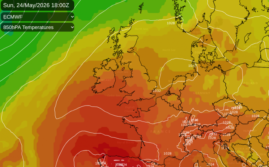
Before all of that, we still have some rain and showers mainly for the northern and western parts of the UK with the likelihood of showery rain continuing through the weekend for NW Scotland. For eastern Britain and much of southern Britain, there will be a lot of dry weather over the next few days. This fine, dry and sometimes sunny weather is linked to high pressure. There will be much warmer air heading our way but also more day-to-day heating from sunshine over the long weekend.
Wednesday
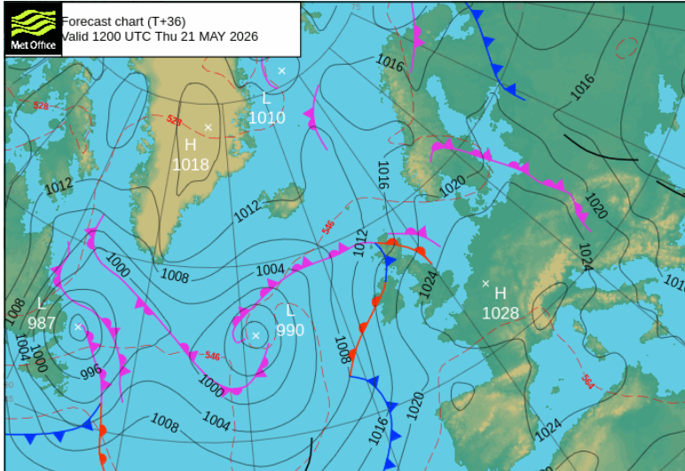
It is already feeling warmer for London and the Home Counties on Wednesday lunchtime as temperatures move into the high teens. A contrast to the chilly northerly flow of last week but we still have the leap to 27/28C by Friday. Further north, around the Moray Firth in sunny spells, Inverness has passed 17C. Two low pressures are lurking, a fading low to the NW of Scotland.
There are some showers about today, a band clearing eastern counties of Northern Ireland and a scattering over Britain but the far north and northeast of mainland Scotland could see some heavier, even thundery downpours this afternoon. A band of rain will move northwards over Orkney this afternoon towards Shetland and leave sunshine behind. Temperatures will widely be 15 to 20C with bright spells for much of the UK. The top temperature today could reach 21 or 22C.
Tonight
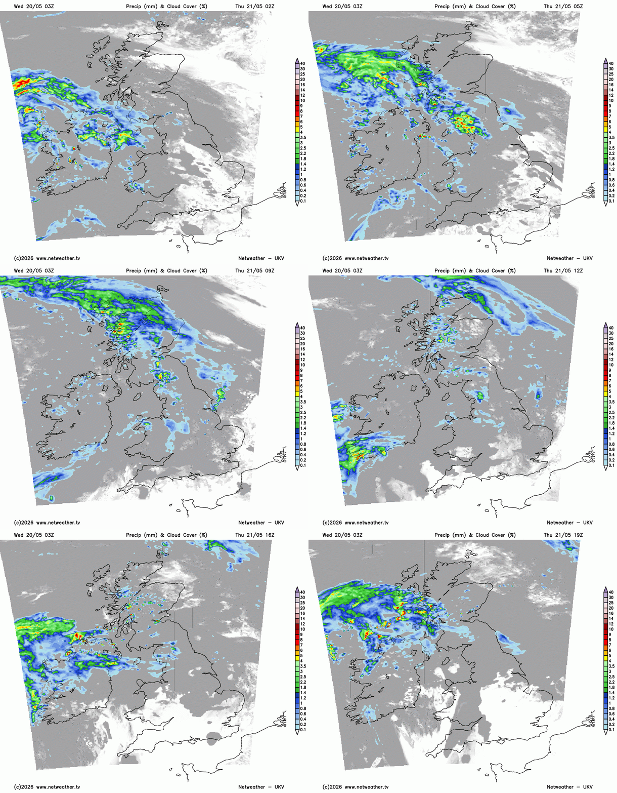
Northern Scotland will be clear and cool tonight but other parts should stay in double figures. The Atlantic low pressure is going to throw its frontal bands over western and northern parts of the UK with outbreaks of rain lasting into Thursday. Cumbria, the Isle of Man and the Inner Hebrides could see heavier rain overnight. Southern and eastern Britain won’t see much.
Thursday
East Anglia and southern England should have a fair, dry start with sunny spells. Elsewhere, there will be more cloud with further outbreaks of rain. One band moving northeast over Scotland, followed by showery bits for western counties but sunny spells appearing in the east. The frontal band will wave about, bringing another pulse of rain towards Northern Ireland later on Thursday. To the south and east of this, it stays fine with sunny spells and temperatures into the low twenties. Top temperatures will be around 22 to 24C
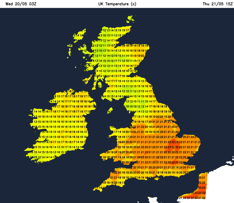
The frontal rain will push northwards over western Scotland. It will be a mild night, even a bit murky in places. The high pressure is beginning to have more influence over much of the UK, not just southern areas.
Friday
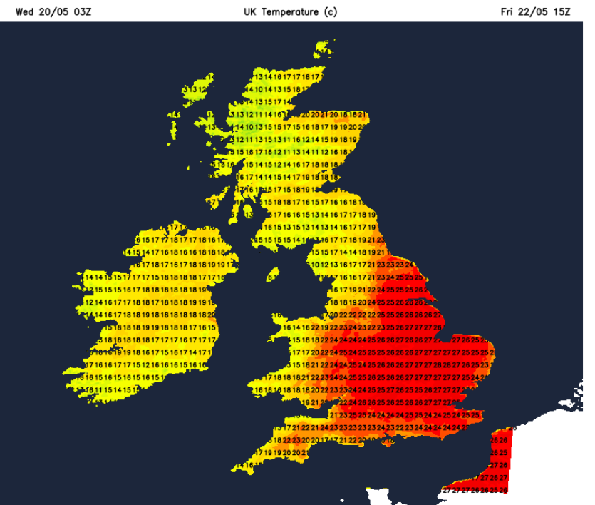
There will still be a lot of cloud through the Irish Sea, over Ireland, over western and the far north of Scotland with a bit of patchy rain and a southerly breeze. Things will brighten up as the sunny parts of Britain heat up. The Midlands into southeastern Britain could see 27 to 29C. Scotland and Northern Ireland could reach 20C in a light SSW breeze. There is still a suggestion of elevated storms for Friday night over England but there is uncertainty here.
Next, a very warm, even hot Bank Holiday weekend when temperatures could pass 30C.
Loading recent activity...