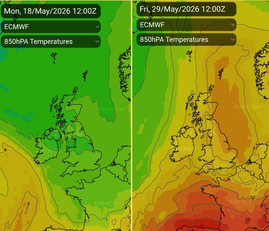
Later this week, temperatures are going to rise into the twenties Celsius. In the first half of the week, we are seeing a change to a westerly flow off the Atlantic after the chilly northerly but there will be bands of rain and plenty of heavy showers. By Thursday, a frontal boundary will start to drift over western and northern parts, allowing warmer air to surge up from the southwest. With high pressure building towards the UK, the showers will ease and there will be more sunshine and the temperatures will surge.
Friday
High pressure will be over Germany but influencing more of NW Europe. There will be low pressure over the Atlantic heading northwards to Iceland and in between a SW backing Southerly flow will bring real warmth our way.
For Scotland and Northern Ireland, it does look a little more mixed, with more cloud and some patchy rain. However, eastern areas should be fair weather with warm sunny spells and rising temperatures. Temperatures will range from the mid to high teens, just into the low twenties. The air will feel warmer than it has done.
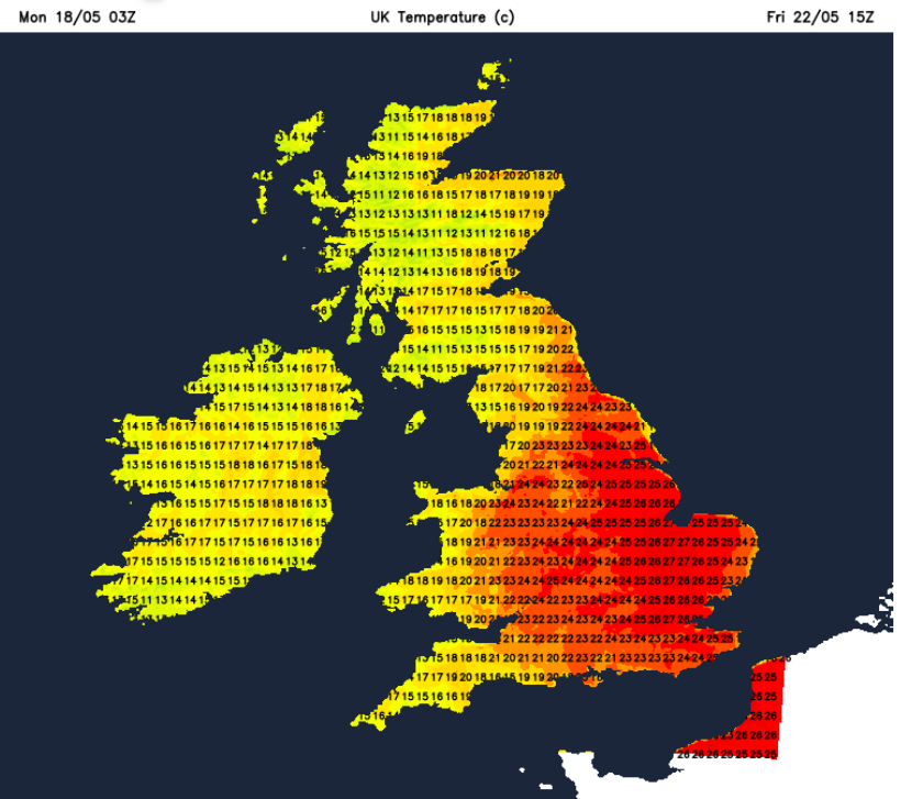
For England and Wales, there could be glorious sunshine and it will feel very warm. Temperatures will range from the high teens and the 20s Celsius, potentially up to 28C. This heat will last into the evening with a more humid feel to the air. And that clammy warmth should be a signal that there is a threat of thunderstorms. There will be the heat, humidity in the air and instability so later in the day or overnight, there is the risk of heavy rain and thunderstorms with the threat lasting into Saturday.
There is plenty of uncertainty around quite where and when but the risk is there.
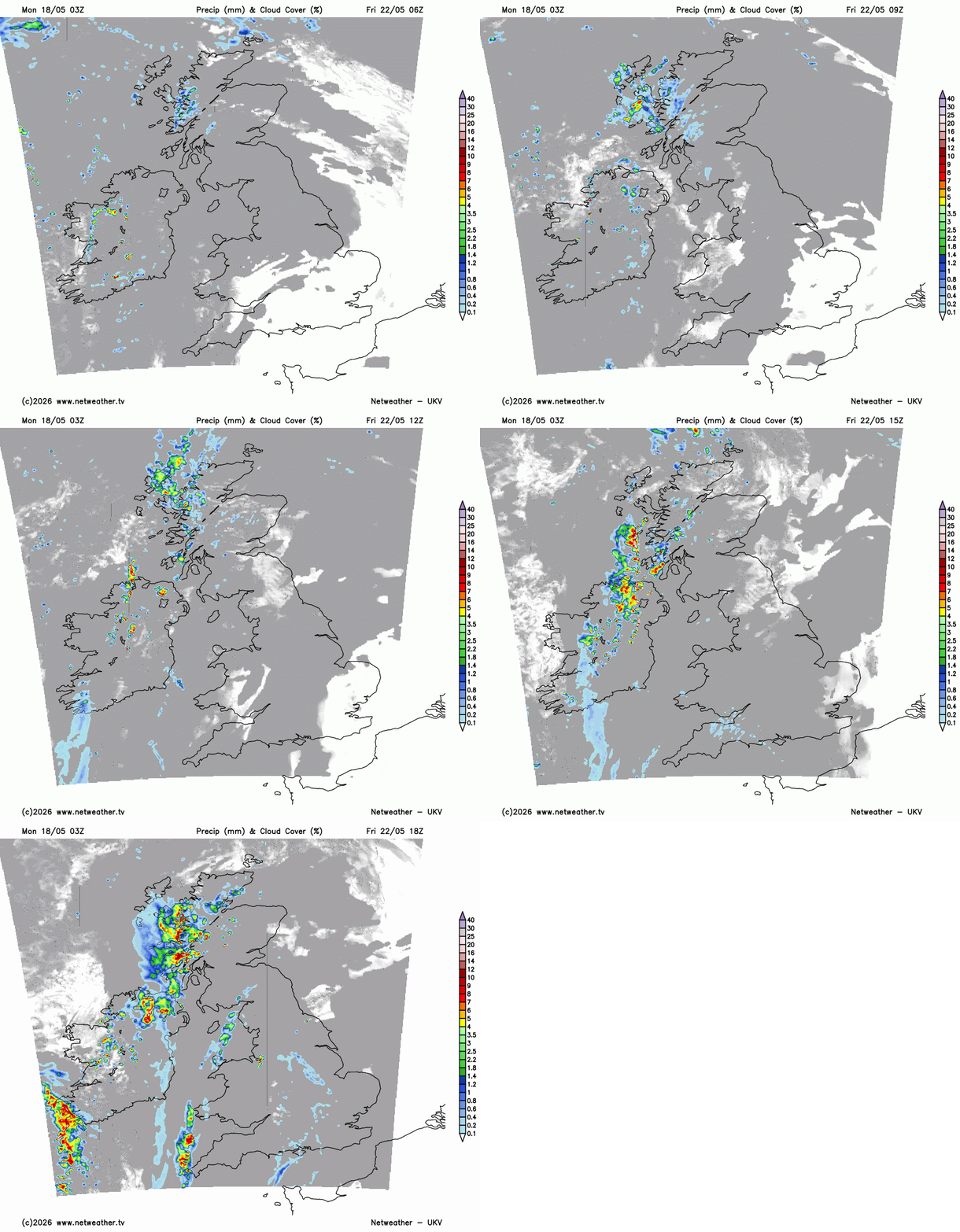
At the weekend, will the line of heavy showers running up through Britain clear away over the North Sea early on Saturday or take their time? The ECM model wants to develop a circulation over northern France which keeps the risk of hefty showers over England. The Met Office Global model builds the high pressure over much of the UK, but the Atlantic influence creeps in from the northwest with more cloud and the threat of showery rain. Under the high pressure, it should stay fine and very warm.
With showers, it’s hard to pinpoint where and when anyway but for the Bank Holiday weekend, it looks warmer than it has been for a while, as a southerly flow takes over from the northerly one. There will be warm, strong sunshine, although perhaps more mixed weather for Northern Ireland and western Scotland at times. High pressure will try to settle the weather down later this week but there is the threat of thunderstorms starting later on Friday.
Loading recent activity...