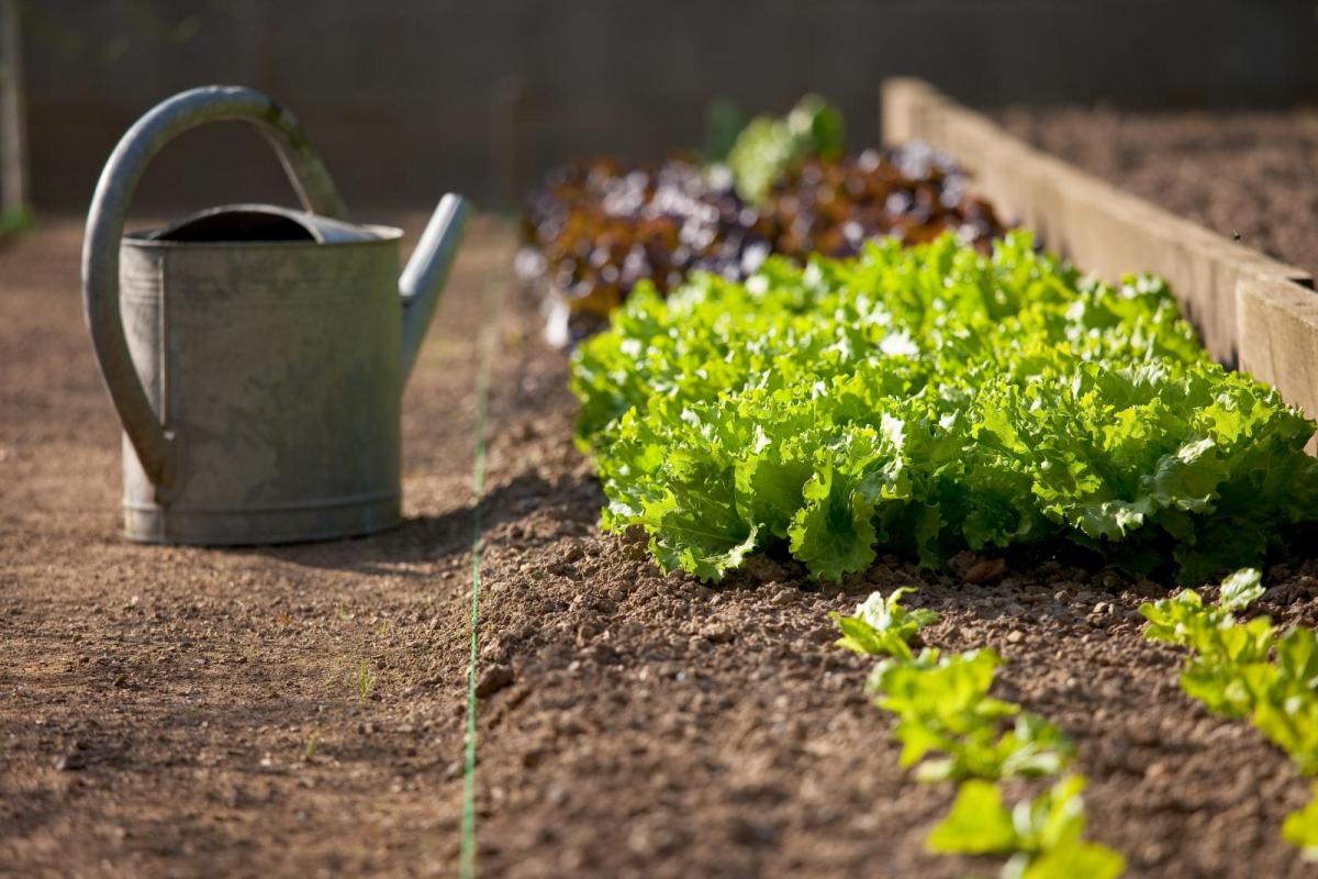
The coming week will be challenging for gardeners, as we see bouts of unusually cold air from the arctic spread south, bringing not only a risk of frost overnight and cold winds but also a risk of hail later in the week, all of which may damage any tender younger plants not under cover.
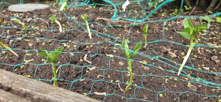
"I've put my broad beans out but my small garden is quite sheltered, and broad beans are hardy enough. They are more likely to be wrecked by pigeons, hence the netting. The ground could do with some decent rain" - Jo Farrow - Netweather Forecaster
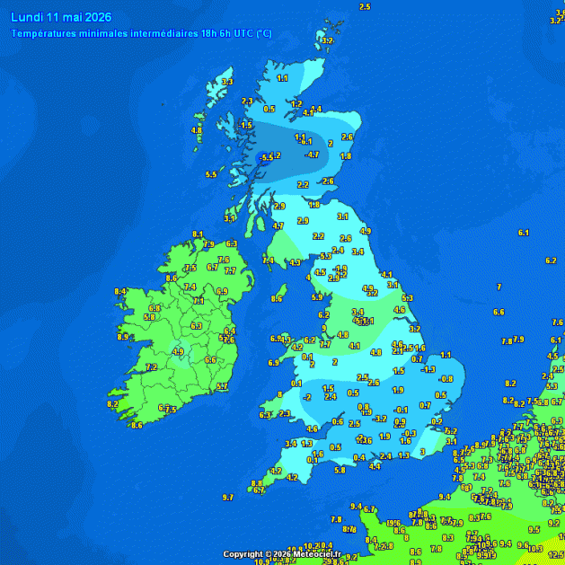
Last night saw temperatures fall close to or below freezing quite widely in rural areas of south Wales, central and southern England, as cold air of arctic origin swept south and skies cleared. Benson in Oxfordshire dropping to -3.2C.
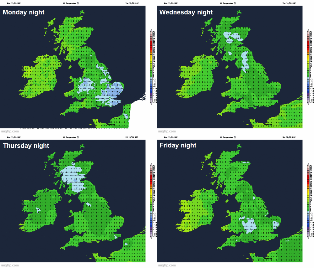
Tonight will again see a risk of frost develop under clearing skies, particularly in rural areas inland across England and Wales. Less cold air will spread from the west off the Atlantic on Tuesday, so less risk of a frost on Tuesday night. However, Wednesday sees winds veer northwesterly then eventually northerly into Thursday, this will pull down another surge of arctic air, with a more widespread risk of frost likely to return at night Wednesday, Thursday and Friday night as showers die out and skies clear.
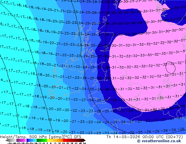
Colder mid-level temperatures will arrive from the northwest on Wednesday too, unusually cold for the time of year looking at 500 hPa percentile ranks. Temperatures at 500 hPa are forecast to fall as low as -32C across eastern England late Wednesday / early Thursday. This will create steep low to mid-level lapse rates, particularly with surface heating in sunny spells in the now strong sunshine just over a month away from the summer solstice. This will help shower clouds to build on Wednesday and Thursday, with heavier showers likely to produce hail and thunder thanks to the cold air aloft.
Unusually cold air aloft Wednesday night, with 500 hPa temperatures in the lowest 10% of temperature records.
.png?w=590)
The advice is that vegetable plants and bedding should be planted out after all risk of frost has passed, as a late cold spell can cause problems and put all your hard growing efforts at risk, even if your plants are in the greenhouse or cold frame. Most plants need an average night temperature of around 10C to thrive.
Without extra protection, low temperatures, frost, cold winds and hail can damage plants' leaves and check growth.
It is not just cold air that is a problem, it is also the wind which can desiccate the foliage. The stems and leaves of seedlings are particularly vulnerable. Their growth is very soft. As soon as a cool breeze blows them about, they keel over and will not recover.
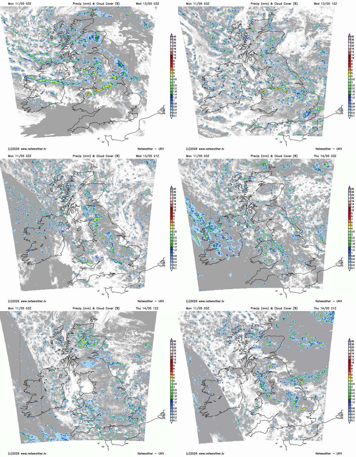
And later this week, there is a risk of hail from heavy showers, as another surge of arctic air spreads south. With a pool of colder mid-level temperatures this time moving south creating steep low to mid-level lapse rates with surface heating in sunny spells, which will allow parcels of warmed air to rise rapidly from the surface and create cumulonimbus clouds, with the cold air aloft generating hail in these clouds.
Risk of hail and thunder from heavy showers spreading south on Wednesday and Thursday
Even small hail during spring in the UK can cause significant damage to young plants by bruising, shredding leaves, and breaking tender stems, particularly if there is a heavy fall of hail. Early spring growth is particularly vulnerable to these ice pellets, which can lead to stunted growth or death of seedlings, often leaving scars that become more noticeable as the plant grows.
It looks to turn less cold over the weekend by day, while the risk of frost at night should go, as winds turn southwesterly or southerly.
Loading recent activity...