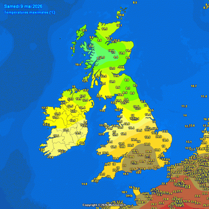
Temperatures reached the high teens and low twenties across southern England, Midlands and south Wales on Saturday, the top spot went to Wiggonholt in West Sussex - which reached 22.9C. However, it was much cooler further north, especially across NE England and SE Scotland - where maximum temperatures stayed in single figures.
Large north - south temperature contrasts yesterday
However, Sunday will turn cooler for all, particularly noticeable across southern UK, where a strong northeasterly breeze and cloud will make it feel much cooler than yesterday.
Turning cooler from the north through the coming week, particularly from mid-week, as arctic air spread south
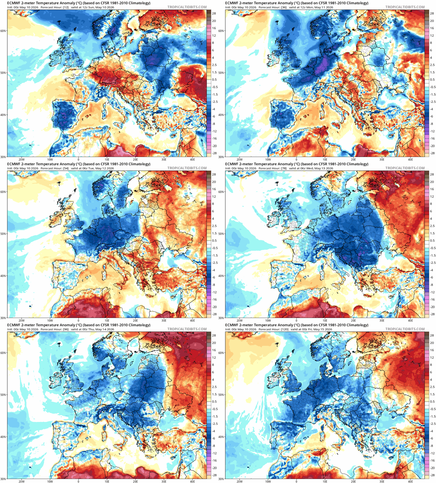
And this sets the scene for the coming week really, with high pressure to the west and low pressure systems moving down close to the east pulling down winds from a chillier northerly direction - with temperatures below average for early May. Later in the week, air will have originated from within the arctic circle, so it will feel distinctly chilly, particularly out of the sun, while snow is a possibility for Scottish mountains. There will be showers most days in the cool northerly or northwesterly flow, turning heavier from mid-week, when arctic air arrives, while at night there will be a risk of widespread frost as skies clear - particularly later in the week.
For now, a weak cold front will only slowly clear south across southern areas, bringing a cloudy and cool day in a brisk northeasterly wind across southern England, East Anglia, south Midlands and south Wales, some light rain may graze the far southeast too this morning. Turning wet and windy across northern Scotland, but in between a fine dry and sunny day for southern Scotland, N. Ireland, north Wales, northern England and north Midlands. A cool day for all, temperatures reaching 11-14C in the north, 13-16C in the south.
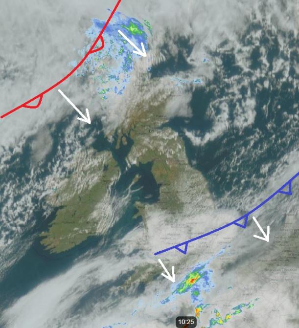
A band of cloud and showery rain will clear south across Scotland into northern England overnight, clear skies moving down into Scotland will mean it will turn cold with patchy frost by dawn. Dry and chilly with clear spells overnight across Wales, central and southern England.
Band of cloud and showery rain along a weakening cold front will continue south across England and Wales on Monday, reaching southern England early afternoon. Drier conditions with sunny spells following from the north elsewhere, though the odd light shower possible in the north. Temperatures reaching 11-14C at best generally, perhaps 15-16C in the southwest.
Another weakening cold front will move southeast across the UK on Tuesday, reaching the southeast early evening, just a band of cloud with some patchy rain not amounting to much for most, very little rain when it reaches the southeast. Some sunshine ahead of the front, while sunny spells return following the front clearance, but with blustery showers arriving in the northwest. Temperatures similar to Monday
An area of low pressure originating from Greenland looks to drop southeast across Scotland Tuesday night then on over the North Sea, this will pull weather fronts down across the UK, bringing more unsettled conditions and colder arctic air south on Wednesday across all parts, with widespread heavy showers with hail and thunder developing as cold air moves in aloft and the sun warm the surface in sunny spells causing steep lapse rates (steep drop in temperature going up).
Cold northerly flow with sunshine and heavy showers with hail and thunder Wednesday and Thursday
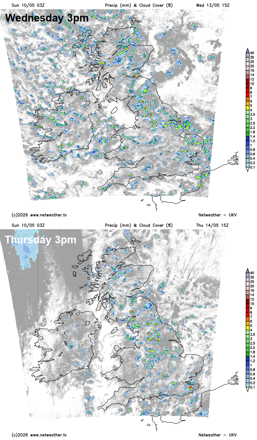
The cold and showery north to northwesterly flow continues on Thursday too, with low pressure close to the east over the North Sea, with sunny spells and scattered heavy showers with hail and thunder developing - most frequent across eastern areas. Temperatures reaching 11-14C at best, which is below average for the time of year.
Friday perhaps seeing fewer showers and more in the way of sunshine, while winds will ease, so feeling a little less chilly than the previous few days. Chance of rain moving in from the northwest across the north.
Next weekend, for now, looks to turn warmer in the south - as we lose the cool northerly flow, some sunny spells but could also be some showers around.
Loading recent activity...