After the warm April, May has so far got off to a far more ordinary start. However, in the Central England Temperature series from 1659, which roughly represents the English Midlands, May is still running 0.6C above the old 1961-1990 average temperature so far, even though the early part of the month is normally cooler on average than later in the month Relative to the 1991-2020 average, temperatures have tended to be close to normal. High sea surface temperatures around Britain following the warm March and April are likely moderating any cold northerly outbreaks.
Next week is set to have two blasts from the north and north-west, which means that it will tend to be cooler than average for the time of year, though not exceptionally so, and any snow is forecast to be limited to high ground in the north. Gardeners in particular should watch out for frosts. Frost will be widespread at night in Scotland this weekend, especially in the northern half of Scotland, and on Thursday and Friday next week, a ground frost may develop quite widely in England, Wales and Northern Ireland as well, though with air temperatures mostly staying above freezing.
The upcoming week will be a wet one in northern Scotland, but for most of the rest of the UK it will be showery on Wednesday and Thursday and predominantly dry on other days, and accumulated precipitation totals are expected to be widely short of 10mm.
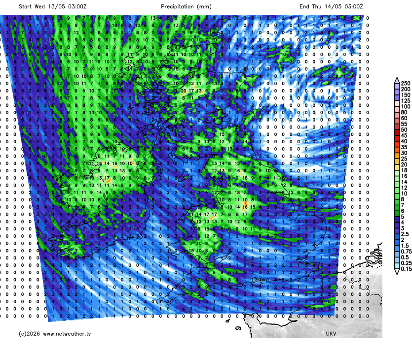
In general, while the anticipated shift to a more unsettled regime is happening, the first third of May is panning out rather less wet and unsettled than I had previously envisaged, with low pressure taking longer to take hold around the British Isles. Currently we still have a strong 1035-1040mb anticyclone sat not far to the west of Scotland. It won't be until Wednesday that we see low pressure taking over as the more dominant influence on our weather, and even then, the lows will be centred primarily around Scandinavia rather than Britain, giving us a showery north to north-westerly.
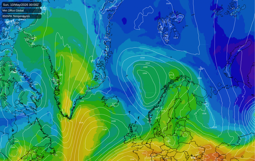
With our air masses frequently coming from the Arctic during next week, it is worth taking a look at how that part of the world is faring. The Arctic sea ice extent has been running at record lows, or very close to it, since mid-March, and this currently remains the case. Unlike in many other low years for Arctic sea ice extent, the negative extent anomaly is consistent over much of the Arctic, rather than concentrated in one or two specific regions.
This points to a pattern of anomalous warmth over much of the Arctic, a pattern which has persisted through much of March and April. This pattern also looks set to continue during the next 10-15 days, with sustained, though unexceptional, above-average temperatures over much of the Arctic, even relative to the recent 1991-2020 long-term average.
The Antarctic sea ice extent is also below the long-term average, but unlike in the Arctic, it is currently not exceptionally low, and is running higher than several recent years. For most regions of Antarctica, sea ice extent is close to the long-term average, and the shortfall is coming mainly from a region of West Antarctica, near the Antarctic Peninsula, where sea ice has not formed during the past month where normally we would expect it to be forming by now.
During the next 10-15 days, temperatures are forecast to be generally above the long-term average over much of Antarctica, but especially the central area and East Antarctica, with below-average temperatures affecting West Antarctica at times. This may provide favourable conditions for the sea ice forming in that anomalously ice free area in West Antarctica. However, some warm northerlies may hinder the continued expansion of sea ice in parts of East Antarctica, particularly around Wednesday/Thursday of next week, when an air mass will be coming in from a long way north. (Northerlies are usually warm in the Southern Hemisphere, the inverse of the situation in the Northern Hemisphere).
Loading recent activity...