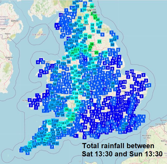
After a long spell of dry weather through April, many places finally saw their first drop of rain in weeks, as a spell of rain moved through yesterday evening and overnight. Though some places saw more rain than others, generally only 2-10mm at most, while a swathe from SW England up through the west Midlands, Greater Manchester to Leeds and up into NE England saw 15-25 mm, locally more, as the rain stalled over these areas.
Some more chances for rain today across south Wales, Midlands and southern England, but very localised in the form of showers, some thundery, with many places staying dry and sunny. Yesterday’s rain which moved north still lingering across NE England Sunday afternoon, but elsewhere largely dry with just the odd shower.
The new week will feature a cooler northerly flow to start the week, eventually veering northeasterly by mid-week, with a fair bit of cloud spreading down across the country in this flow - thick enough to bring scattered showers in places, though many places missing them and staying dry. Some bright or sunny spells will be likely in places too. After mid-week, wind looks to swing around to come from a southerly direction across the south eventually, as an area of low pressure moves down from the northwest, bringing in warmer air across the south. However, staying cooler across the north. Still a risk of showers in places after mid-week, more substantial rain in the far northwest on Thursday, though many places missing the showers, some places staying dry all week.
Showers around through much of the coming week, on the cool side too, though warming up in the south later
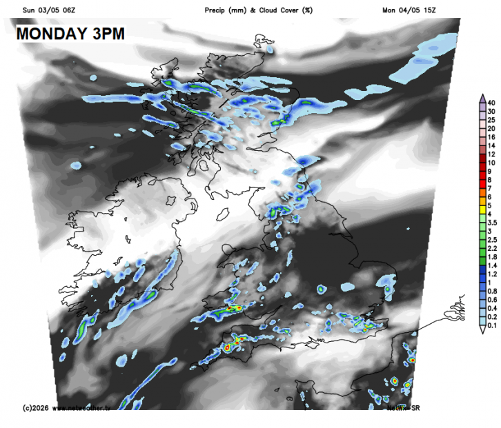
Bank Holiday Monday will see a weather sandwich with a cold front moving down across northern Scotland bringing showers here, while a slow-moving front across the south will bring cloudier skies and some showers to southern England and south Wales too, some heavy. But in between, a filling of dry and sunny spells. Temperatures reaching 14-17C generally, perhaps 18-19C in Cardiff and London.
Turning cooler on Tuesday, as a northerly breeze sets in across most areas, bringing variable amounts of cloud along with some showers, mostly across central and northern areas this time, with some sunny spells too. Temperatures reaching 10-15C across central and northern areas, 16-17C across the south.
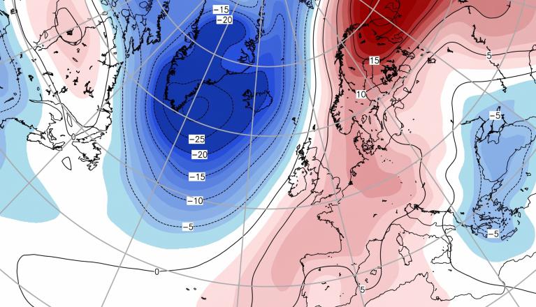
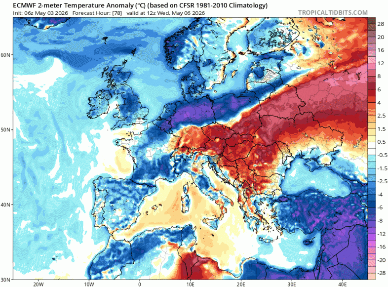
Wednesday looks like the coolest day of the week, as flow turns northeasterly, bringing arctic air in across the north. Could be quite cloudy across many areas, with limited spells of sunshine and some showers across northern and western areas. Temperatures 10-15C at best.
Temperatures across UK and much of northern and western Europe below average by day on Wednesday
Later in the week, an area of low pressure looks to arrive from the northwest, introducing cloud and more substantial rain across northern and western Scotland along with Northern Ireland on Thursday, sunny spells and a few showers elsewhere. Some uncertainty by Friday, but low pressure may approach the south from the southwest, introducing outbreaks of rain or showers across England and Wales, perhaps thundery in places. But it should be warmer in the south by then, but remaining on the cool side for the time of year across Scotland and far north of England.
Next weekend looks like it may be unsettled across the south, with low pressure over Bay of Biscay throwing showers or longer spells of rain over here, while northern areas could be drier and more settled but staying on the cooler side in northeasterly or easterly winds.
Loading recent activity...