Southern Wales championed the weekend warmth. The top temperatures were 22.5C at Whitechurch, Pembrokeshire on Saturday, and Cardiff at 20.6C on Sunday. The London marathon participants and spectators enjoyed fine, sunny weather without humid heat as Sabastian Sawe made history by becoming the first athlete to run a sub-two-hour marathon in a competitive race.
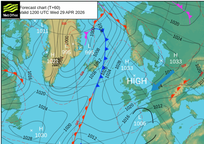
The week ahead is influenced again by high pressure, but it will drift about, changing the wind direction. There will be strong, warm sunshine with temperatures from the mid-teens to low twenties. Tuesday will feel cooler for everyone in a NE wind, and you’ll notice the brisk east wind off the North Sea midweek. That should change by Friday, when temperatures in England might creep up to 23 or 24C.
Gardeners and growers are looking for rain. April is known for its hit-and-miss showers and there will be some of those about. Already over Scotland on Monday morning and spreading southwards into central Britain, but it’s only persistent frontal rain soaking the ground that would make a difference.
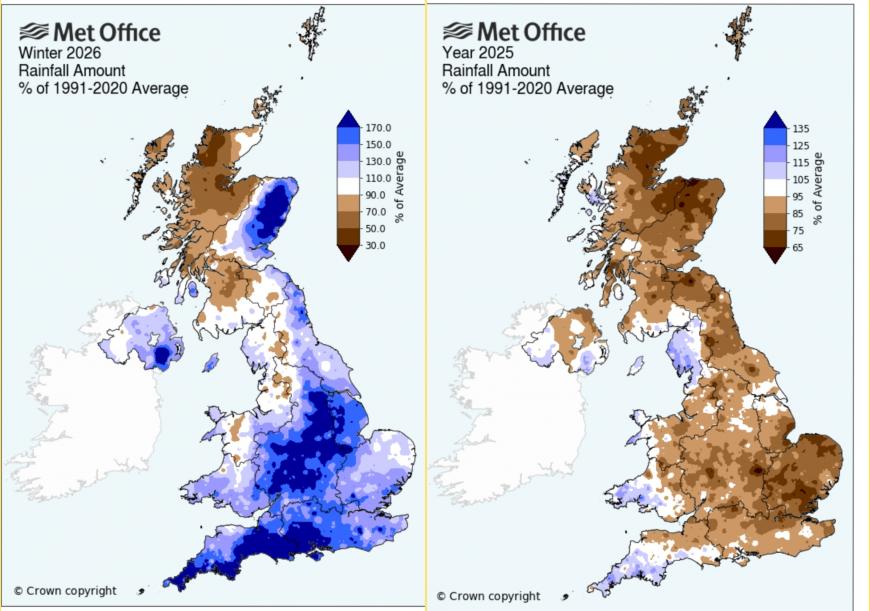
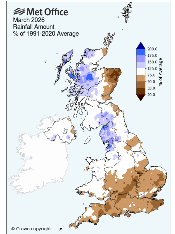
There was a lot of rain over winter but that was desperately needed after the dry 2025, when many regions were in drought with hosepipe bans, or suffering from water scarcity. March has been dry, away from NW Britain, and we are entering another week dominated by high pressure.
“Climate change is affecting UK weather patterns, and a growing population needs more water. With higher demand and less predictable rainfall, we all need to be more water-efficient. Demand for water is increasing, but rainfall is changing.” Severn Trent Water
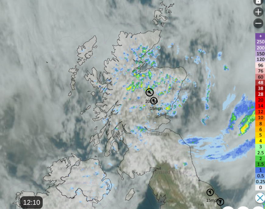
Netweather Radar with satellite (top winds) at 12:10 Monday 27th.
Southern Britain will continue with dry, sunny and warm weather for Monday afternoon, reaching 18 to 22C. Further north, over Northern Ireland and Scotland, there have been areas of cloud, and a scattering of showers for Monday morning. Northern Ireland will become mostly dry through the afternoon with sunny spells by this evening. Temperatures today will be around 14 to 16C.
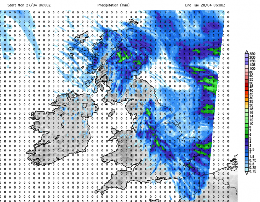
In Scotland, the temperatures will be similar, but the showers will begin to spread southwards over northern England this afternoon, reaching the Midlands by this evening. There could be some heavy, even thundery showers for Angus and Fife, and over the Pennines this afternoon, with the shower risk increasing over East Anglia even towards the Home Counties and London by Monday evening. Included in these areas, there could be sudden gusty winds with heavy downpours, so just beware if you think the fine, sunny weather will last all day. The showers should reach Kent late evening.
Tonight
With the high centred over western Norway, there will be a northeasterly flow off the North Sea tonight. This will bring plenty of cloud, cooler air and damp weather. Temperatures overnight wil be around 5 to 10C as the blanket of cloud moves steadily westwards.
Tuesday
There will be a lot of cloud across the UK for the start of Tuesday, with patchy light rain in a few places. It will feel chilly without the sunshine and in the noticeable NE wind. Northern Ireland, western Britain, and the NW Highlands will see more bright spells and with lighter winds, not feel too bad.
Gradually clearer skies will appear from the North Sea as the bank of cloud edges westwards over Wales and southwest England. The cool breeze will continue, but it will feel better when the sunshine appears. There will be a scattering of showers along the English Channel, and these could reach Devon and Cornwall during Tuesday night. It will be a cool, calm night with the high pressure centred east of Scotland and some patchy cloud over mainland Scotland and Shetland. Under the clear spells there could be a patchy frost.
Wednesday
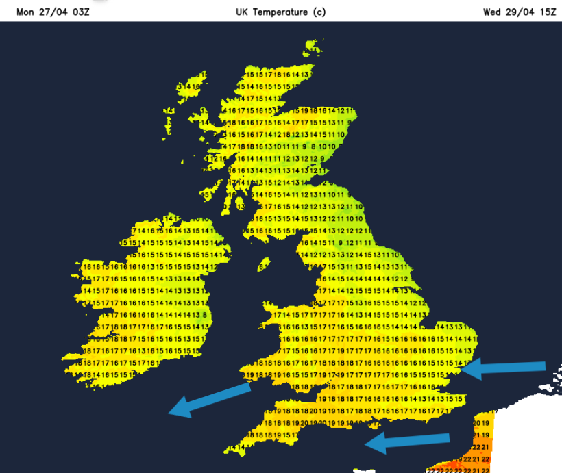
For most, it will be a fine, dry day with sunshine. Showers could still trouble the tip of Cornwall, and there will be a noticeable easterly wind over England. This will be gusty for western England and for Wales to the lee of high ground. Western parts will see higher temperatures, perhaps 19 to 22C and there will be lighter winds further north.
Loading recent activity...