The week ahead looks settled and will feel warm in any sunshine away from the easterly breeze. There will be more nippy nights but temperatures will creep up into the high teens. Birmingham will move from 13C on Tuesday up to 17C, and Cardiff from 14C to 19C by Thursday. There will be some low cloud off the North Sea and a cool easterly wind, so don’t pack away those jumpers too quickly.
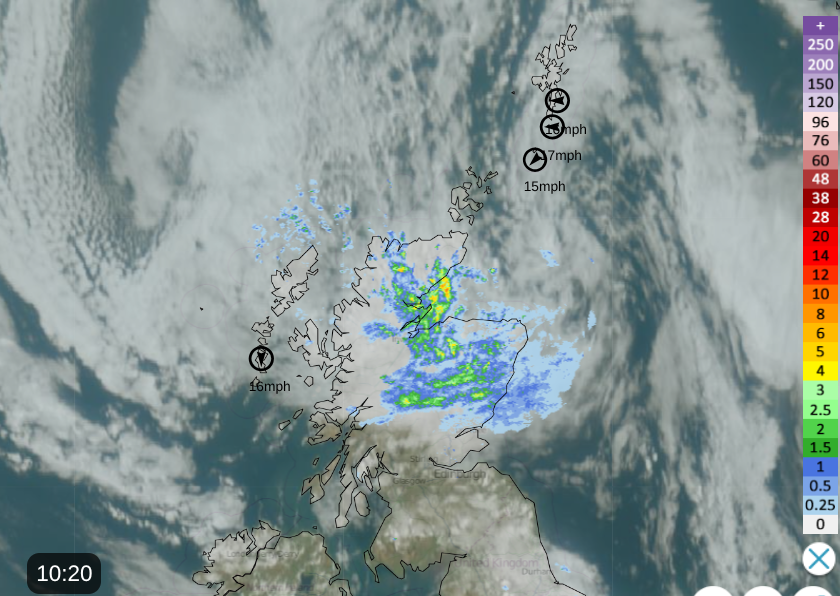
Netweather Radar with satellite and top windspeeds 10:20am Monday 20th
Monday will see more showers before drier weather sets in. Northeast Scotland has a wet start to the working week with an occluded front overhead. The rain will edge westwards over more of northern Scotland today.
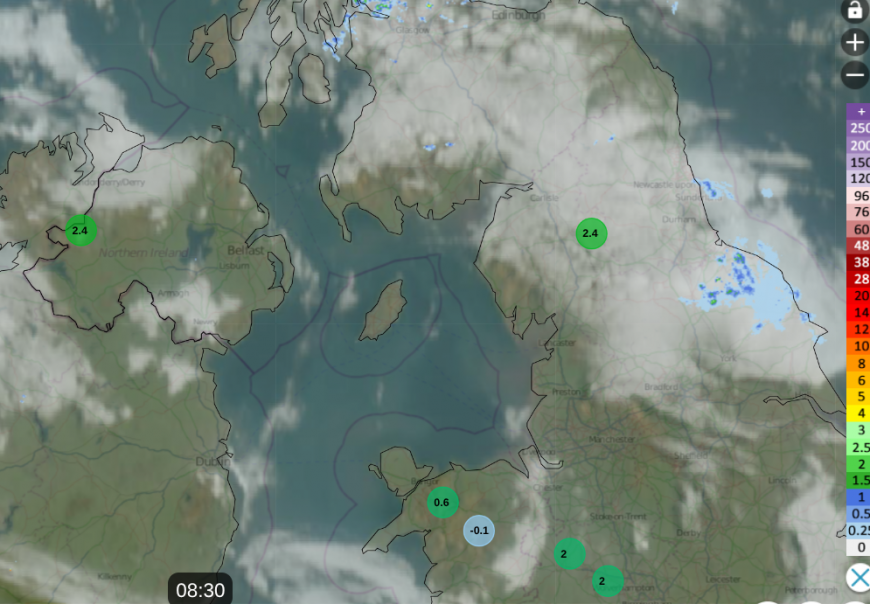
Netweather Radar showing cloud cover over northern England and southern Scotland with damp weather for North Yorkshire and low temperatures around 0830am, some at mountain sites
There will be a scattering of showers over the Southern Uplands and a rash of showers for northern England, particularly over the Pennines and fells in the northwest. The Midlands will see a scattering of showers too. Temperatures by day will be around 10 to 14C, which is nearly up to average for the time of year. Northern Ireland should remain dry and bright as will southwest Britain. The breeze will be very light but there will be a gradual easterly flow through the day, which will bring clusters of showers off the North Sea into Monday night.
Tuesday
Overnight a band of cloud will traverse Britain bringing a few showers and giving a mixed start on Tuesday. There will be thicker cloud over Scotland, through NW England into Wales for early morning but sunny breaks will appear, as other areas have a sunny but nippy start on Tuesday. The easterly breeze will pick up over England and Wales and stir the atmosphere, allowing more brightness and sunny spells. Further north there will be calm conditions and the cloud cover will linger til lunchtime, even for much of the day over the Northern Isles. This cloud in the far northeast will lurk through the night into Wednesday. Where the skies are clear do expect a rural frost and there could be some mist and fog in places.

High pressure will be away to the north, close to Iceland and extending over Scotland midweek. There is a low pressure west of Portugal but the high in the north manages to block this low. In between there will be this cool easterly flow, with some brisk winds away from the high pressure.
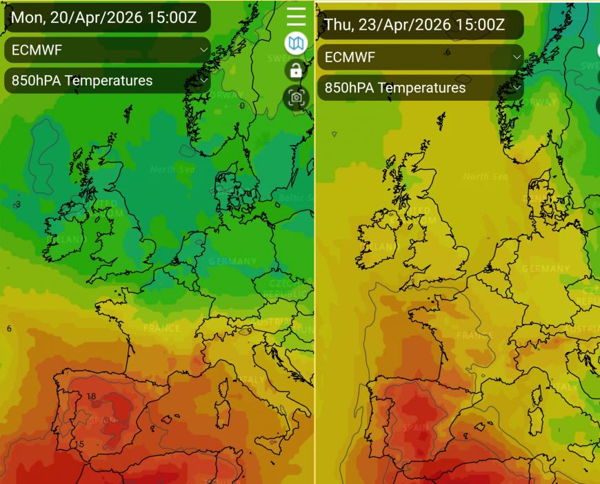
The model viewer showing ECM 850hPa temperatures, starting the week with cooler air, but warmer air from Iberia by Thursday
Gradually warmer air from the south will reach up through France to the UK but often at this time of year what really makes a difference is sheltered sunshine. By night, with clear skies temperatures will fall away so gardeners be wary. By day with clear skies there will be strong April sunshine this week, this warmer air from the south but also a cool easterly breeze off the North Sea and some cloud from the northeast. Later on Wednesday that low pressure near Portugal will throw a frontal band towards SW England. This will extend high cloud over southwest Britain and could bring a few showery outbreaks of rain to Cornwall, maybe reaching Devon by lunchtime. There is some uncertainty as the models vary with their timings.
It will also be blustery away from northern Scotland on Wednesday. The easterly wind funnelling through the Forth and the Central Belt, a cool wind for Belfast and across Northern Ireland. It will be windy for England and Wales particularly into the Thames estuary, along the English Channel coasts and strong lee gusts could impact Devon (west of Dartmoor) and Cornwall.
For warmth this week you’ll need the strong sunshine, the warmer air after midweek will also help but you need to be away from the brisk easterly wind and the areas of cloud off the North Sea.
Top -Tulips at Brockbushes, Northumberland
Loading recent activity...