Tuesday afternoon brings cloud and outbreaks of rain spreading north-eastwards from the south-west, while brightness hangs on for a time in northern Scotland and eastern England. London and the south-east should reach around 14C, with locally heavy showers bubbling up in the warmth. Overnight the winds pick up and the rain turns heavier across northern and western areas, though it will be a milder night than of late for most, with the edge finally taken off the recent rural frosts.
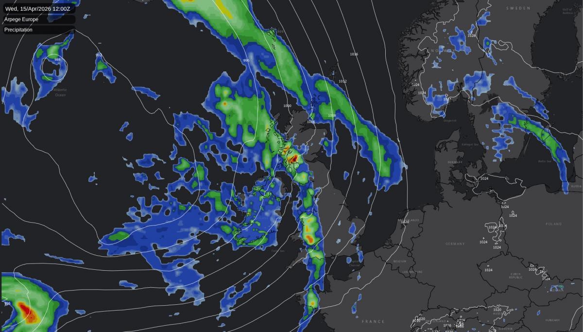
Wednesday is set to be the most unsettled day of the week. Bands of rain and showers move eastwards, heavy at times, with brisk winds behind them. The rain will be most persistent across the north-west, particularly western Scotland and the western fringes of Wales and Cumbria, where totals pile up through the day.
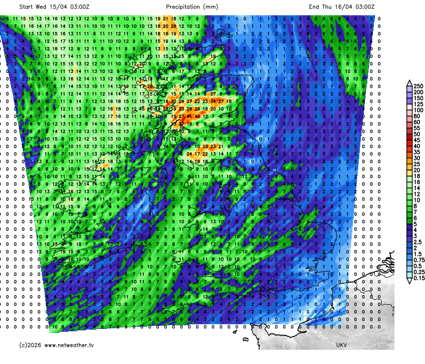
Eastern England starts brighter before the front arrives later on. Winds will be blustery, with gales in the hills and mountains across northern and western Britain and gusts of 45 to 60 mph likely over the Scottish Munros. Sunnier breaks between showers still feel warm, a sign of the tropical maritime air replacing the cool polar flow that delivered frost to rural hollows earlier in the week.
Thursday sees a clear improvement. Showers become more scattered and lighter, sunny spells broaden out, and temperatures climb into the mid-teens across England, Wales and eastern Scotland, with the high teens possible over eastern England. The Scottish Highlands still pick up a stream of showers off the Atlantic in the morning, with an early risk of hail and thunder before winds ease into the afternoon.
The midweek shift is the kind of change that tends to register in the weather community as much as on the charts. Members on the Netweather community have been logging consecutive rural frosts this week, with overnight lows down to -2�C in sheltered hollows, alongside the usual April grumbling about bright mornings that never quite warm up. The tropical maritime air arriving from Wednesday lifts that floor, and for anyone who has spent the first half of April scraping windscreens, Thursday onwards will feel like a recognisable change of season.
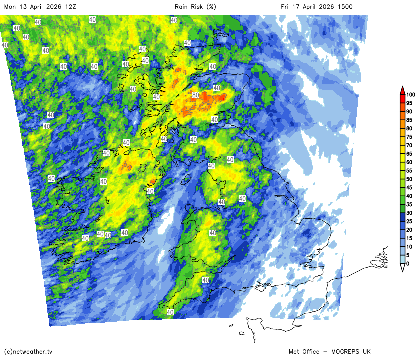
Friday brings a sharper regional contrast. Southern and eastern England should stay dry and sunny with temperatures into the high teens, while a low pressure system edging in close to the north-west turns Scotland, Northern Ireland and parts of western Britain cloudier, windier and wetter. There is real uncertainty about how far south and east the rain will reach, so confidence drops a notch from Thursday.
Friday afternoon rain risk map
Saturday looks like a day of sunshine and showers for most, with rain clearing eastwards early on followed by a scattering of showers through the day. The north-west sees the most frequent and heaviest of them and stays breezy along western coasts, but few areas are guaranteed to stay entirely dry. It will still feel warm in the sunnier breaks, particularly further south.
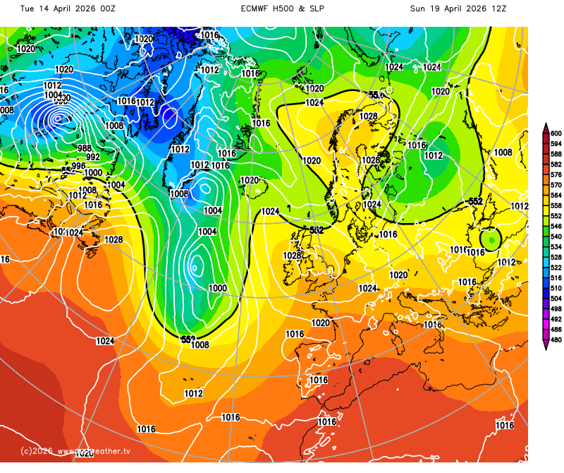
Sunday is the better bet for more widespread dry weather and warm sunshine as high pressure builds in from the southwest, though confidence on how firmly it establishes is low. Nights may turn chilly under clearing skies, with patchy rural frost possible in sheltered spots even as daytime temperatures run a degree or two above the April norm.
Loading recent activity...