The weather for the week ahead will see a cool and unsettled start with blustery showers, followed by a transition to warmer conditions from mid-week, as we lose the cool polar maritime flow and pick up a warmer tropical maritime flow while high pressure builds over the near continent. Temperatures returning to the high teens across parts of the south from mid-week.
After a cool start to the week, warming up from mid-week as we change from a polar to tropical airmass
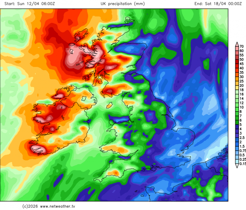
Wednesday is looking the most unsettled day of the week across all parts of the UK, Thursday the most settled day. Rainfall amounts are looking highest towards northwest and far west, particularly western Scotland, small rainfall amounts towards the east of England - where it will be predominantly dry through the week.
For now, it’s classic sunshine and April showers on the menu for the rest of Sunday, some of the showers heavy with hail and thunder across central and western areas, though parts of coastal SE England, East Anglia and NE England escaping most the showers and staying dry. On the windy side for all, particularly across the northwest, where coastal gales will continue.
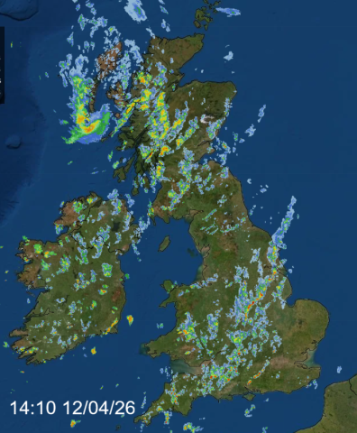
Showers generally fade overnight, away from the far northwest, with clear spells developing, allowing it to turn cold with a rural frost developing in places. So Monday will see a chilly start followed by sunny spells and scattered showers developing widely. Showers may be heavy with a risk of hail and thunder in some areas.
Cold Monday night, gardeners beware ...
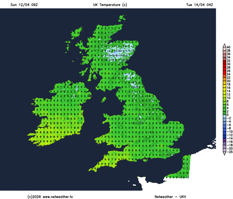
Tuesday is looking generally a fine, dry day in the east after another widespread cold night under clearing skies, with a rural frost. Turning cloudier and breezier towards the west, with showery rain spreading north through the afternoon and evening
Wednesday looks like the most unsettled day of the week and likely starting with wet and windy weather conditions across the northwest and far west, gradually clearing east and northeast through the morning. Elsewhere, a band of rain across SW England, Wales and NW England in the morning will reach eastern England after a dry and bright start, followed by brighter skies from the west and showers across western areas.
Thursday looks to become drier and brighter with sunny spells and only isolated mainly light showers, warmer too, with temperatures reaching the mid-teens across England, Wales and eastern Scotland, perhaps high teens across eastern England.
Friday there is increased uncertainty over detail, but broadly it looks like an area of low pressure will move in close to the northwest, bringing windier and cloudier condtions to northern and western areas, with some outbreaks of rain moving northeast. Southern and eastern England could stay dry, sunny and warm though - with temperatures reaching the high teens. Cooler elsewhere.
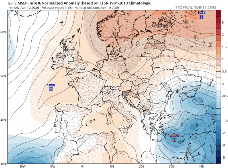
Next weekend - there are signs that high pressure will build in across the UK from both the Atlantic and NE Europe, bringing mostly dry and settled conditions across many areas and pleasantly warm and sunny conditions too.
Loading recent activity...