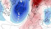
We have a Bank Holiday weekend coming up, and there are all sorts in the forecast. Rain, hill snow, sunny spells and blustery showers. There will be a lot of changes over the four day weekend, it’s a very mobile setup and not all bleak news.
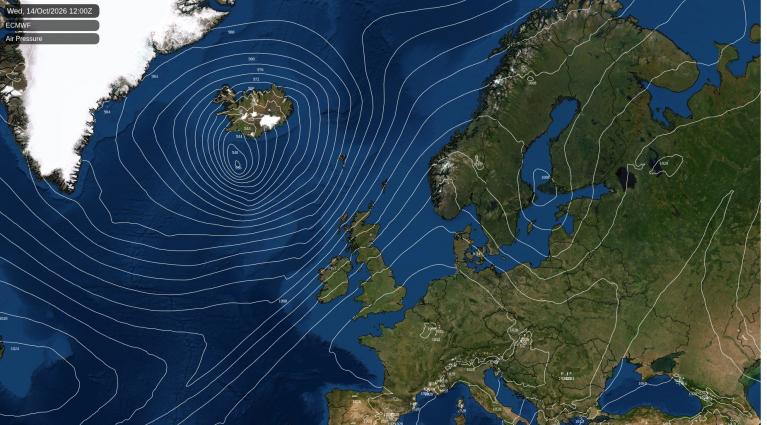
Catching the eye at the moment are the strong winds forecast for later on Saturday as a deepening area of low pressure moves over Scotland. It might become a named storm. There will be heavy rain, snow for northern Scotland, and wild conditions for exposed coasts and hills, especially for western and northern parts of the UK. Saturday will be windy everywhere.
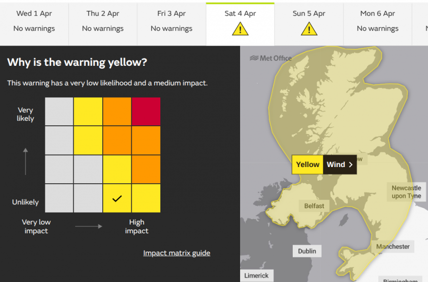
The Met Office has issued a yellow wind warning for Saturday evening, overnight into Sunday morning. Expect strengthening winds during Saturday afternoon for Snowdonia and around the Irish Sea. The warning covers Northern Ireland and northwest Britain, so all of Scotland bar the Northern Isles, northern England, particularly the northwest and Pennines, and northwest Wales.
“A spell of very strong winds later Saturday and overnight into Easter Sunday morning may cause some damage and travel disruption” MO
This warning has a very low likelihood and a medium impact. Medium impacts include things like flying debris and dislodged slates. Disruption to road, rail, air and/or ferry transport but this is less at night-time and on a Bank Holiday. As we get closer to Saturday, the likelihood could increase.
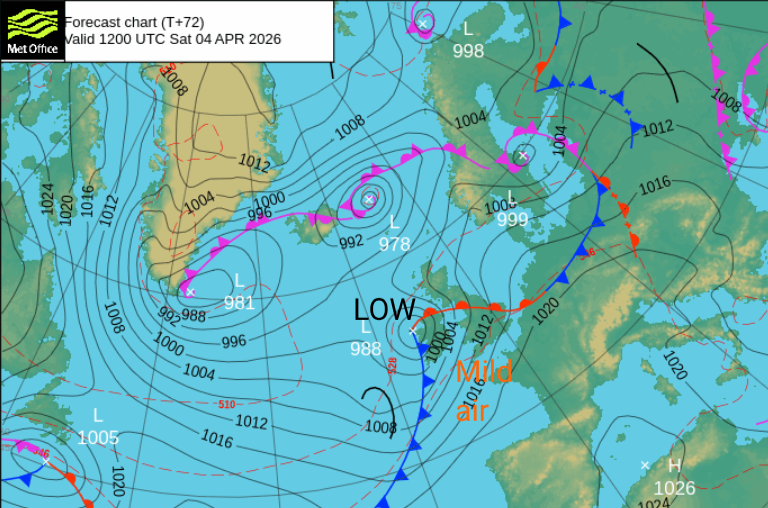
This low pressure has not been named. There is a tricky balance with it being a Bank Holiday weekend and people travelling, visiting different places around the UK, or heading to the coasts and hills. And yet the worst of the winds and wet weather looks to be overnight, when most people won’t be out and about. If the UK Met Office does decide to name this storm (or Met Eireann), the next name on the list is Dave. We will have to wait and see if we have ‘Storm Dave’ for Easter weekend.
Our naming group has only managed Amy, Bram and Chandra this season since September 2025. It has been a different story for southwestern Europe which is up to T for Therese after an incredible season which saw Claudia and Goretti impact the UK as well.
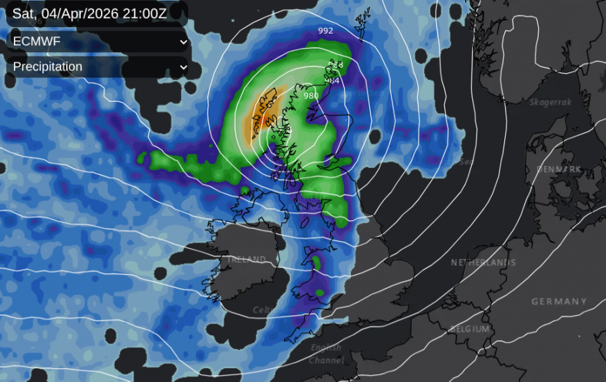
There has been some uncertainty around the development of this low pressure later on Saturday. The Met Office global model had been different to other models which might be one reason for not naming the low. There is some convergence today showing the low centre close to Mull and Skye at 21Z Saturday but across to the Moray Firth by 00Z, a faster progression.
The ECM has a core of high gusts moving from the Inner Hebrides across central Scotland to Angus then Aberdeenshire and Orkney by the small hours. The low is continuing to deepen overnight.
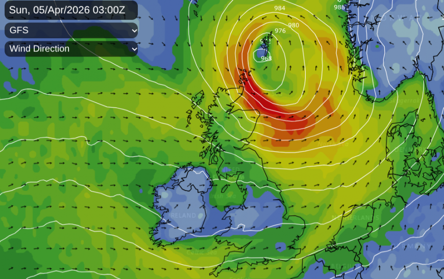
The GFS model has a similar track but strong and gusty winds through the Irish Sea and over northern England/ SE Scotland on Saturday evening before the deepening low continues northwards. This could bring W/NW gales to Orkney and the Moray Firth.
On the UKV model, much of the UK becomes increasingly windy on Saturday apart from the north of Scotland. By Saturday evening, there will be S/SW gales through the Irish Sea, but a sudden veer to the NW for Donegal. Here, there could be severe gales and gusts over 60mph. Through Saturday evening, the SW veering NW gales will hit the Solway Firth, the Firth of Clyde and batter the west coast of Scotland by late evening. Depending on the position of the low, strong gusty winds could sweep through the Central Belt in the middle of the night so it is worth preparing for that. As the low continues to deepen, gales are likely over Grampian in the wee hours as the low finally pulls away on Sunday morning
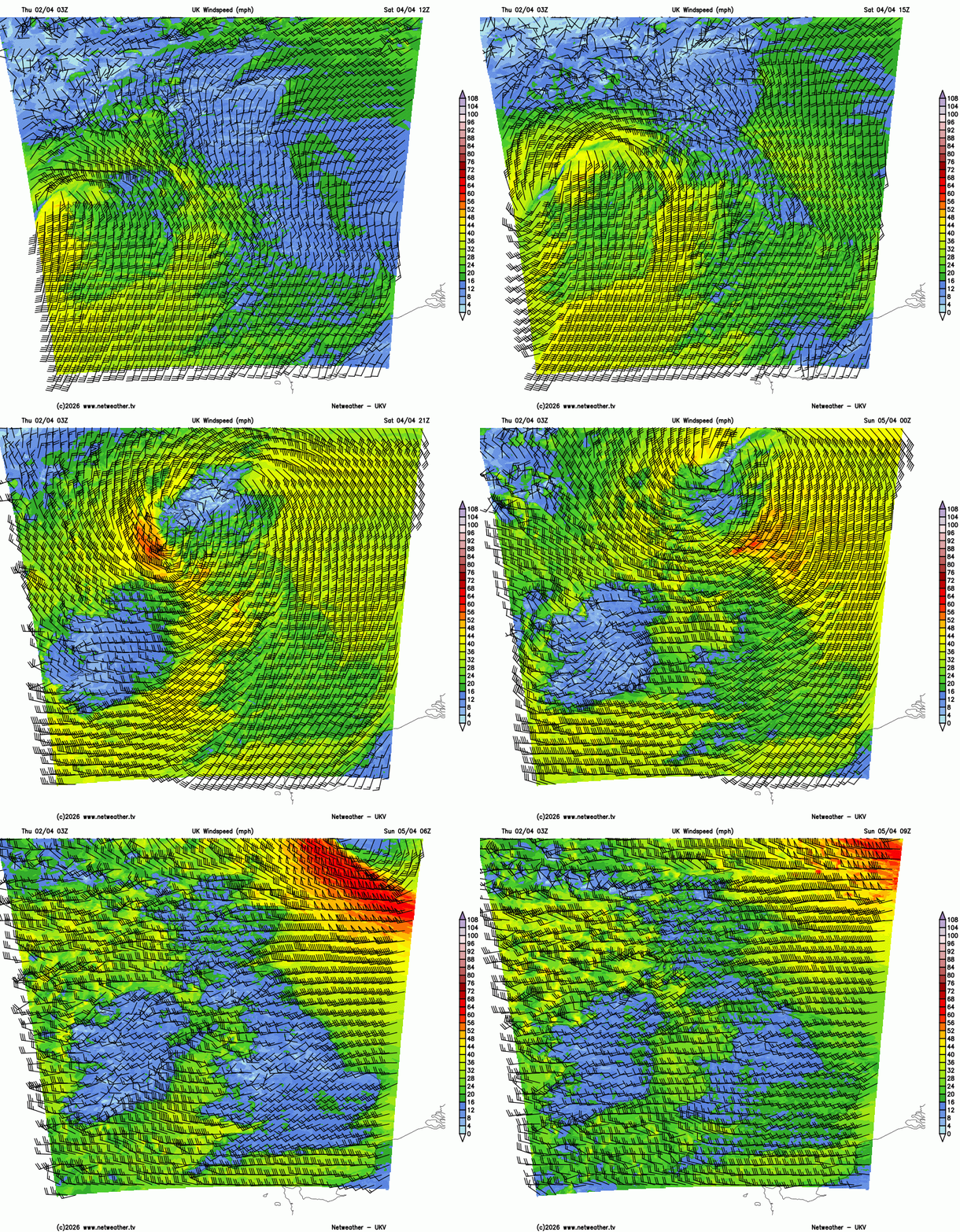
UKV model showing wind speeds with half barb 5mph, full barb 10mph and pennant 50mph, so two full barbs shows 20mph
The Northern Isles have a yellow wind warning for Easter Sunday from midnight. Again, this is currently very low likelihood at this stage but Medium impacts could occur.
The outlook
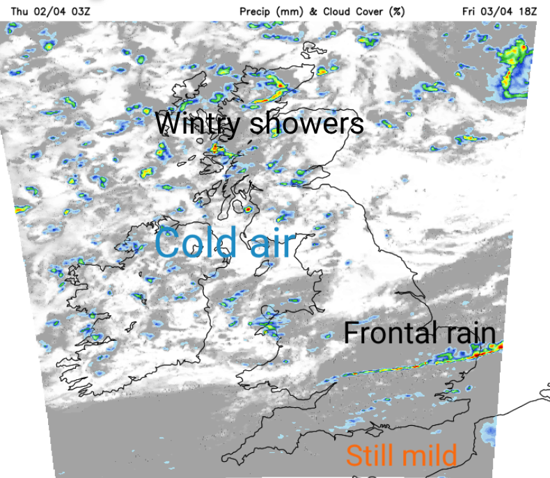
Good Friday ends with a cold front pushing over southeastern Britain with some sharp showers along the front for eastern England. (This front will wave back northwards on Saturday.) Southern Britain will still have mild air and very light winds overnight. It will be colder in the north, with a frost, a light breeze and a few more snow showers.
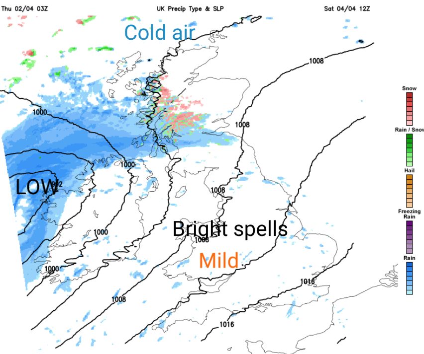
Saturday could start off dry for much of Britain with chilly sunshine for Scotland but increasing cloud over Wales and England. As the front, a warm front, pushes north, there will be freshening SW winds with rising temperatures over southern Britain. Temperatures could reach 14 to 16C.
The frontal rain might not amount to much over central Britain, perhaps just thicker cloud and a bit of dampness by lunchtime. Heavier rain is expected for Northern Ireland and Scotland with sleet and snow over the high ground of Scotland as the frontal band comes up against the colder air in the north.
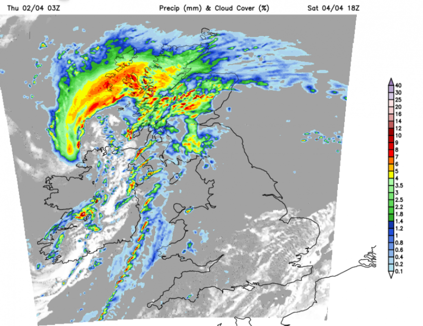
Remember, there is slight uncertainty about the timing and path of the low pressure later on Saturday, which will affect where it will be wet, and the strongest winds. Northern mainland Scotland could see a covering of snow
Before the whole lot pulls away northeastwards with wild weather for Orkney and Shetland. Northwestern Britain will be cold and SE Britain will still be mild.
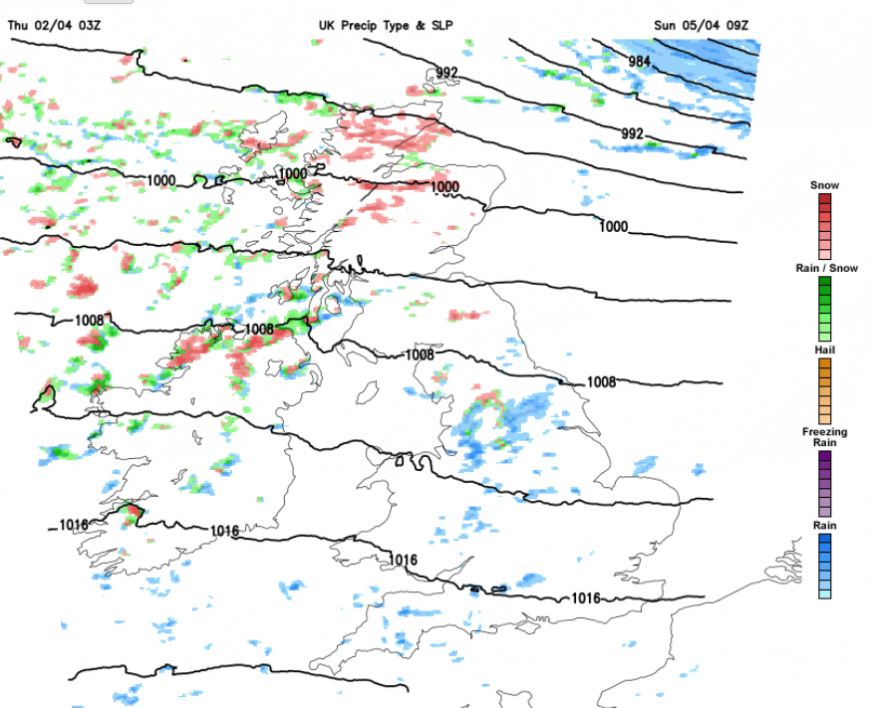
Easter Sunday will start in a blustery westerly flow. The overnight low pressure will be east of Shetland and will head for Scandinavia. England won’t be as mild as on Saturday, especially in the wind. Clusters of showers will move across Scotland and the Pennines with a mixture of rain, sleet, hail and hill snow but for much of the UK, there will be a lot of fair weather with bright or sunny spells. Southern England shouldn’t see many showers and will have a fine day, it’s just that the air isn’t that warm. Find some sheltered sunshine and it will be pleasant enough.
Pressure should rise for Sunday night and as skies clear, it will turn cold and calm.
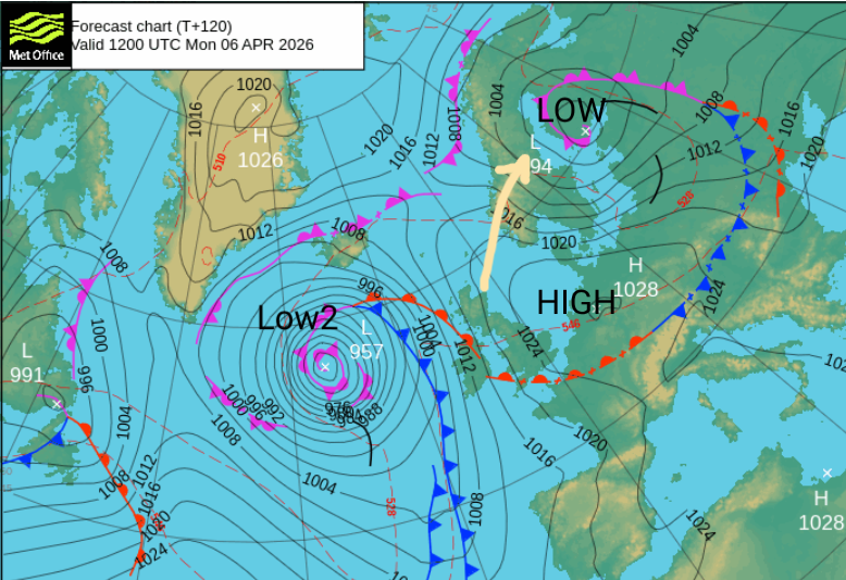
Monday might be a fair day, if the high pressure over mainland Europe can hold off an incoming Atlantic frontal system. Ireland could be windy in the southerly flow but there might be milder air caught up around the high, and in any sunshine it could feel pleasant.
Loading recent activity...