We are now in the run-up to Easter weekend and school holidays. There will be a lot of dry weather over the next few days with the potential for warmth on Tuesday, especially if you encounter some sheltered sunshine. Milder air comes and goes and there will still be times when colder air edges in from the northwest, giving quite a chill with nippy nights.
Northwestern Scotland will see rain and stronger winds each day with more rain over Scotland on Wednesday followed by another wet and windy bout from the Atlantic for Northern Ireland later on Thursday. There is some uncertainty in the model output for the start of the long weekend but deepening low pressures from the Atlantic could bring spells of wet and windy weather, especially in the north and west. Saturday does look warmer but there is cold air lurking to the northwest.
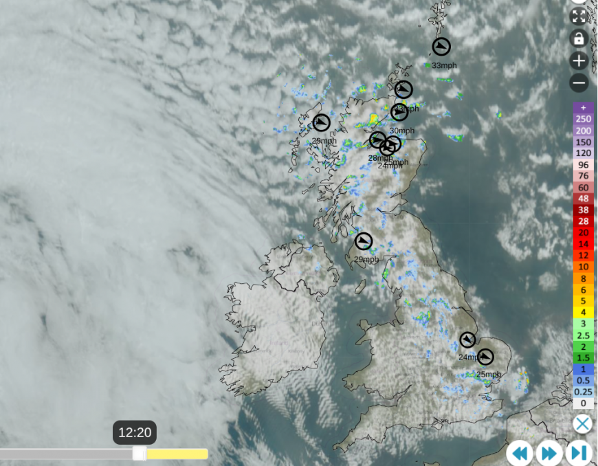
Netweather Radar with satellite, top 10 wind speeds at 12:20 Monday 30th
The week has started off feeling cool, even cold in the blustery wind. The radar shows the scattered showers, which will fade as pressure rises from the southwest. The shield of cloud (white area on right) over the Atlantic is an incoming warm front. Temperatures today will be around 9 to 13C but it will feel cooler in the brisk W/NW wind. By the Monday evening rush hour, there should just be a scattering of showers over northern Scotland and East Anglia, with fair weather for most of the UK.
Tonight
The winds will ease for a time with temperatures over Britain falling away under clear skies. The warm front will bring patchy rain to western Scotland and Wales, with milder air for Northern Ireland under thicker cloud cover. Southeastern Britain and perhaps Angus will hold onto clear spells for much of the night with temperatures falling well down into single figures, even a touch of frost in rural spots.
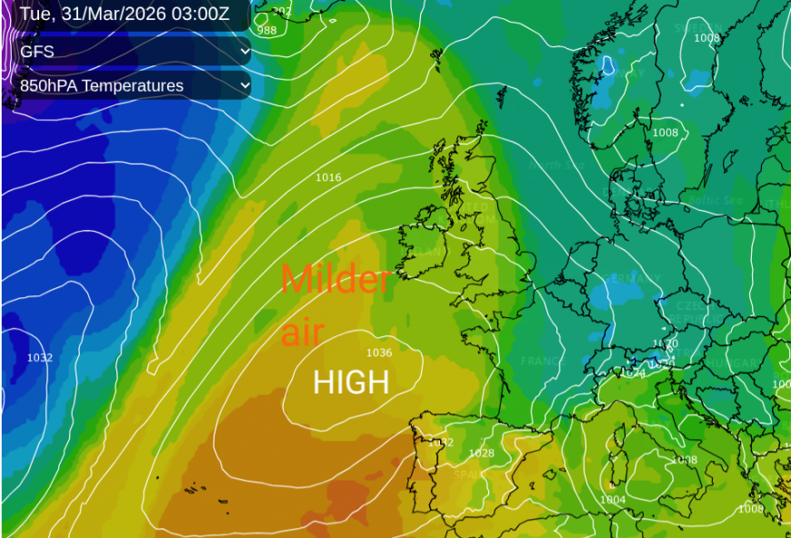
Tuesday will be a mixed day with this milder ‘warm sector’ air but a mixture of grey cloud and damp weather, particularly for western counties, then breaks in the cloud allowing warm sunshine.
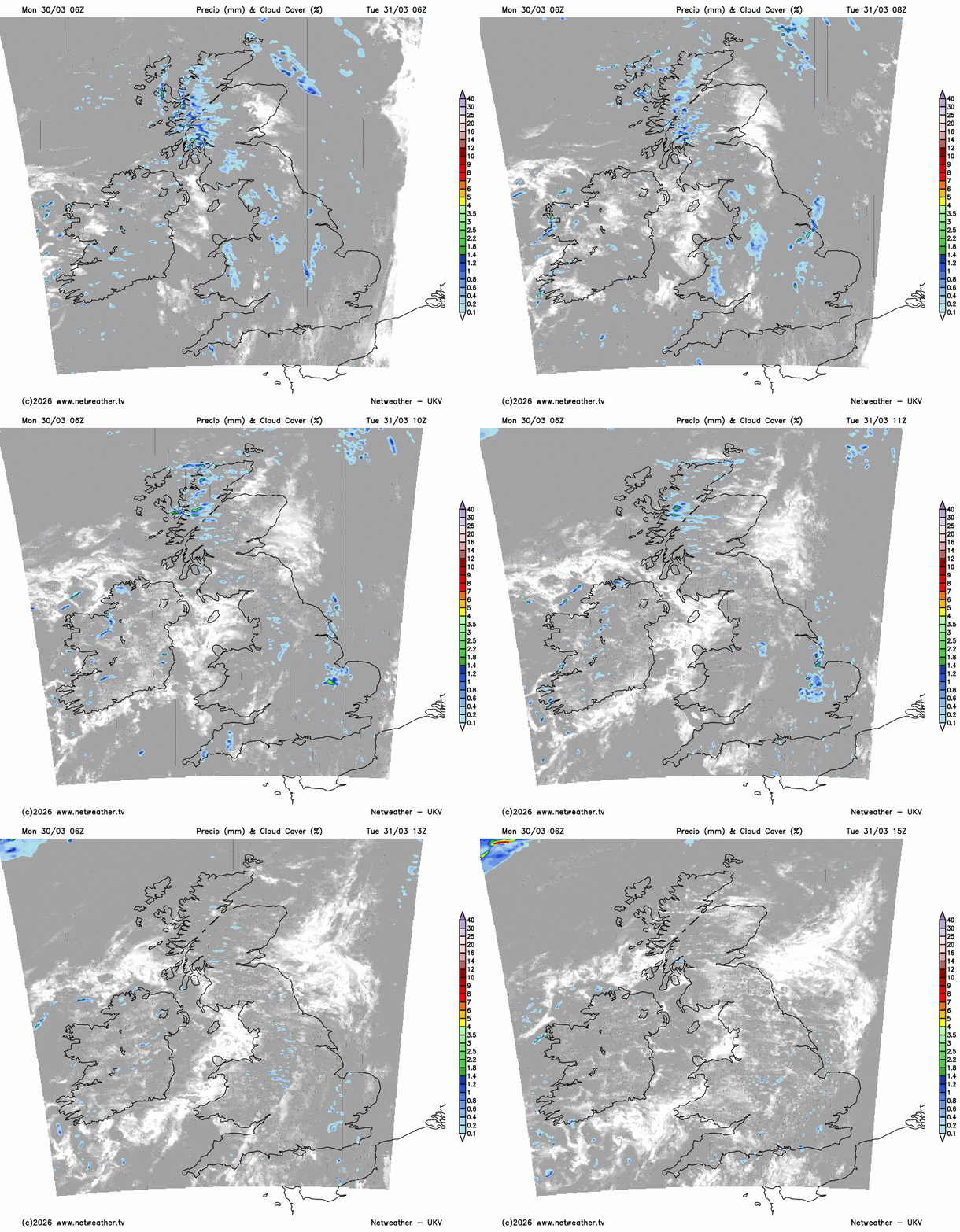
Temperatures will widely be 11 to 14C but where the sunshine appears, they could move up 15 to 17C perhaps even 18C on Tuesday. So this change of airmass has potential, with some sheltered sunshine but for many it will just be mild. Still blustery for northwest Scotland.
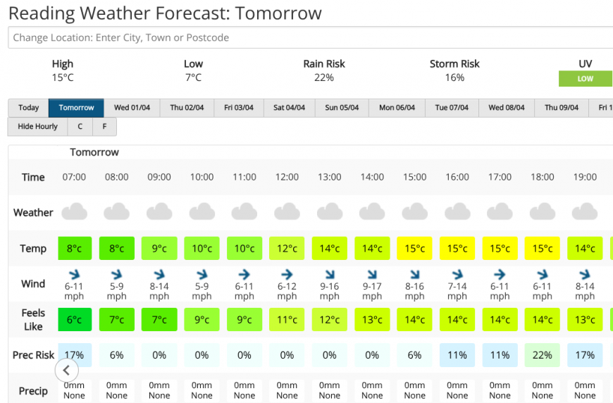
The milder air shown for Reading in Berkshire, but with cloudy skies. If the sun does break through, it could reach 16 or 17C which would feel pleasant with light winds.
The next change will appear from the northwest when the cold front edges in. After a quiet Tuesday night, there will be a dramatic wind veer for the far north of Scotland as this frontal boundary arrives.
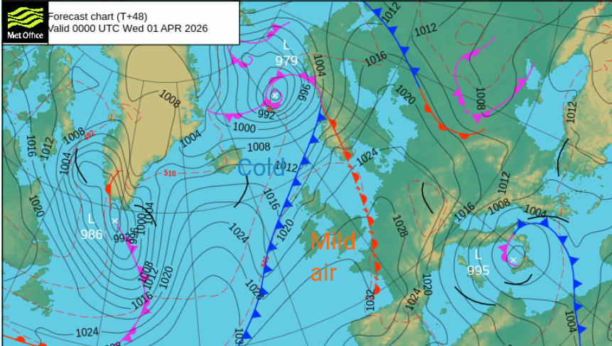
On Wednesday the frontal band will begin to wave and so slow down. There will be rain with embedded line convection resulting in sudden intense rainfall, squally winds and this change to a northerly. As the rain (and mountain snow)moves across the Great Glen at lunchtime, it will turn much colder in the far north.
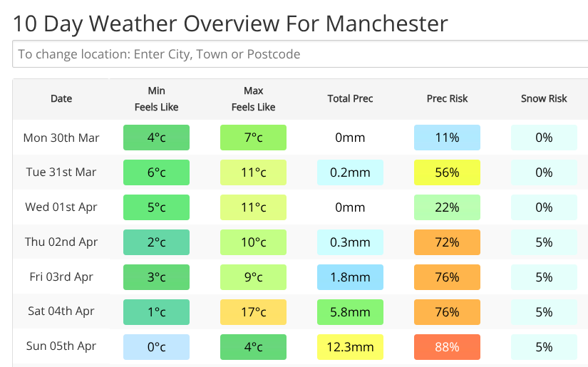
Manchester this week with chilly nights, drier start to the week, the potential for warmth by Saturday but a more unsettled weekend
Ahead of this rainband, there will be a lot of fine weather with bright or sunny spells. Northern Britain will become more blustery. There will be a few showers for SW England in the morning, the odd shower for Sussex and Kent by the afternoon but overall fair for most of England and Wales with temperatures in the mid-teens.
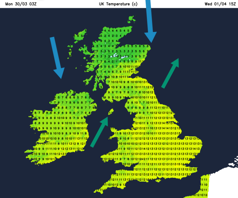
The rain band will sweep over Northern Ireland, Glasgow and Grampian in the afternoon leaving a wintry mix over the Highlands. This dig of cold air will reach right down through the UK during Wednesday night with a widespread frost for the northwestern half of the UK. In the colder air, clear skies and with calm conditions leading to a sunny but chilly start on Maundy Thursday.
Loading recent activity...