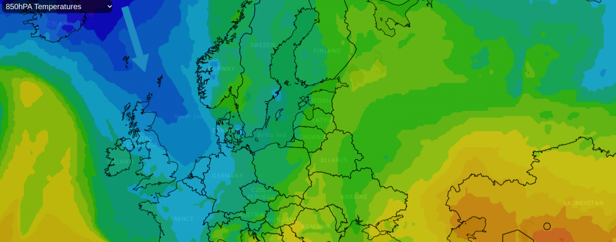
Wednesday has taken a noticeably colder turn, even with the spring sunshine. Thinking back to last Wednesday, north Wales saw 20.9C and north London 20.2C. Today, north Wales starts the day with a chilly wind, passing snow showers and should reach 7C this afternoon. For London, with temperatures of 6C there are blustery rain showers and a forecast temperature of 9 or 10C by the afternoon.
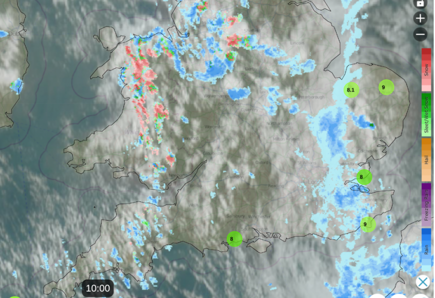
Netweather Radar at 10am showing cloud cover, 8C/9C top temps around coasts and mixed showers over southern Britain
Snow showers on a northwesterly flow have reached the south Pennines and Yorkshire Dales this morning, with wintry showers over Northern Ireland and SW Scotland. The focus for snow showers overnight into Wednesday morning has been western Scotland across the Highlands into Moray but bands of snow showers have managed to work their way inland over Scotland. The east and south remain more sheltered with sunshine.
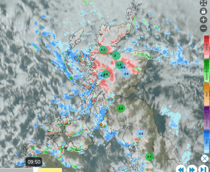
Netweather Radar at 09:50am showing cloud cover, mountain top temperatures of -5C, sleet and snow showers with lightning strike near Stranraer.
The far north of Scotland, then northeast Britain, will see colder air move in tonight on the brisk northerly flow linked to two low centres over Scandinavia. Over the Atlantic is a large high pressure, which will bring more settled weather to the UK for the start of Thursday, but a low pressure close to Iceland will throw its weather fronts our way for the end of the working week.
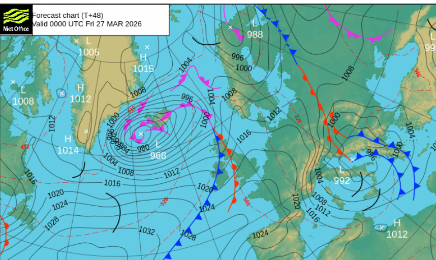
This means that by Saturday, the UK will be in a cool northwesterly flow. At this time of year, the airmass makes a lot of difference. There can still be plenty of sunshine, which makes sheltered outdoor spots very pleasant, but it was the southerly air from Iberia which allowed the temperatures to surge last week and last Saturday. With a cooler flow off the north Atlantic, any shade or brisk winds will soon make it feel nippy, and certainly once the sun sets. The sun is getting stronger, but the air temperatures will only be 8 to 11C on Saturday.
The Mirror getting carried away with "UK cities buried in hours" snow hype
Wednesday
The chilly northwest wind will continue through today. It will bring further rain, sleet, hail and snow showers mixed with bright or sunny spells. There is a risk of thunder and lightning in the heavier showers, continuing for western Scotland this morning and shifting to the east coast of England by this afternoon.
It will remain a cold day with fresh and gusty winds, gales for exposed areas and a real wintry chill away from the sunshine.
This evening
Many areas will become dry and clear. There will still be clusters of showers with a bit of snow over Grampian and the North Yorkshire Moors. The winds will ease with fewer showers as pressure begins to rise from the southwest. There will be a risk of ice after the daytime showers and a frost as temperatures fall away.
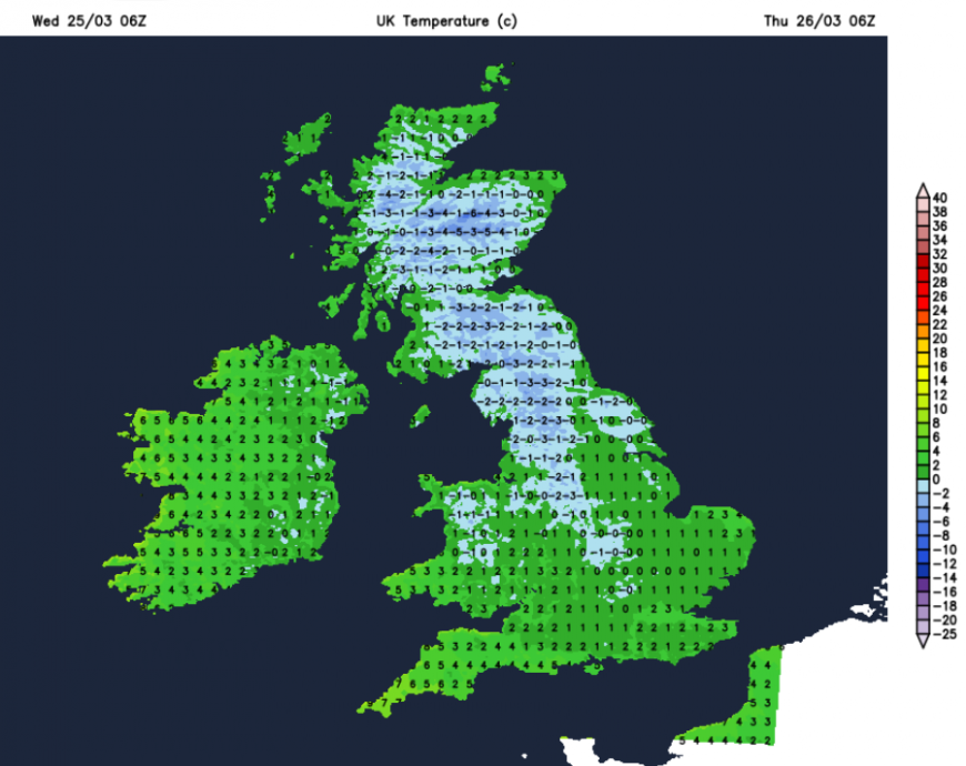
Thursday will look glorious out of the window but there will be a chill in the air. The cold winds will have eased for most, just blustery along North Sea coasts and for Kent and there will be plenty of sunshine to start the day. As the warm front approaches from the Atlantic, there will be increasing cloud and patchy rain by lunchtime for western Scotland and Northern Ireland. High cloud will gradually creep over the northwestern half of the UK as much of England and Wales continue with sunshine and lighter winds.
Temperatures will be 8 to 11C and the patchy light rain will spread over Scotland and the far north of England into the afternoon. Northern Ireland will see showery outbreaks and the patchy rain will reach Anglesey, Merseyside and Manchester by Thursday evening. It won’t feel as cold, as the cold Arctic air is cut off, and the winds will be lighter.
Loading recent activity...