Firstly, before we look to the change to cold Arctic air, Happy World Meteorological Day!
“World Meteorological Day 2026 celebrates the global efforts of the meteorological, hydrological and climate community in observing our planet to protect lives, strengthen resilience, and safeguard our future.”

This year’s theme is Observing Today, Protecting Tomorrow, focusing on the invaluable role many people play in sourcing and recording the initial data which feeds into our weather models to create quality forecasts. Around the UK, observers head to weather enclosures and take readings hourly, twice a day, once a day, or even once a month. Thanks to them on World Met. Day
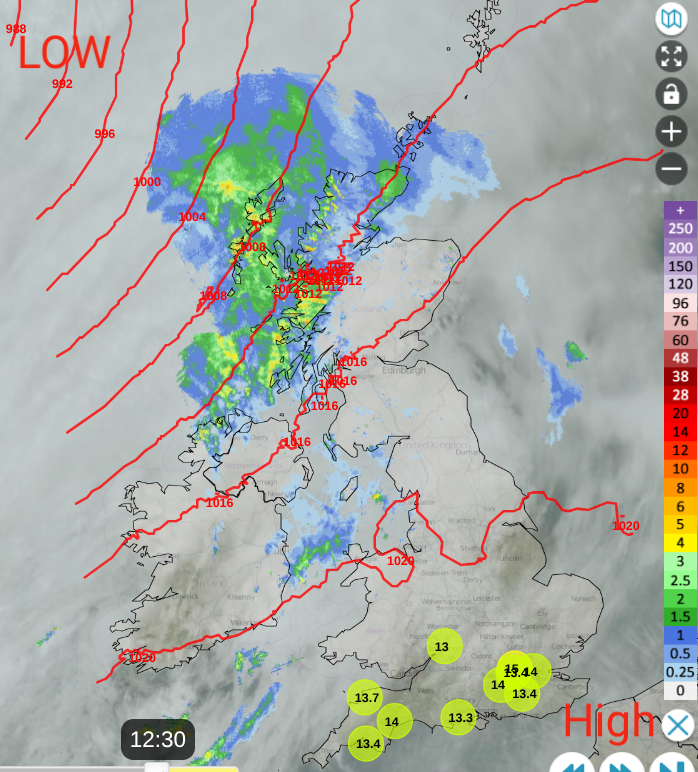
Netweather Radar Monday 23rd 12:30pm showing top ten temps (around 13-14C for southern England) with rain in the far northwest
There has been some glorious spring weather over the past week. Temperatures have passed 20C in a few spots thanks to warm air from Iberia last week. Even as that faded, the combination of sunshine and light winds meant the fine weather continued into the weekend. Areas of cloud and morning fog did interrupt at times. By night, temperatures have dipped below freezing in the cool, clear air with a patchy frost so we’ve seen great contrasts over 24 hours.
For the new working week, the trend is to colder conditions with mention of snow showers from the northwest. It will become windy as the settled weather under the current high pressure is shoved aside by an Atlantic low pressure.
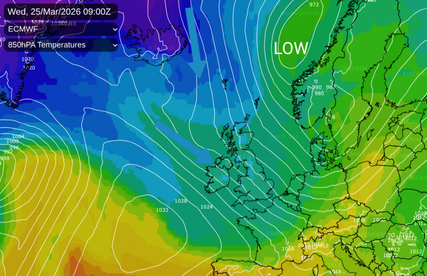
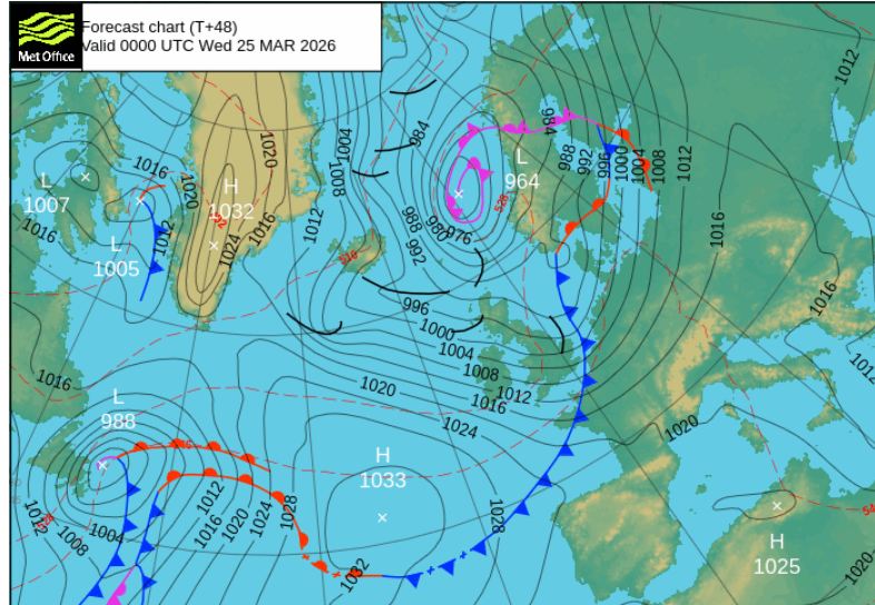
This low pressure will bring rain and blustery winds to northwest Scotland on Monday, then slide south of Iceland towards the Norwegian Sea. Its cold front will bring rain down over central Britain and Northern Ireland, with the plunge of cold Arctic air following for the middle of this week.
Monday
There has been a lot of cloud across the UK for Monday morning, although it has often been bright and dry. Patchy rain from the incoming Atlantic low will continue to spill over Northern Ireland and Scotland, mainly from the northwest, with a few sunny spells in the east. The Central Belt should reach 10C and 12C for Belfast and County Down. For England and Wales, much of Monday will be fair and bright with temperatures of 11 to 15C so a pleasant day, but not the warmth of last week.
The breeze from the south or southwest will pick up through the afternoon, freshening for northwest Scotland as persistent rain sets in for Highland and Argyll. Patches of rain could reach over north Wales but the focus for the warm front rain remains over Scotland during the day.
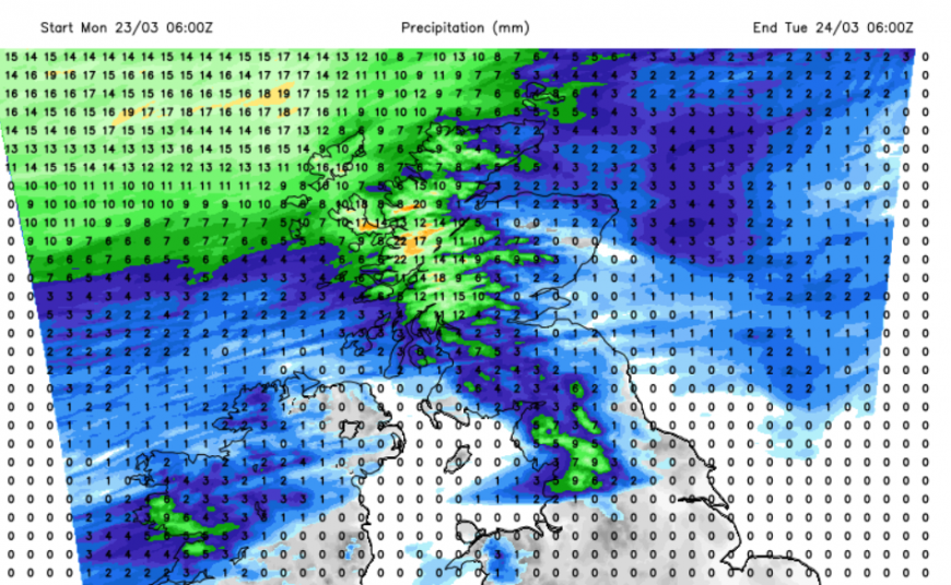
With high pressure over much of mainland Europe, southern Britain will have a quiet end to Monday with a layer of cloud but staying dry. Closer to the low centre, the Western and Northern Isles will see showery outbreaks of rain and gales, even severe gales for exposed parts of NW Scotland.
It won’t be a cold night with a layer of frontal cloud and the blustery wind, although cooler air will arrive from the north behind the cold front.
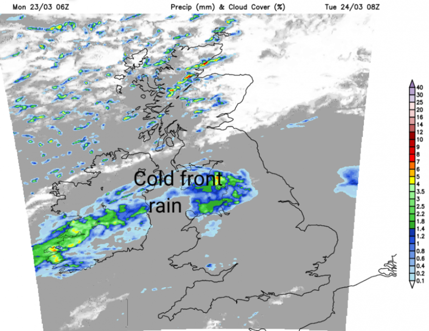
The cold front will have worked its way down through Scotland on Monday night and will begin to wave over northern England and the southern counties of Northern Ireland on Tuesday. There will be some uncertainty around where this rain will affect but it looks to be over a central swathe of Britain, with the windward, northwest England seeing a wet spell. The Pennines and later northwest Wales will also see rain but sheltered northeastern England could miss most of the wet weather. Tuesday will be a windy day, easing somewhat in the north by the afternoon but freshening for England and Wales in the afternoon. For southern Britain, temperatures will be around 11 to 14C and it will feel cooler in the wind. If the sunny spells do appear, then it could feel warmer in sheltered spots.
To the north of the cold front, there will be plenty of heavy showers with hail mixed in, even thundery at times. The colder air will begin to seep in, so over the mountains, there will be sleet and snow, and the temperatures will struggle.
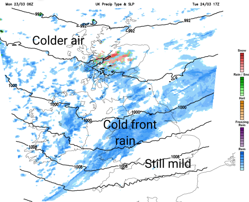
During the evening, the cold front will push southeastwards as a distinct boundary between the mild air in the southeast and the change to colder air in the north. There will be some heavier rain in the evening over Wales, SW England, the Midlands and Lincolnshire along the front with the blustery SW winds ahead of it. Behind the front, the winds veer to the west, then the colder northwesterly. This cold flow will bring more heavy showers in from the west as the overnight temperatures tumble. These showers will turn wintry for Northern Ireland, Scotland, the Cumbrian Fells and the Welsh mountains. Accumulations will mostly be confined to the high ground of northwest Britain and Northern Ireland. There will be some clear skies with lighter winds for NE Britain and the risk of ice.
Wednesday
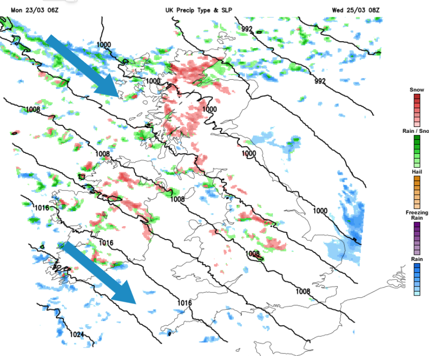
My mum says that March is treacherous, as a gardener. When you look out of the window on Wednesday, if it's sunny, you might be fooled into thinking 'oh that looks like a nice day'. However, the wind will be cruel from the Arctic. Take your big coat. The air will be cold with showers running by on the breeze. These will include rain, sleet, hail and graupel and snow. Daytime temperatures will be 6 to 9C but feel lower in that wind.
Celeste Saulo, Secretary-General, WMO “On this World Meteorological Day, I would therefore like to pay tribute to the many thousands of humans in the WMO community.
Loading recent activity...